DRIVE: From Beatty, NV. drive N on State Highway 95 about 13.7 miles to a good dirt road heading W (this road is 0.6 miles N of highway milepost 71). Turn left (W) here and drive about 75 yards to a barbed wire fence and gate. Pass through the gate and drive 6.5 miles to a fork. Taking the left fork, continue 0.5 miles to a cattle guard. Continue 3.7 miles to a N-S crossroad. At the crossroad continue straight (W) for 1.6 miles to a fork. Bear right here and drive 4.9 miles to where the road drops into a wash. Continue up the wash 3.8 miles to where the road becomes rough and requires a high clearance 4WD vehicle. 2WD's can find suitable parking in the last mile of this stretch. 4WD's can continue another 0.8 miles on a very bad road to the saddle at 7520 feet elevation.
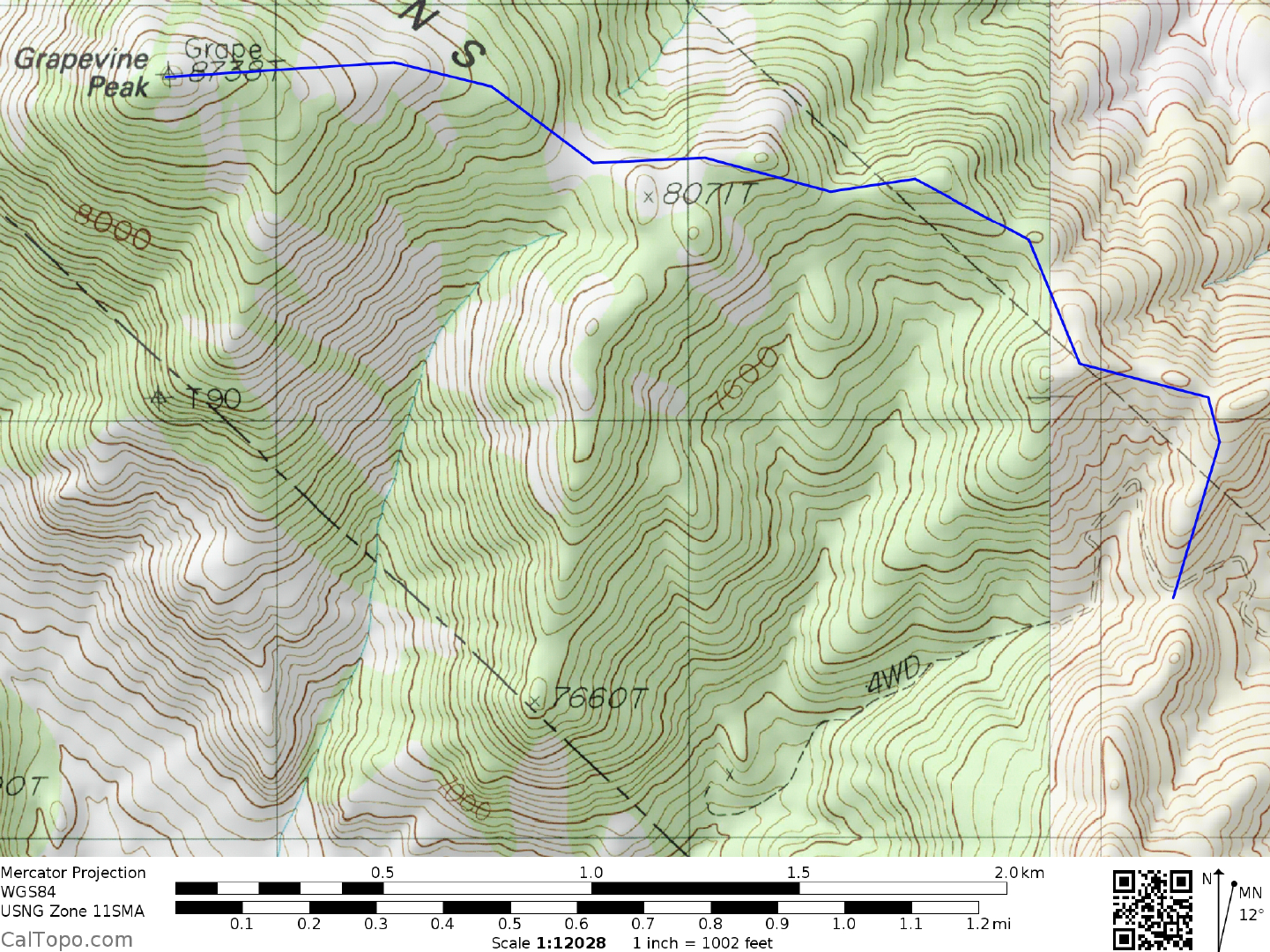
CLIMB: From the saddle at 7520 feet elevation head N for about 0.25 miles, following a faint trail at times along the ridge. The route will then start bearing WNW along the ridge line; follow it for just over a mile across flat areas and saddles as it dips and rises on its way toward an obvious saddle 0.7 miles E of the peak. From the saddle climb easy slopes westward to the summit, passing through a forest of pine en route.
ROUND TRIP STATS/2WD: 2700 feet elevation gain, 6 miles, 4-5 hours
ROUND TRIP STATS/4WD: 1800 feet elevation gain, 4 miles, 3 hours
SIDELINES
- This peak is located within the boundary of Death Valley National Park.
- The nearby town of Beatty, Nevada offers full services (gas, food, lodging) for the traveller. The town was born in 1904 during the fabulous Rhyolite gold rush, being named after its long time resident "Old Man" Jim Beatty, a local rancher. The town site was important as a freight center during this period, with 3 railroads serving it by 1907.
- Wahguyhe Peak, the prominent mountain located about 3 miles ESE of Grapevine Peak can be climbed from the 2WD parking spot by hiking S up the canyon to a saddle W of the peak at 7600 feet elevation. From there turn left (E) and head up loose, sandy slopes to the sharp summit. Wahguyhe is thought to be a Southern Paiute word meaning "summit".
- Primitive camping can be found along the road to the trailhead at various pullouts. There is no water or other facilities.
- A full size pickup truck with pop-up camper made it to the saddle in Oct 2020. One area may require rock stacking. Pinyon pines encroach the road, but many were trimmed years ago.