Guide
DRIVE/ROUTE A: From the Inyo County line just N of Trona, CA., drive 29 miles N on the paved Trona-Wildrose Road to a fork. Bear left here on the signed Panamint Valley Road and go 14 miles N to its junction with State Highway 190 just E of Panamint Springs, CA. Turn right (E) on State Highway 190 and drive 1.9miles (0.1 mile W of highway milepost 60.0), turning left (N) on a fair dirt road. Follow this road 5.7 miles towhere it begins to curve right (NE) toward the mountains. All vehicles park here. The road is basically impassible to all vehicular traffic beyond this point.
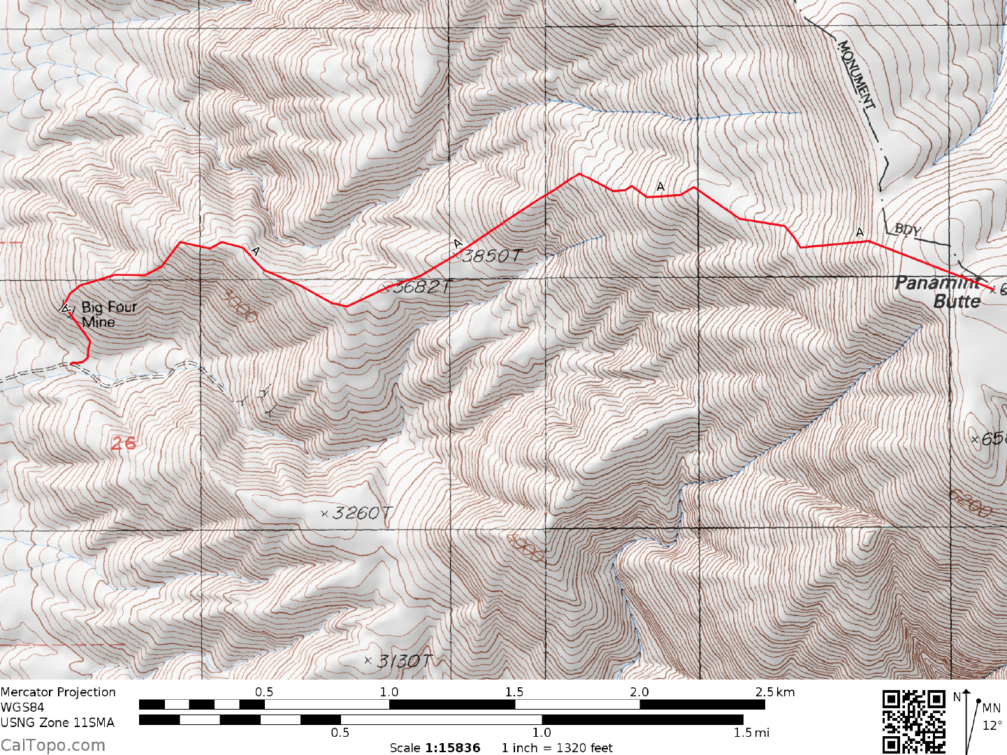
CLIMB/ROUTE A: Walk NE up the road to a small branch road leading left (N) toward the base of the ridgenear the Big Four Mine adits. Climb the slopes up past the adits to the ridgeline above, following the ridge generally E over points 3682 and 3850 to a flattish area at 5250 feet elevation near UTM 670323. From here, climb E up a broad face to the summit plateau and the top. The route up the ridge from the Big Four Mine adits varies from easy walking to steep, tiring, unstable scree slope of the "one foot forward, two steps back" variety encountered on the slopes just above point 3850. There is a faint use trail that will make route finding and footing easier.
ROUND TRIP STATS/2WD/ROUTE A: 5000 feet elevation gain, 8.0 miles, 8 hours. From the mine, about 7 miles and 4300' of gain.
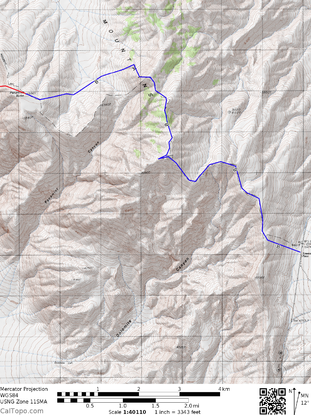
DRIVE/ROUTE B: From the junction of the Panamint Valley Road and State Highway 190 (see DRIVE/ROUTE A directions) drive 9.5 miles E on State Highway 190 to Towne Pass (elevation 4962 feet) and park at the wide turnout on the N side of the highway.
CLIMB/ROUTE B: Hike W up the slope to the ridgeline marking the boundary of Death Valley National Park. Follow the ridgeline, and the white NPS boundary markers, on a roller-coaster ride over bump and saddle to the closed contour point at 7280 feet elevation (UTM 712324), approximately 2 miles ENE of Panamint Butte. From here, drop down nearly 1250 feet SW to a saddle and then up over point 6390, following the undulating ridge for another 2 miles to the summit. En route to Panamint Butte from Towne Pass you'll pass within 0.1 miles of the highpoint of the Cottonwood Mountains, Towne Point at 7287 feetelevation (UTM 716304). NOTE: Because of space limitations this route is not shown on the accompanying topo map. It is however, a straightforward ridge run from Towne Pass
ROUND TRIP STATS/ROUTE B: 5000 feet elevation gain, 16 miles, 11 hours
SIDELINES
- This peak is located within the boundary of Death Valley National Park.
- At mile 5.7 there is an established pull out suitable for camping. As of 3-5-16 the road was passable for another 1.2 miles with a suitable HC 4x4 vehicle with good, AT tires.