Guide
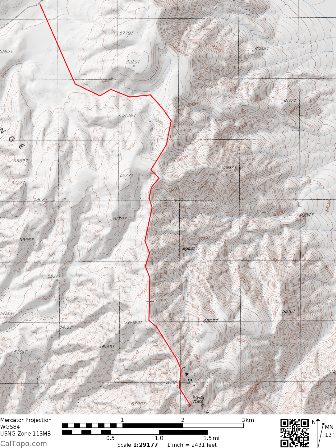
DRIVE/WESTERN APPROACH: From US Highway 395 at Big Pine, CA., turn right (E) on paved State Route 168 heading for Westgard Pass. At a fork in 2. 2 miles bear right on the narrow, paved Waucoba-Saline Valley Road (further on called the Death Valley Road on the Auto Club Death Valley map) and follow it eastward for nearly 50 miles to Crankshaft Junction. The road is paved as it passes over the Inyo Range and drops down into the Eureka Valley. The stretch of road across the valley floor is excellent graded dirt, giving way to more pavement as it climbs out the east side of the valley into Hanging Rock Canyon. Excellent graded dirt is once again encountered as the road tops off at a pass over the Last Chance Range and drops to Crankshaft Junction. It is just before this pass that you'll want to find a turnout for parking.
Note: the exact location of the pullout may change from time to time because of road grading.
DRIVE/SOUTHERN APPROACH: From the turnoff to Scotty's Castle just N of the Grapevine Ranger Station in Death Valley, drive W on the paved road leading to Ubehebe Crater. In 2.7 miles turn right (N) on a good dirt road, following it about 21 miles to the signe d Crankshaft Junction. From Crankshaft Junction follow the excellent dirt road left (SW) for 3.0 miles up and over a pass through the Last Chance Mountains to the starting point for the hike. A small turnout on the road near here is a good place to park.
Note: the exact location of the pullout may change from time to time because of road grading.
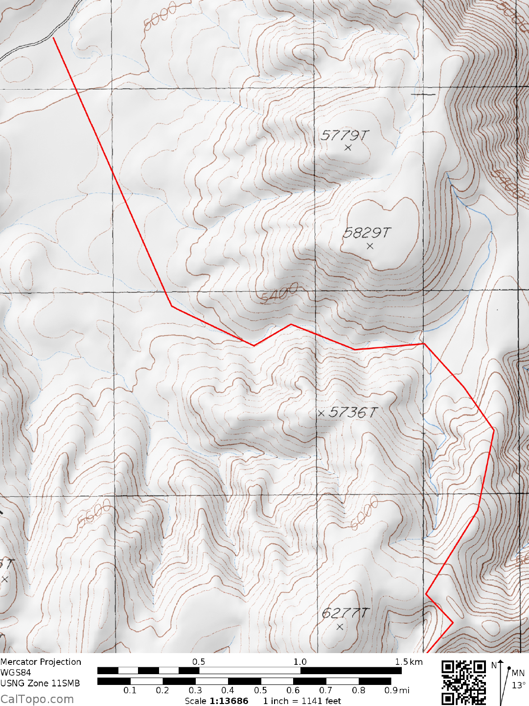
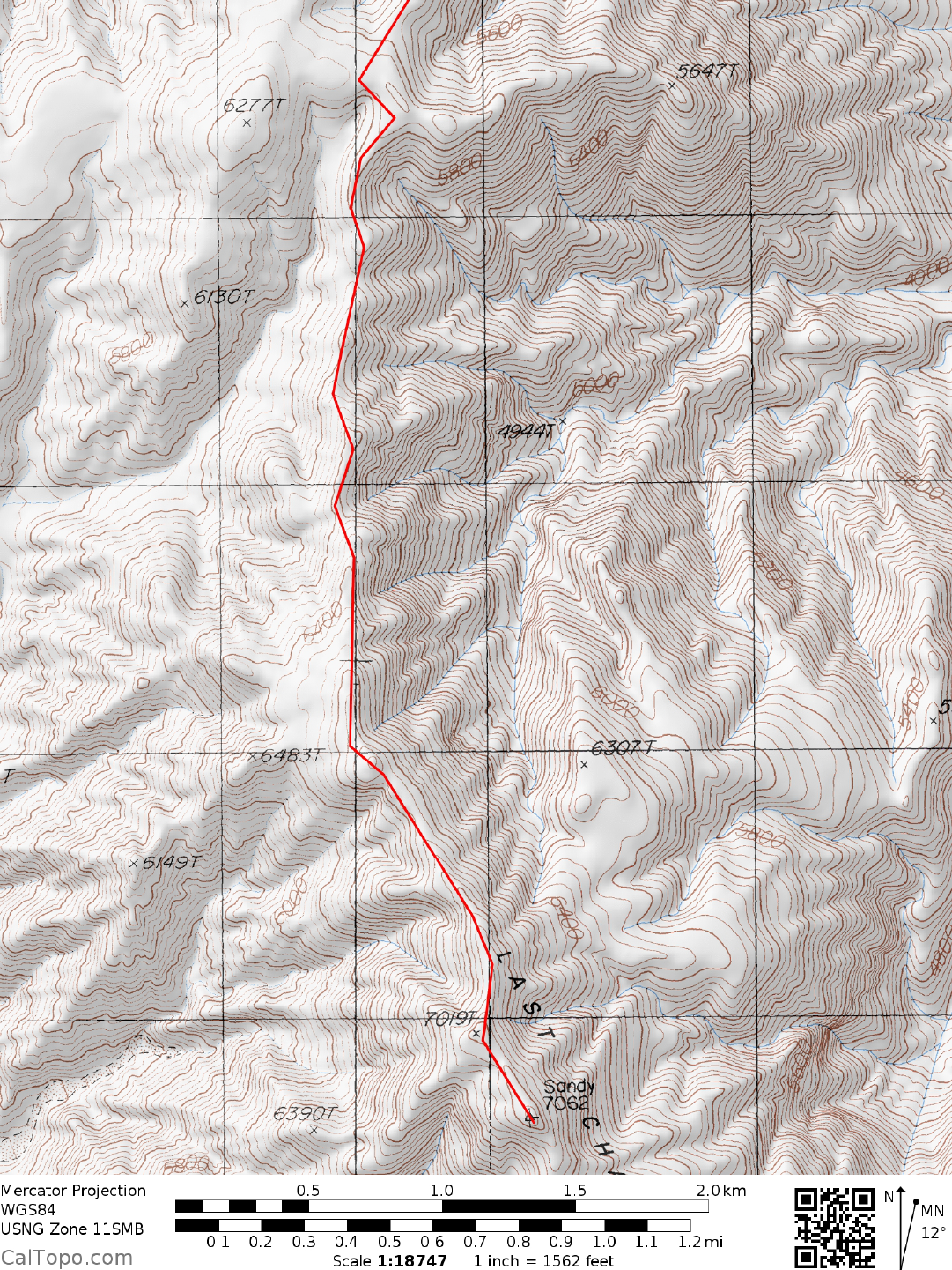
CLIMB: From the vehicles hike 1.0 mile SE, then turn E up a canyon that runs between points 5829 and 5736. In 0.75 miles you'll come to a large, flattish area at approximately 5450 feet elevation. Start bearing SE here to gain the long, undulating ridge which is followed S about 3.5 miles to the summit. Outstanding views of Death Valley, the White Mountains, the Inyo Mountains, and Eastern Sierra are to be enjoyed here.
ROUND TRIP STATS: 2700 feet elevation gain, 11 miles, 7-8 hours
SIDELINES
- Sandy Point is usually climbed in conjunction with Last Chance Mountain as a single outing. To sim plify the DRIVE instructions between these two peaks just reme mber that the parking spot for the start of the Sandy Point hike is 3.0 miles W of Crankshaft Junction on the excellent, graded Death Valley Road. Crankshaft Junction is the turnoff for the approach to Last Chance Mountain. Or alternatively, the new approach to Last Chance Mountain is located a few miles down the hill from the turn out for Sandy Point, and the road in is much better.
- This peak is located within the boundary of Death Valley National Park.