Guide
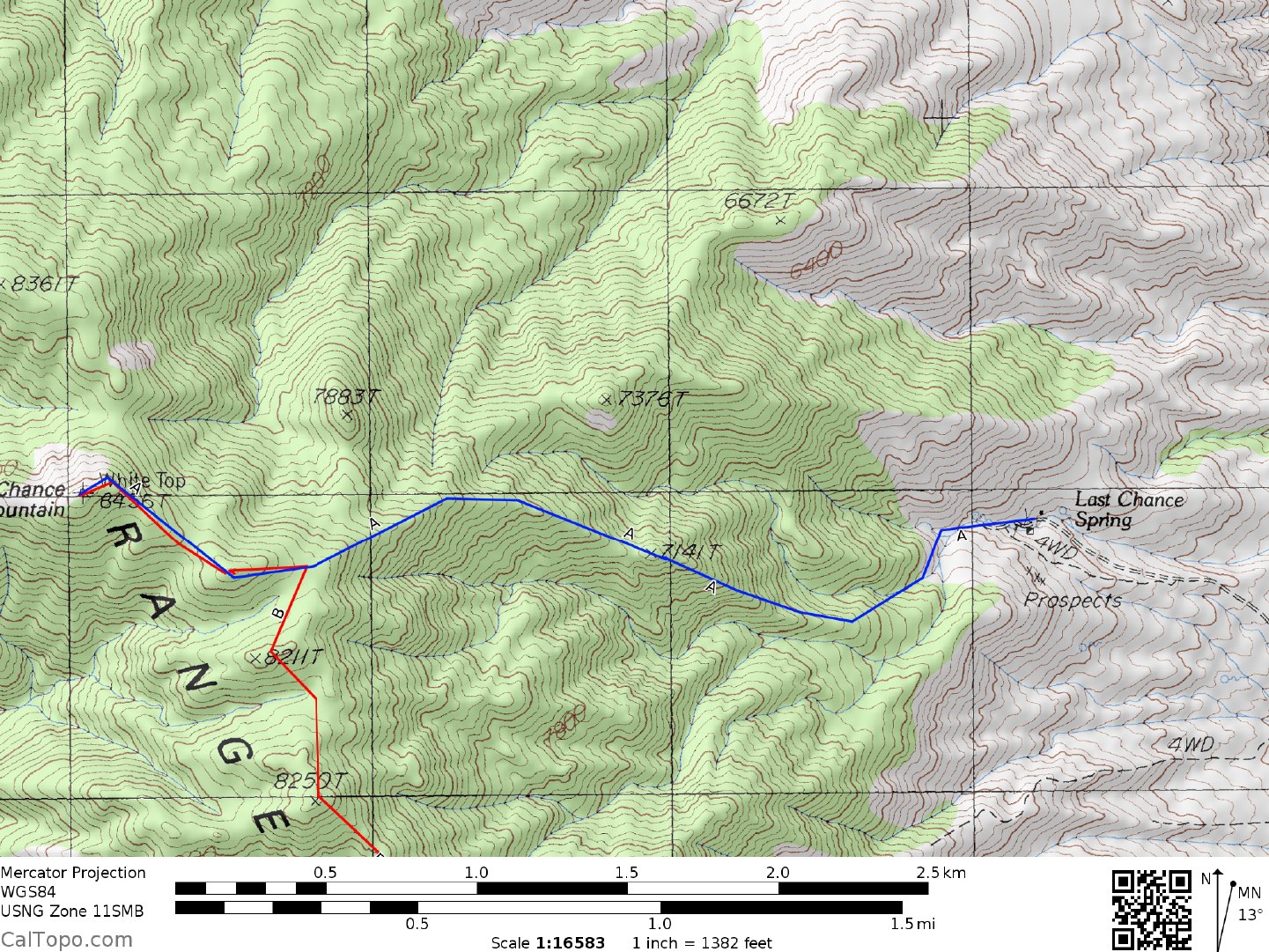
ROUTE A DRIVE/WESTERN APPROACH: From US Highway 395 at Big Pine, CA., turn right (E) on paved State Route 168 heading for Westgard Pass. At a fork in 2.2 miles bear right on the narrow, paved Waucoba-Saline Valley Road (further on called the Death Valley Road on the Auto Club Death Valley map) and follow it eastward for nearly 50 miles to Crankshaft Junction. The road is paved as it passes over the Inyo Range and drops down into the Eureka Valley. The stretch of road across the valley floor is excellent graded dirt, giving way to more pavement as it climbs out the east side of the valley into Hanging Rock Canyon. Excellent graded dirt is once again encountered as the road tops off at a pass over the Last Chance Range and drops to Crankshaft Junction. From the junction, turn left (N) on a fair dirt road and drive 0.8 miles, bearing left (NW) on a poor dirt road which is followed 1.7 miles to a fork. Bear right here and follow a fair dirt road just under 1.0 mile to its end. Park. Note: the last 100+ yards or so have several gravel "bumps" on the driver's side, which will cause the vehicle to tilt. Caution is advised here.
ROUTE A DRIVE/SOUTHERN APPROACH: From the turnoff to Scotty's Castle just N of the Grapevine Ranger Station in Death Valley, drive W on the paved road leading to Ubehebe Crater. In 2.7 miles turn right (N) on a good dirt road, following it about 21 miles to the signed Crankshaft Junction. Follow the DRIVE/WESTERN APPROACH DIRECTIONS from here to the start of the climb.
CLIMB: From the starting point, identify the prominent ridgeline bump at a bearing of 255°. This is point 7141 as shown on the 7.5 minute topo and is recognized by the rock pinnacle just left of it. Your ascent route will take you directly over this point. To get there, hike a faint road W from the cabin for about 250 yards into the canyon, arriving at Last Chance Spring. From the spring, follow the wash uphill and to the left. In 200 yards turn right up a small wash and pick any convenient place to exit left up slopes to the ridgeline above. As an option, you can continue up this wash about 0.2 miles before exiting left up the slope; you'll encounter some small dry waterfalls along the way to liven up an otherwise dull Class 1 hike. In either case you'll end up on the ridgeline which is followed W over point 7141 on its way to point 8280+, 0.4 miles SE of the peak. Contour just below point 8280+ on its N side to a saddle between it and the peak. Climb 0.25 miles WNW to the summit.
ROUND TRIP STATS: 3000 feet elevation gain, 5 miles, 5 hours
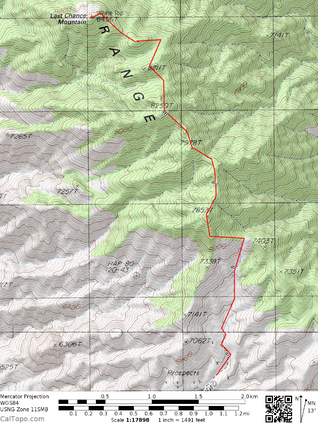
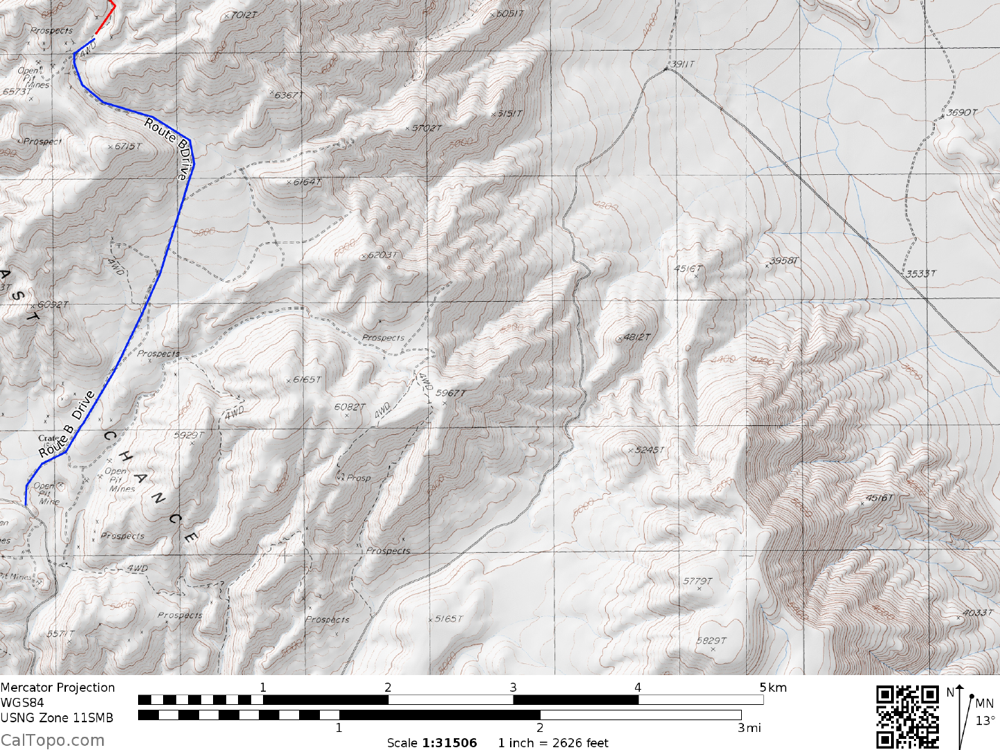
ROUTE B DRIVE/SOUTHERN APPROACH: If you are coming up from Death Valley, go north on Death Valley Road. Where the paved road turns to go up to Ubehebe Crater, Death Valley Road continues straight ahead on a gravel road. This road is often badly washboarded. When you reach Crankshaft Junction, continue towards the Sandy Point TH. At approximately 28 miles from the end of the paved road you will turn right onto a poor, high clearance dirt road leading to the sulphur mine. Once at the mine, stay on its left. The road enters a narrow canyon. At approximately 2.8 miles there is an old mine adit on your left. To your right is an old road leading into a canyon with a saddle visible above. Park
CLIMB: Head towards the saddle ahead. After approximately 0.5 miles the wash will fork. Take the right fork and continue to the saddle at 7300'. Follow the ridge as it heads first left, then right over several intervening bumps to the summit.
ROUND TRIP STATS: Approximately 7 miles and 2800' of elevation gain, 5 hours
Sidelines
Camping Notes: There is room for a few vehicles at the site of the now destroyed cabin. Camping is allowed, but fires are not, as this is within the DVNP boundary. There are ample flat places to camp at or near the start of the sulphur mine route to Last Chance. Again, no fires are allowed, as this area is just within the park boundaries. There is also room for one vehicle each at either of two now closed 4WD roads leading to the south from the road in. They are about a mile from the start of the climb.