Route Description
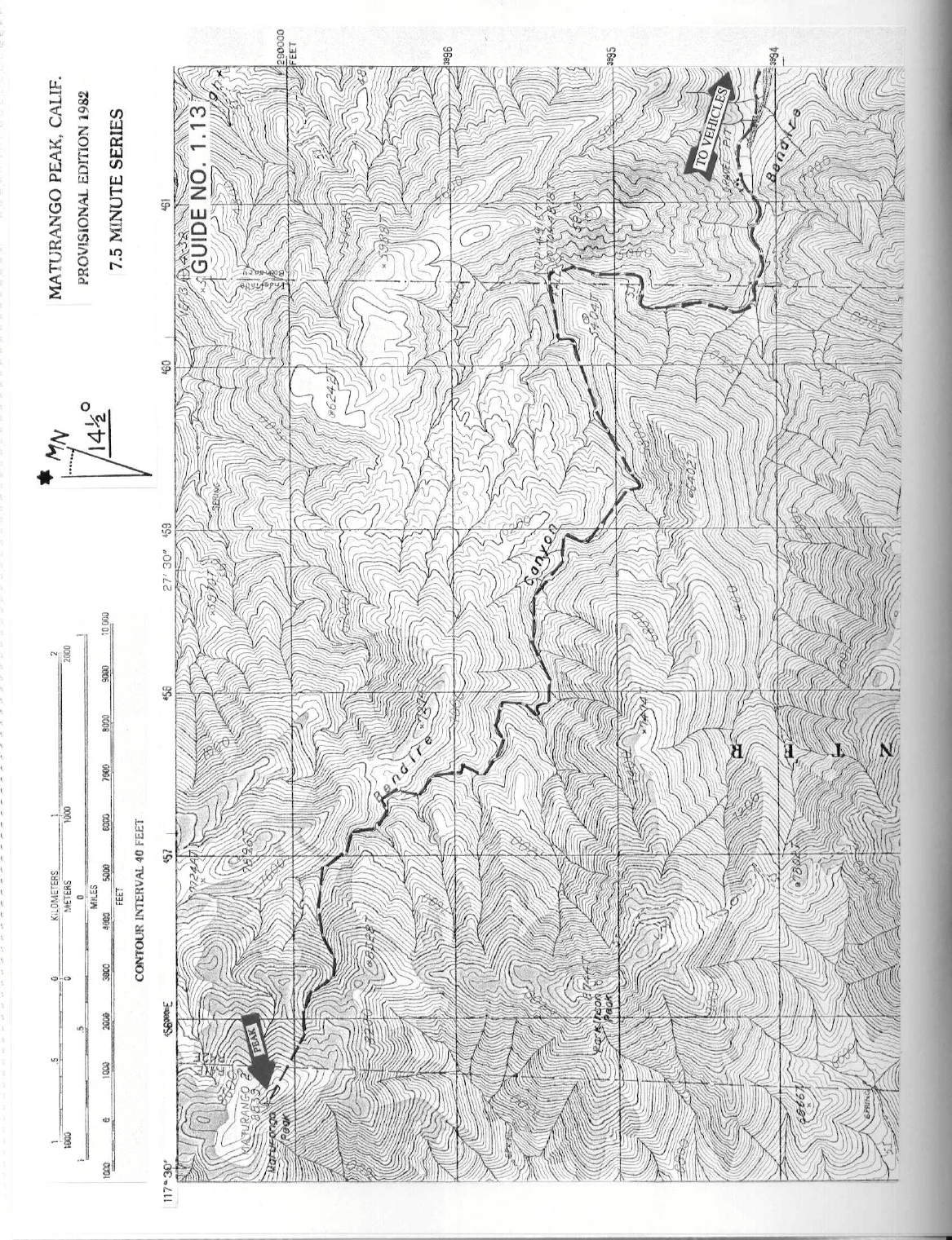
DRIVE: From Trona, CA., drive about 14 miles N of the Inyo County Line sign on the paved Trona-Wildrose Road to the signed, paved Na deau Trail Road. There is an "Onyx Mine" sign at this intersection. Turn left (N) here on the narrow, paved road and drive 6.0 miles to a dirt road on the left signed "Whitaker Western LTD". Turn left here, following the poor dirt road approximately 3.5 miles into Bendire Canyon to the Argus Mountains Wilderness boundary. Park.
CLIMB: Hike W up the canyon road about 2.7 miles, following it as it bears right (N) there and continues 0.75 mile to its end near a dry waterfall at the 4800 foot level in Bendire Canyon. Scramble up loose slopes to the left (S) of the waterfall and follow Bendire Cany on generally W for about 2 miles to a fork at the 6400 foot level. Bear right (N) at this fork and continue following the canyon for 1.5 miles to a large duck at the 7320 foot level, where you'll turn left up a side canyon which is followed to the peak.
ROUND TRIP STATS: 5700 feet elevation gain, 16 miles, 14 hours
SIDELINES
- This peak is within the China Lakes Naval Weapons Center. The approach from the east may be closed at any time.
- Maturango Peak lies W of the boundary of the Argus Mountains Wilderness Area, however the approach hike passes through it. This new wilderness area was creat ed as part of the California Desert Protection Act of 1994, Public Law 103-433, Section 102 (1). The Argus Mountains Wilderness Area encompasses approximately 74,890 acres of land and is managed by the Bureau of Land Management (BLM).