Guide
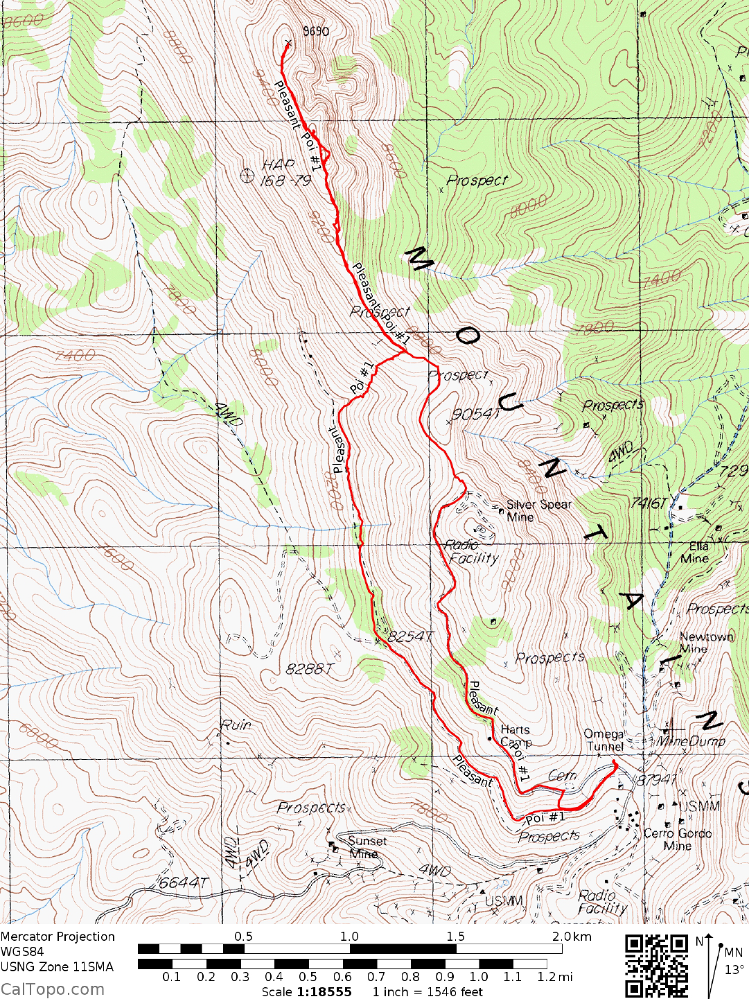
DRIVE/ROUTE A: From Olancha, CA drive 14.6 miles E on State Highway 190 to its junction with State Highway 136. Turn left (N) on State Route 136 and drive 4.9 miles to the town of Keeler on the eastern shore of Owens Dry Lake. If you're coming S on State Highway 136 from Lone Pine, CA you'll drive 12.6 miles to Keeler. Just S of Keeler turn E off the highway onto the signed Cerro Gordo Road. Follow the dirt road (steep at times) 7.5 miles to the historic townsite of Cerro Gordo. About 500 feet beyond Cerro Gordo proper you'll reach a saddle at 8200 feet elevation on the crest of the Inyos. Turn left (N) following a dirt road about 150 feet to a fork. Take a right at the fork (upper road), driving to an unlocked gate. Continue beyond the gate 1.5 miles to the crest of the Inyos at 9080 feet elevation. NOTE: Although the area around Cerro Gordo is rife with No Trespassing and Private Property signs, driving routes A and B described herein heading N toward Pleasant Point are all open for public access. (Follow up: The gate for the A has been locked since 2010. The B route is still open and in good condition as of 11-10-14.)
CLIMB/ROUTE A: Hike N along the crest for 1.5 miles to the highpoint, bypassing a false summit en route.
ROUND TRIP STATS/ROUTE A: 700 feet elevation gain, 3 miles, 2-3 hours
DRIVE/ROUTE B: Follow Drive/Route A directions to the 8200 foot saddle just beyond Cerro Gordo. Turn left (N) following a dirt road about 150 feet to a fork. Ta ke a left at the fork (lower road), driving 0.1 miles to an unlocked gate and a BLM sign "Swansea-Cerro Gordo Road". Continue beyond the gate 0.75 miles to a junction with a foot trail. Park.
CLIMB/ROUTE B: Hike N along the foot trail about 1.0 mile to two abandoned cabins just off the trail. Leaving the trail here, climb N across steep, slate covered slopes to the crest. Head N along the crest to the summit.
ROUND TRIP STATS/ROUTE B: 1500 feet elevation gain, 4 miles, 3-4 hours
DRIVE/ROUTE C: Follow Drive/Route B/Southern A pproach for New York Butte, Guide No. 1.10 to the starting point for this clim b at 9000 feet elevation. 4WD is a must on this route.
CLIMB/ROUTE C: Hike SE up an easy slope to the NW ridge of Pleasant, which is followed to the top.
ROUND TRIP STATS/ROUTE C: 700 feet elevation gain, 1.25 miles, 1 hour