

|
This peak guide is presented here for the convenience of our visitors.
|
|||
|---|---|---|---|
|
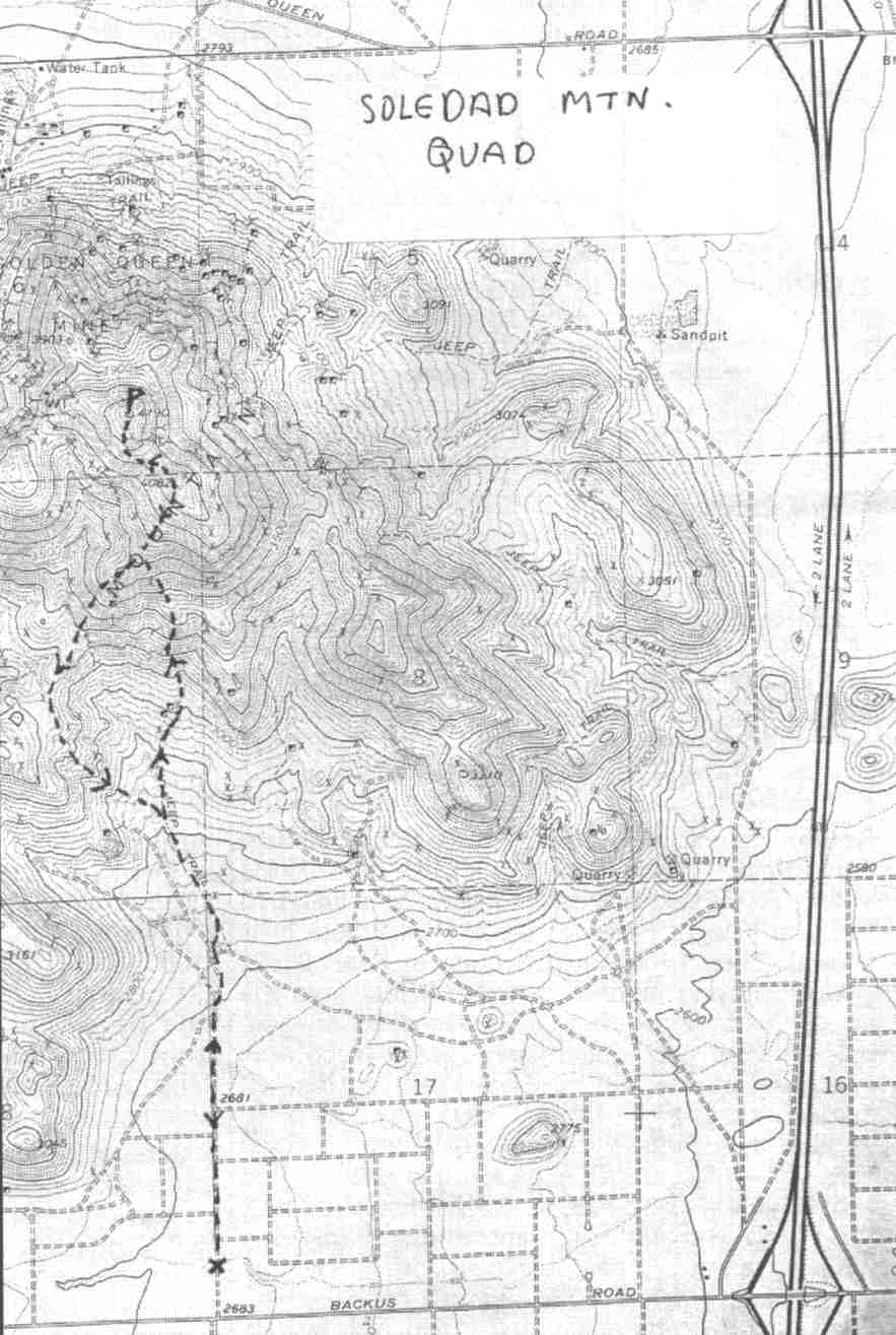
This guide is based on a Sage article by Bob Michael Topo Map: Soledad Mountain 7½ DRIVINGFrom Lancaster, drive north on Hwy. 14 to Backus Road. Go west on bakus to where you turn off up a promising-looking dirt road almost due south of the summit. Park near here as a wash has cut a gully across the road that was floored with soft sand. HIKINGIt was just over a mile to the southern flank of the peak. The whole mountain is fractured and mineralized rhyolitic volcanics. While the entire mountain has been heavily prospected, the northern side - site of the "Golden Queen Mine" - has really been ripped up in the search for gold; roads to core-drilling sites ascend the north side to a few hundred feet below the summit. The southern side is still pretty wild, and much less dug up; at any rate, access on the north appears doubtful because of all the private mining property. My route cut up a southwestern ridge to the 4082' false southern summit. Between about 3500' and 3700' was a tedious, dicey steep stretch of crumbling volcanic gravel on hardpan dirt that was like walking on steep eggs. Some craggy stuff on the S side of the true summit can be contoured to the south and west. NOTESIts name means " solitude" in Spanish, and it's a good name for a peak that rises all by its lonesome southwest of the town of Mojave in the rather flat and uninspiring western end of the Mojave Desert. It's a classic example of the kind of desert land-form geornorphologists call an "inselberg" (German for "island mountain") In fact, this is absolutely the furthest-west desert peak of any consequence; the view from the summit takes in HPS peaks rather than anything on the desert list. A landmark on the Sierra commute, I'm sure all of us have thought of running up it, but it's not on any List, summer is too hot, and it's a long way to South Lake ... This peak is a long way from anything else I've climbed, and the view was correspondingly different. Probably the closest recognizable peaks are HPS Tehachapi, Double, Cross, and Chuckwalla. To the west, the almost-flat prairie of the Mojave tapered to a point at Gorman between the converging traces of the San Andreas and Garlock Faults. Many of the HPS northern Ventura County peaks were arrayed west of Gorman. |
|
||||||
| Desert Peaks Section, Angeles Chapter, Sierra Club © Copyright 1998-2012 - All Rights Reserved Updated: February 9, 2012 |