

|
This peak guide is presented for the convenience of our visitors.
|
|||||
|---|---|---|---|---|---|
|
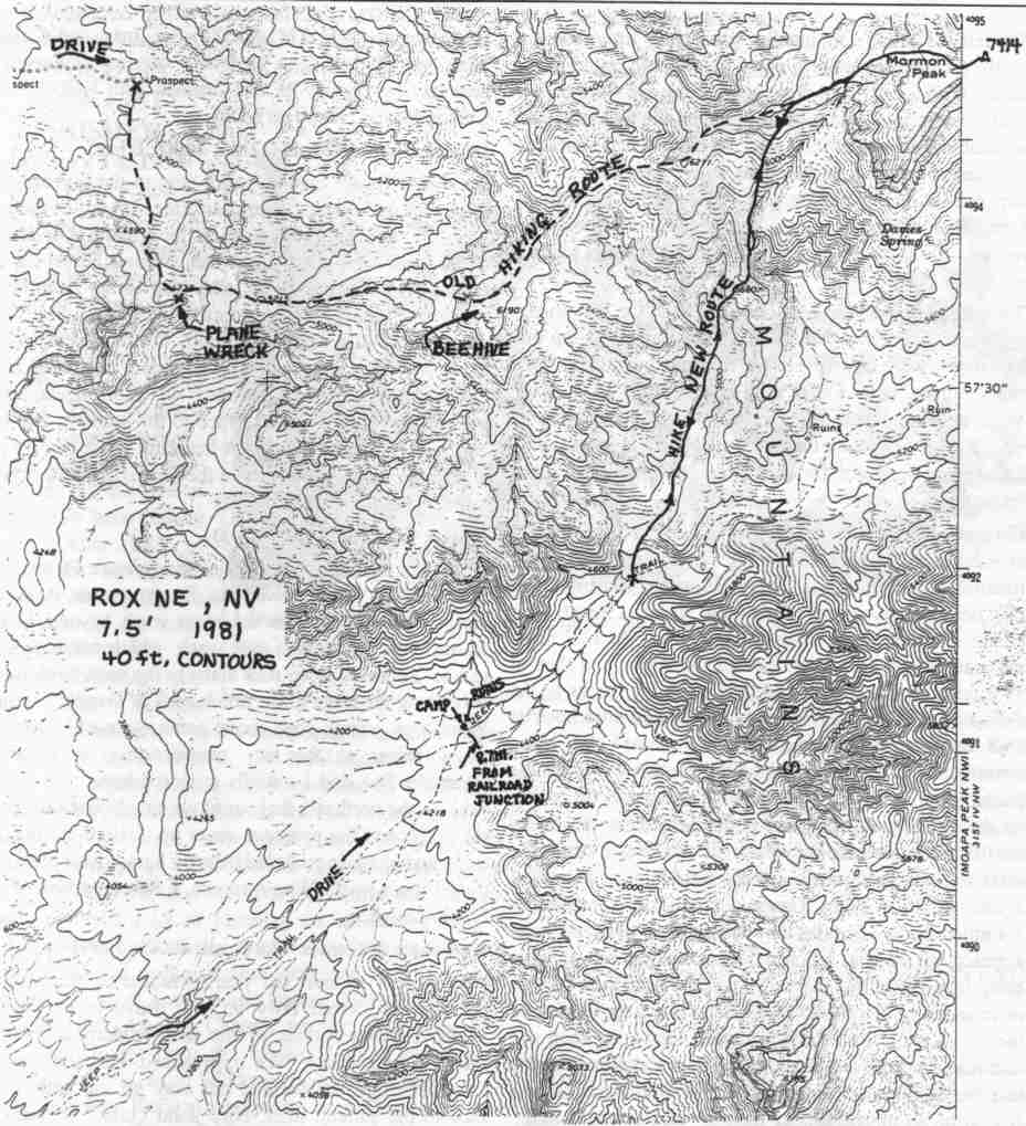
This guide is based on a Sage article by Richard L. Carey. Topo Map: Moapa Peak NW 7½, Rox NE 7½ DRIVINGOn I-15 at Glendale take highway 168 NW for 2.8 miles to a dirt road just before a railroad overpass where you turn right (N) onto a very good graded dirt road. Reset your odometer and note the following mileages: At 11.7 miles the road crosses to the left side of the tracks and then at 14.3 miles ford a stream and then cross the tracks to the right side at 15.5 miles. There is a railroad switchbox at 15.8 miles marked "Rox, CPC399". At 16.1 miles overall, or 0.3 miles past the box, the road crosses the tracks again to the left (W) side. Turn right at this point, go through a gate, and head north paralleling the tracks for 0.3 miles to a road on your right. Take this road up a wash and after it climbs up on the flat plain go straight at a junction at 2.4 miles. Continue straight at a junction at 8.4 miles and at 8.7 miles the road makes a right turn with a mescal pit on your left which is one of the few suitable camping areas in the canyon. Start the hike from here or drive another 0.8 miles to where there is a large canyon on the left (Very limited parking here). HIKINGLeave the road and hike north and then NNE up the canyon and after 3/4 mile take the right branch up to a saddle at 5680 ft. Continue NE on up to the ridge and then go east to the summit. |
|
||||||
| Desert Peaks Section, Angeles Chapter, Sierra Club © Copyright 1998-2012 - All Rights Reserved Updated: February 9, 2012 |