

|
This peak guide is presented for the convenience of our visitors.
|
|||||
|---|---|---|---|---|---|
|
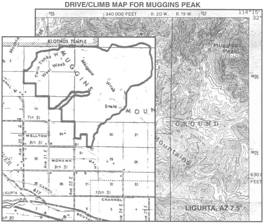
This guide is based on a Sage article by Mark Adrian. Topo Map: Ligurta 7½ DRIVINGFrom Yuma, AZ, proceed east on 18 to the Ligurta exit. Go east through Ligurta to Dome Valley Road and turn north. Follow Dome Valley Road (aka Avenue 20E) north to the 4-way stop-signed intersection with County 7th and Avenue 20E. Turn east on to County 7th and proceed 1 mile to the Dome Valley Transfer Station. Follow the dirt road around the southeastern comer of the transfer station and proceed north/northeast passing a BLM sign at 1.6 miles. Continue driving the now 4WD track up Muggins Wash to 3.0 miles where there is ample parking. Note : 4WD/ clearance mandatory. HIKINGApproach the peak from the southwest. The route has some class 3. NOTESThe Muggins Mountains, named after a prospecter's mule, offer a variety of scenic values, day hikes and allegedly, rock climbing opportunities. I had seen Muggins Peak numerous times in the past and the locals have dubbed it "cat ears" for the distinctive profile of its two summits, the northern being the named and highest. Although, you can't tell the northern is higher until you're on top, for it must only be a few feet difference. So, being able to drive to within one air mile of the peak was a generous "find". But, that generosity soon ends, for the short distance is more than compensated for by an elusive third class route. |
|
||||||
| Desert Peaks Section, Angeles Chapter, Sierra Club © Copyright 1998-2012 - All Rights Reserved Updated: February 9, 2012 |