

|
This peak guide is presented for the convenience of our visitors.
|
|||||
|---|---|---|---|---|---|
|
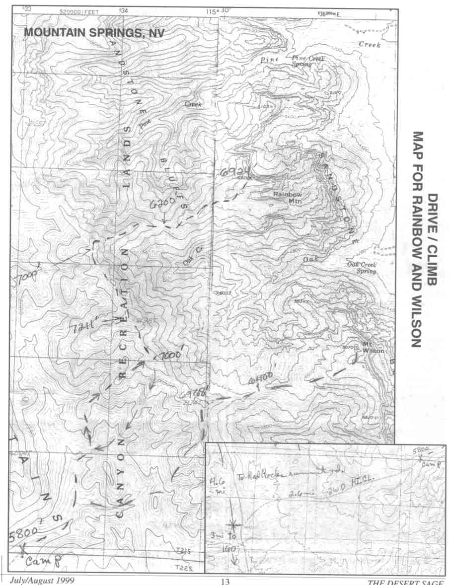
This guide is based on a Sage article by Ted Brasket. Topo Map: Blue Diamond 7½ DRIVINGAfter going over Mt. Springs Pass on Highway 160, you'll come to the paved Lovell Canyon Road in approximately 3.5 miles. 3 miles north on Lovell Canyon Road turn right on 2WD high clearance road. It's 2.6 miles to its end and camp. Go the full 3 miles on Lovell Road before turning right. HIKINGRainbow Mountain from camp (not visible, 28 degrees 13 degrees mag). Follow the wash above camp NE for approximately 0.5 miles. The wash divides here with one branch going ENE and the other ' due north. Take the north branch for approximately 0.25 miles. Leave the wash on the east side and get on a ridge running north. It joins a ridge that will take you NE up to the main north-south ridge crest at 7000'. There's an easy class 3 rock band on the way up. The north- bound I+ miles up and down the ridge is a delightful journey with fantastic scenic views. All along the crest it drops off steep on the east side. It's mountain vegetation down to the saddle then abruptly turns to multicolored sandstone. When you reach ridge point 7,000' across from Rainbow Mountain, go north just past the high point to the first notch in the ridge. It's a severe drop off approximately 70' to the base of the ridge that runs down to the saddle 800' below. Stay on the north side of the ridge to get on top as soon as possible. This descent is a bit steep. Stay on top of the ridge bypassing obstacles mostly on the north side. Careful route-finding will keep you from ever dropping down to high-angle loose side hills. It goes really good down and back up. Study your route up the Red Rocks from this ridge. There's one of "Mother's" tricks on the route to the summit. What looks to be connected all the way up, isn't. You think you're doing great until you reach a dead-end looking down 100' wall on three sides and have to back-track down and by-pass this area on the north side. Just before the summit do an easy class 3 down-climb of maybe 12'. The views to Bridge Mountain and back to Mt. Wilson and the canyons in between are unreal. NOTESOf the colorful Red Rocks high points, Rainbow Mountain is the most brilliant. It can be combined with Bridge Mountain for an excellent weekend trip. |
|
||||||
| Desert Peaks Section, Angeles Chapter, Sierra Club © Copyright 1998-2012 - All Rights Reserved Updated: February 9, 2012 |