

|
This peak guide is presented for the convenience of our visitors.
|
|||||
|---|---|---|---|---|---|
|
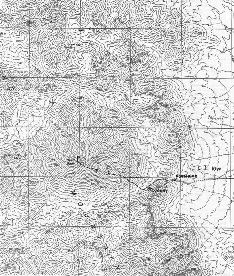
This guide is based on a Sage article by Bob Michael Topo Map: State Line Pass 7½ DRIVINGThe peak is easily reachable on a fairly good (2WD high clearance) road which leads into the canyon on its southeast side. To access this road, it is necessary to exit I-15 at Jean and head south for 5 miles on old US 91 which parallels I-15 on the east. The pavement ends at a T-junction; the dirt road on the right goes under I-15 in a culvert-like underpass and leads up the bajada about 4 miles to the roadhead where the road disappears into the wash about 1/4 mile east of a large quarry in the metamorphosed limestone on the SE side of the peak. HIKINGLocate a rudimentary ridge on the SE flank of the peak which descends almost straight to the quarry. This ridge extends the altitude gain over slightly more distance and is slightly easier going - but not much. Not only is this peak ridiculously steep, but the igneous rock weathers to a tedious platy chiprock which makes for nasty footing. Follow it to the summit ridge which is more solid and less steep. This ridge narrows to two twin pointed summits (the northern one is higher) with great views of Clark, Kingston, and McCullough ranges and the desolate southern end of the Springs. NOTESA steep, sinister-looking peak with a name to match is the southernmost named summit in the Spring Mountains. This peak which dominates the view to the range west of I-15 between Stateline and Jean. The peak has an interesting geology; it is a roughly circular plug of shallow intrusive (igneous) rock which cooled too quickly and too near the surface to develop the coarse grainy texture of a granite. This once-molten mass was intruded into the limestone which makes up most of the Springs. The contact zone of shattered and "cooked" (contact-metamorphosed) limestone surrounding this intrusion has preferentially eroded away, creating a topographic "moat" around the peak which accentuates its steepness and prominence. |
|
||||||
| Desert Peaks Section, Angeles Chapter, Sierra Club © Copyright 1998-2012 - All Rights Reserved Updated: February 9, 2012 |