

|
This peak guide is presented for the convenience of our visitors.
|
|||||
|---|---|---|---|---|---|
|
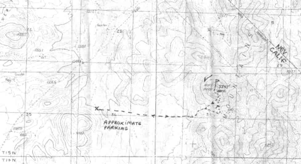
This guide is based on a Sage article by Bob Michael. Topo Map: Hart Peak 7½ DRIVINGFrom the Nipton Road, take Ivanpah Road over the pass east of New York Mountain into the Lanfair Valley. Just south of the pass summit, the excellent, graded Hart Mine Road turns off to the east. The roads have been completely redone since the 7.5' "Hart Peak" topo was compiled; just stay on the "main drag" past the Hart Mine and soon the unmistakable triangular crag of Hart Peak looms ahead to the east. Pull off the road onto a poor, marginal 4WD road at about 4430' (1350m). HIKINGNot specified. NOTESSome of the finest country in our desert is the highlands between the Mid Hills and the McCullough Range with the New Yorks at the center, with its Joshua forests and groves of yucca and juniper. Far enough from both LA and Vegas to still have a nice outback vibe. Here in the Castle Mountains on the furthest eastern borderland of California rises a dramatic, steep turret of a peak which -is rather reminiscent of Mopah, both visually and geologically. The register dates back half a century and has the names of most of the pioneers of Desert Peaking -- Andy Smatko, Tom and Trudie Hunt, Bill and Marge Henderson, Ed Lane, Arkel Erb, Graham Stephenson, etc. |
|
||||||
| Desert Peaks Section, Angeles Chapter, Sierra Club © Copyright 1998-2012 - All Rights Reserved Updated: February 8, 2012 |