

|
This peak guide is presented for the convenience of our visitors.
|
|||||
|---|---|---|---|---|---|
|
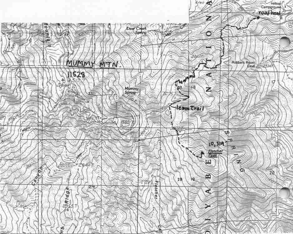
This guide is based on a Sage article by Bob Michael. Topo Map: Angel Peak 7½ DRIVINGThe trailhead is at the 8,400' highpoint of Nevada Highway 158, a short, very scenic high route which connects Lee and Kyle Canyons. This is also a route to Mummy Mountain. HIKINGThe route to Fletcher leaves the Deer Creek Trail about three miles from the roadhead at 10,000' in a slight saddle between two bumps (see attached map) and drops about 250' to the major saddle separating Fletcher from the Mummy massif. From this saddle it is a straight shot up the northeast ridge of Fletcher with about 550 feet of gain to the top. NOTESFletcher Peak is a southeastern spur of Mummy Mountain, but a quite respectable peak in its own right. It is accessed via the Deer Creek Trail. This ridge supports one of the most beautiful forests of ancient patina'd, wind-sculpted bristlecones I've ever passed through; their bitter resinous fragrance is the distilled essence of high remote desert ranges. You have excellent views of golden aspen groves climbing the slopes out of Kyle Canyon below you, and of the soaring cliffs at the south end of the Mummy a mile northwest. |
|
||||||
| Desert Peaks Section, Angeles Chapter, Sierra Club © Copyright 1998-2012 - All Rights Reserved Updated: February 9, 2012 |