

|
This peak guide is presented for the convenience of our visitors.
|
|||
|---|---|---|---|
|
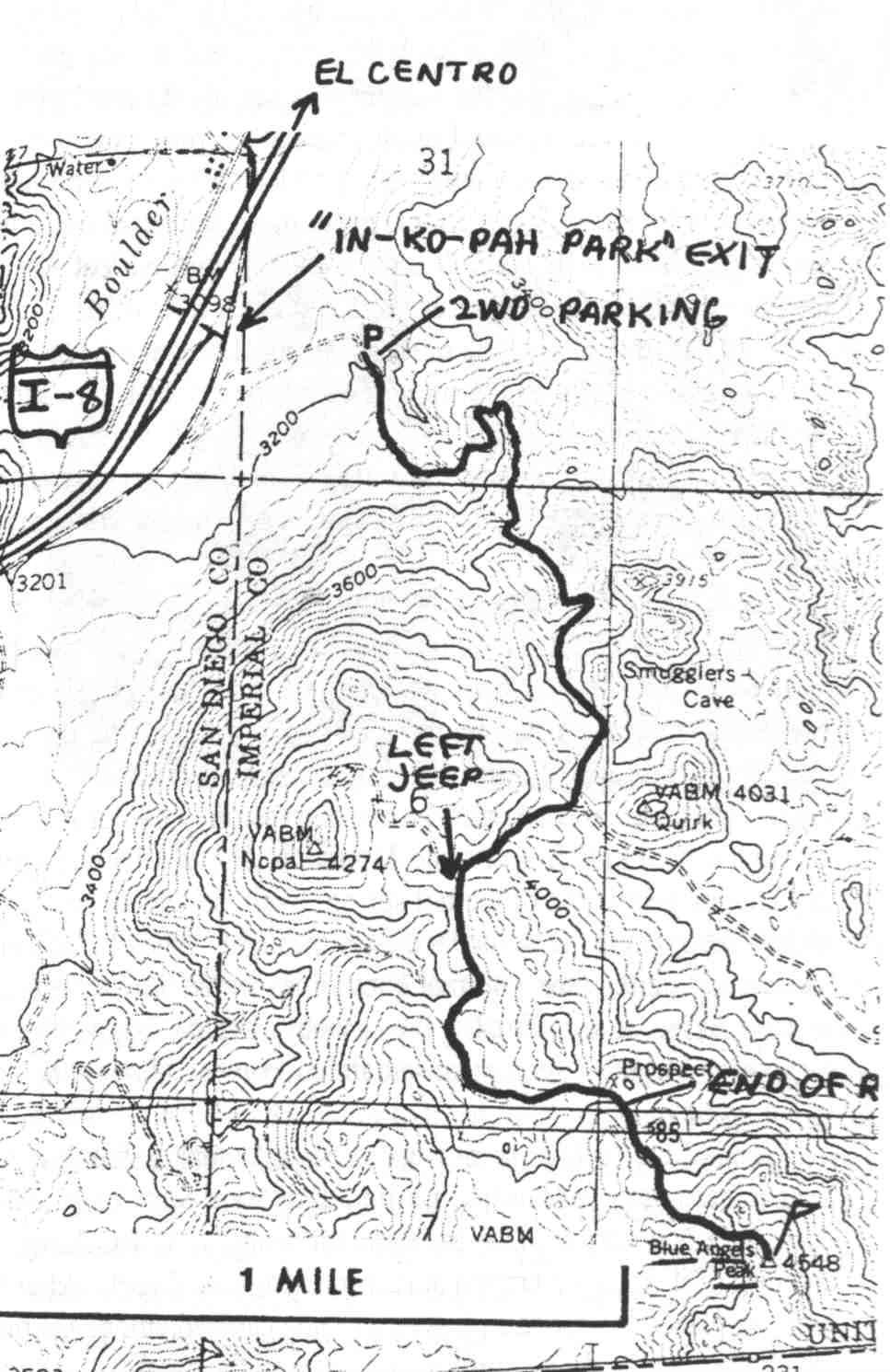
This guide is based on a Sage article by Bob Michael. Bob refers to information found in California County Summits by Gary Suttle (Berkeley: Wilderness Press, 1994) . Topo Map: In-Ko-Pah Gorge OE S 7½ DRIVINGFrom Yuma head east on I-8 . Get off at the In-Ko-Pah Park exit astride the San Diego County line; the dirt access road (see accompanying map) is very obvious. Suttle says to park at the indi-cated point, near some high-tension power lines, this is pretty much the reasonable end for 2WD's, so we left Patty's "Amanda'' there and hopped into Rich's Jeep to drive the 4wd road, very steep in places but not too awful. We parked at the indicated saddle where the road deteriorated and we weren't sure we could turn around ahead. The road ends at the mine pros-pect shown the topo. (Worth a detour nice Muscovite mica tablets and smoky quartz specimens from a pegmatite vein.) HIKINGSuttle describes a ''use trail" going south from here; all we could see was an animal trail which fizzled in about a hundred yards, so we just contoured south through huge granite boulders and mild chaparral to a gentle east-west spur ridge at 4280+. Head east on this ridge and get into the drainage between Blue Angels Peak and its craggy northern forepeak; a natural easy path through the chaparral goes up this drainage to the north ridge of the peak. Finish on the eastern side of this summit ridge to avoid major bouldering and brush. NOTESThis peak is in the extreme southwest corner of Imperia1 County, not too far from DPS Jacumba Peak, where the Peninsular Ranges march south into Baja. It is quite possibly the southernmost named peak in the state; a sil-ver boundary monument is plainly visible a couple hundred yards south of the bouldery summit. |
|
||||||
| Desert Peaks Section, Angeles Chapter, Sierra Club © Copyright 1998-2012 - All Rights Reserved Updated: February 9, 2012 |