

|
This peak guide is presented for the convenience of our visitors.
|
|||
|---|---|---|---|
|
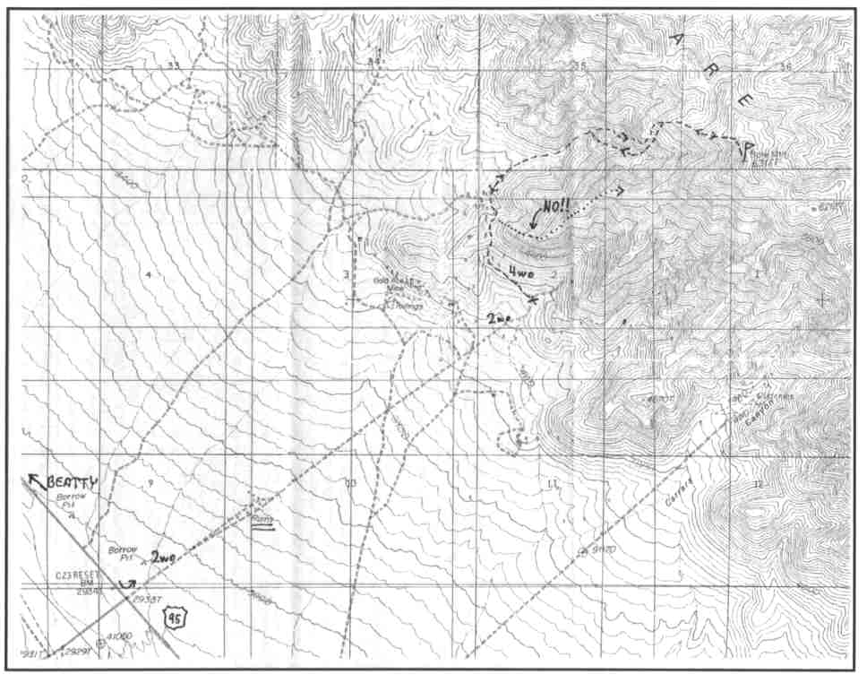
This guide is based on a Sage article by Bob Michael. Topo Map: Carrara Canyon 7½ DRIVINGFrom Beatty, we head about 7 miles southeast of town on Highway 95. Our approach road joins 95 at a stop sign. Some concrete ruins (shown on the topo) are visible about a mile NE of 95; the correct road goes right past these. I was able to take my 2wd truck to the end of the road about 2 miles from 95 with no trouble. HIKINGHike north down into a quite beautiful canyon. Exit the upper canyon on a steep but doable ridge when the walls began to close into a "box". The class 1-2 ridge goes very nicely to the crest of the range. NOTESThe summit gives great views to the east of the forbidden territory of the Nevada Test Site; Yucca Flats, Frenchman Flats, and Yucca Mountain, the site of the proposed national nuke waste burial vault. What a (literally) eye-popping view one would have had at times from this summit back in the good old days of atmospheric A-bomb tests To the north of the nuke testing area, but still in the Test Site, is the high lonely pinyon-forested plateau country of Timber Mountain :and Shoshone Mountain; seemingly unmarked by man, this was an awesome vision of an enormous expanse of more or less primordial high desert. |
|
||||||
| Desert Peaks Section, Angeles Chapter, Sierra Club © Copyright 1998-2012 - All Rights Reserved Updated: February 9, 2012 |