After lunch we headed out of town on the road to Chicago Valley. Just before the bend at the top of Resting Spring Pass, on the left hand side, there is a wonderful display of layered, faulted volcanic stratas. It is only evident because of the exposure made when they created this road. We studied the area for 45 minutes or so. The rain cooperated and didn't start up again until we were ready to leave.
Then we stopped in the Kingston Range to observe stromatolite deposits (1 billion year old matted algae). There are nearby mining sites that in the future just might destroy these specimens.
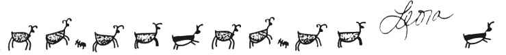
Over the hill at 5000' and down the other side we ended at Cima Road and the I-15 intersection. We stopped at Cow Cove and saw some marvelous petroglyphs. The BLM has intentionally not publicized their whereabouts, and neither shall we. At this time it was sprinkling lightly but it didn't stop us from walking the 1/4 mile or so to the petroglyph site. There were perhaps 1,000 Indian drawings carved in the thin layer of desert varnish that coats the rocks. Ron and I had never seen petroglyphs in the rain. (It makes it much more difficult to spot them.)
The Long Beach group left us here and we decided to camp at this point. It was 5pm, misting, and we were more than an hour from the planned campsite at Mitchell Caverns. We were down to 6 people at this point and our Italian potluck, planned on 12, was a success. Ron managed to get a fire going and we warmed ourselves next to it for an hour or so.
It rained all night long. The road in had been somewhat slick so we decided to skip breakfast and head out about 7am. We had no problem getting out and now were down to 2 vehicles. Our next destination was Mitchell Caverns. As we headed up the Cima Road toward the towns of Cima and Kelso, it began to snow at the 4500' level. By 5000' we saw beautifully snow covered Joshua Trees and boulders. The road was getting icy as we gained altitude, but we were soon over the pass and dropping down into Cima. It continued to rain and the wind had kicked up. We opted to not take the dirt road options and rather we headed for I-40 toward Goffs and north to the Caverns. At the I-40 onramp, our remaining participants decided to call it quits. So did Ron & I. This was a great overview of the East Mojave area.
Heading back home the weather began to clear up and we stopped at Calico Ghost Town off I-15. It was a nice place to visit-once. Passing by all of that now lush desert landscape, I couldn't help but imagine how all of those wildflowers are going to look in a few weeks. They should be spectacular. When we got home there was a message on our answering machine from Nancy & Julie saying they had gotten out all right.
Thanks to Gretchen Lawrence, Carolyn Brannon, Michael Donahue, Roberta Young, Nancy Granquist and Julie Tanaka, and certainly Dr. Howard Shiflett, it was a fun and educational outing. --Leora Jones
McCullough Mtn & Potosi Mtn
Mar 14-15, 1992 George Toby & Harry Brumer
The weather was great for both days. Cool, clear, and breezy. Participants were Ruth Armentrout, Walt and Carolina Kabler, Ron Grau, Evelyn Chadwell, John Canby, Delores Holladay, Charlie Knapke and the Leaders. We met Sat morn at the little town of Nipton and caravaned to the McCullough roadhead per the Desert Peaks Guide directions for Route A. We followed the power line road 3.9 miles N and turned left (w) on a fair dirt road. Here the guide is a bit in error. It says to go 4.0 miles, bearing LEFT at all forks and park. The correction is -drive