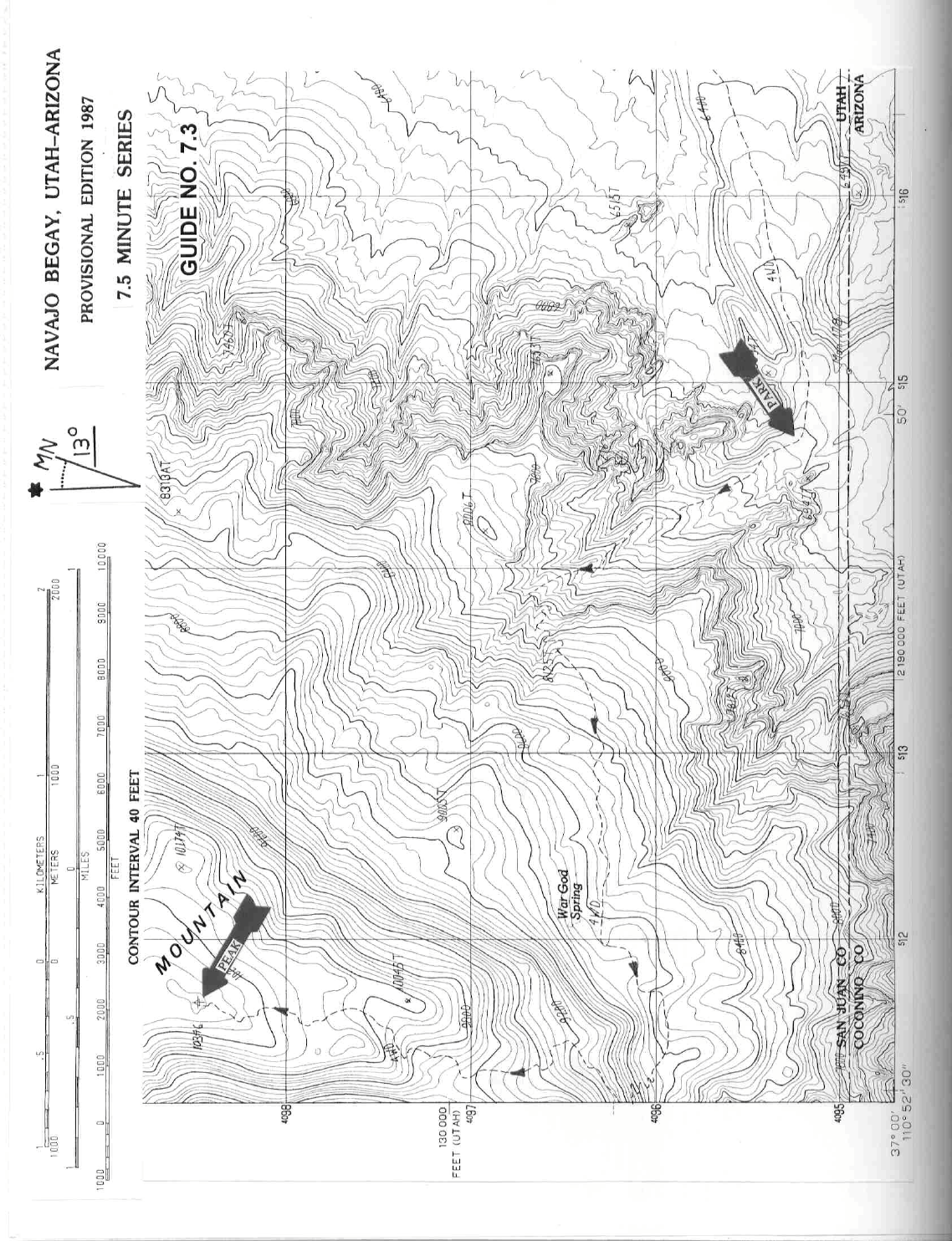
7 UTAH RANGES GUIDE NO. 7.3
NAVAJO MOUNTAIN 10388 FEET CLASS 1
Delisted April, 2018
MILEAGE: 630 miles of paved road, 27 miles of good to excellent dirt, 2.6 miles of poor dirt
DRIVE: From Flagstaff, AZ. drive 63 miles N on US Highway 89 to its junction with US Highway 160. Turn
right (E) on US Highway 160 and drive 49.1 m
iles (8 miles beyond the village of Cow Springs and 0.6 miles
E of highway milepost marker 361) to signed State Highway 98, where you'll turn left (N) and go 12.2 miles
to Indian Route 16. Turning right (N) on Route 16, drive 32.1 miles to a signed fork "Navajo Mountain
Trading Post" (The road between State Route 98 and this fork is paved for about the first 10 miles and
possibly even further now. The road beyond here is mostly excellent dirt). Bear right at the fork, crossing the
Arizona-Utah border in 4.5 miles. Continuing another 0.7 miles, turn left (W) on a powerline road (poor dirt)
and follow it 2.4 miles to a small radio repeater station just off the road. Continue another 0.2 miles to a good
parking spot for 2WD vehicles. Experienced 4WD'ers might consider continuing up the road another 5.8
miles to the summit. Steep, loose hairpin turns and generally rotten road en route can make this one of the
most difficult 4WD routes in this guide book. On the other hand, some climbers have reported this road to be
in fairly good condition, presumably just after road maintenance by crews needing to reach the radio
installation on the summit.
CLIMB: Hike up the rugged 4WD road 5.8 miles to the sum
m
it. As a alternative, hike up the 4WD road to a
well-marked trail which starts from the W side of a corral near the 8800 foot level. Following this trail will
cut off about 0.5 miles of hiking from the 4WD road route. The forested, flat summit of Navajo Mountain has
a large radio installation located on it.
ROUND TRIP STATS/2WD: 3500 feet elevation gain, 11.6 miles, 6 hours
SIDELINES
1. Navajo Mountain is considered sacred by the Navajo Indians, in spite of the radio installations adorning its
sum
m
it. You might want to get permission from the Indians at the Navajo Mountain Trading Post before you
set off on this hike.
2. The Automobile Club's "Indian Country" map is the best road guide to this area and would certainly
be
worthwhile having along on this trip.
3. Gasoline is available at the following locations en route to Navaho Mountain: 1) Tuba
City
, 2) at the
intersection of State Highway 98 and Indian Route 16 and 3) at Inscription House, 5.4 miles N of State
Highway 98 on Indian Route 16.
4. From the summit of Navajo Mountain, walk 0.7 miles NNW for a great view of the Rainbow Bridge
National Monum
ent, Lake Powell and Glen Cany
on.