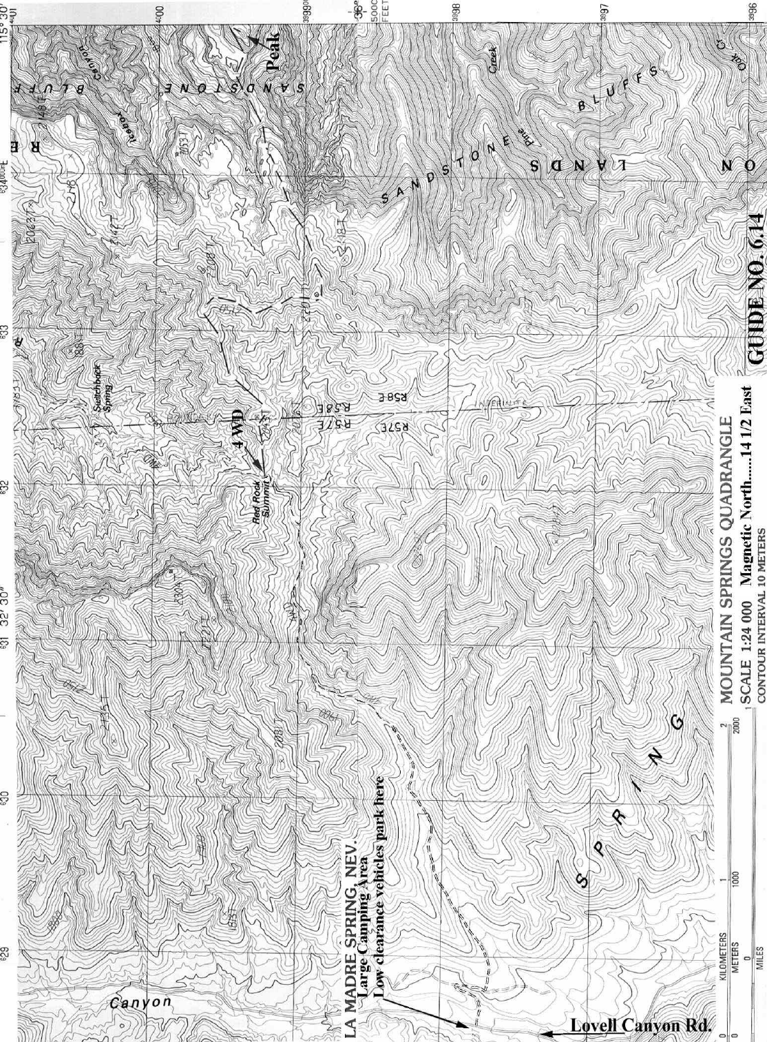
GUIDE
NO. 6.14
6 NEVADA RANGES
BRIDGE MOUNTAIN 7003 FEET CLASS 3
MILEAGE: 290 miles of paved road, 1.5 miles of poor dirt, 1.5 miles of rough 4WD dirt
road.
DRIVE: From the state line at Primm, Nevada, drive 33 miles north on 1-15 to the Blue
Diamond / Pahrump exit. Turn left (W) onto State Route 160. Follow this route over
Mountain Springs Pass for 24 miles (passing the Potosi Mtn turnoff en route) to the signed,
paved, Lovell Canyon road. (If coming from the Death Valley area, this turnoff is roughly
29 miles S of Pahrump on NV 160). Turn right (N) and follow this narrow road 7.5 miles
to a dirt road turnoff on the right. There is a large camping area immediately across the road
on the left; all low-clearance cars should park here. High clearance vehicles may turn right
on the dirt road, marked by a small sign “549” just off the pavement. Ignore two left-
branching roads in the first 1/4 mile. Pass through a gate (generally open) and ignore a faint
road on the right shortly afterwards. About 1.5 miles after leaving the pavement, the road
drops into the bottom of the wash for the first time. All 2WD vehicles should park here;
there is room for a few cars in the wash. 4WD vehicles may continue up the extremely
rough road for another 1.5 miles to the trailhead at Red Rock Summit. Park. There is room
for about 10 cars.
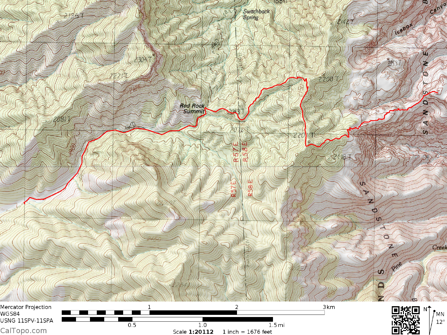
CLIMB:The peak is not visible from the trailhead. Follow the maintained trail from the SE
side of the parking area for 1 mile through piñon and juniper to the crest of the main N-S
ridge. The trail proceeds S along the ridge and the summit becomes visible to the E. The
trail passes an abandoned use trail on the left, rounds a bump to the S and descends the E-W
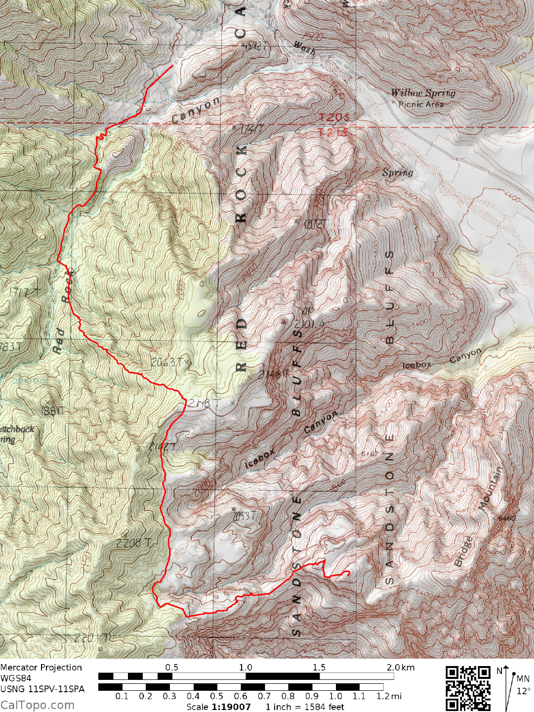
ridge connecting the peak to the main ridge. The trail ends shortly after reaching an area of
reddish slickrock (1 more mile), but the route continues and is marked by frequent ducks and
parallel lines or arrows marked on the rock. Descend (several possibilities here) to the saddle
on the ridge, then up and a bit left into the bottom of the obvious crack ascending the peak.
Ascend (3
rd
class) either the crack itself or the slickrock face to the right, which is somewhat
exposed but has plentiful holds. Most will find it easiest to ascend the face and descend the
crack. Exit at the first easy ledge leading left into another crack/corner, which you ascend to
the namesake natural bridge. Either ascend the steep rock in the alcove behind the bridge
(using a dead tree for aid), or cross over the top of the bridge right-to-left to the area behind
the bridge. Move to the right (5) of the “hidden forest” between you and the summit, and
descend a bit to a saddle at its right end. Ascend the final few hundred feet of the summit
mass by climbing up and left from the saddle using one of several ledge and crack systems
on the slabs, which are somewhat exposed in spots but the rock surface provides excellent
friction. The final rocks at the top are easy. There is a fine view of Las Vegas and Lake Mead
from the summit.
ROUND TRIP STATS/4WD: 2700 feet elevation gain (incl. 850’ on the return), 6.5 miles,
6-7 hours
SIDELINES
1. The summit is the unnamed point at UTM 349994 on the La Madre Spring quadrangle,
not the much lower point (6460’) labeled Bridge Mountain on adjacent maps.
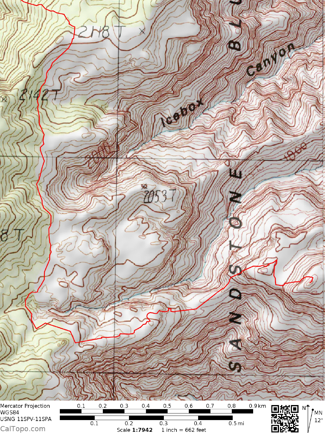
2. The dirt road to the trailhead is suitable only for experienced drivers with capable
vehicles. This road continues over the summit and joins the Scenic Loop road in Red
Rock Canyon to the E. The eastern side is 4WD-only and just as long as from the west,
but is much easier driving. Access to the trailhead from the E is subject to a $15 fee
charged for driving the Scenic Loop, and is only available during daylight hours, but
many will prefer this approach due to the easier road conditions. The road from the
Willow Springs picnic area is very rough for the first few miles. There are two areas to
park along the way which may be used to avoid the even worse road above. From the
first pull out one may walk up the road, looking for a use trail on the left at approximately
a mile. Follow this to the crest over a saddle, then follow a cairned route to the right,
eventually meeting up with the route described above. Distance for the hike is closer
to 9 miles from the first pull out. See maps below.
3. There are no wood fires allowed in the area between April 15 and November 15.
4. Camping may be found at the parking area for the Lovell Canyon starting point.
Camping may also be found at the Red Rock Canyon Campground, located east of the
park on the south side of Charleston Blvd., just west of the shooting range.
© 2002 Desert Peaks Section, Sierra Club.
Revised 4/1/18