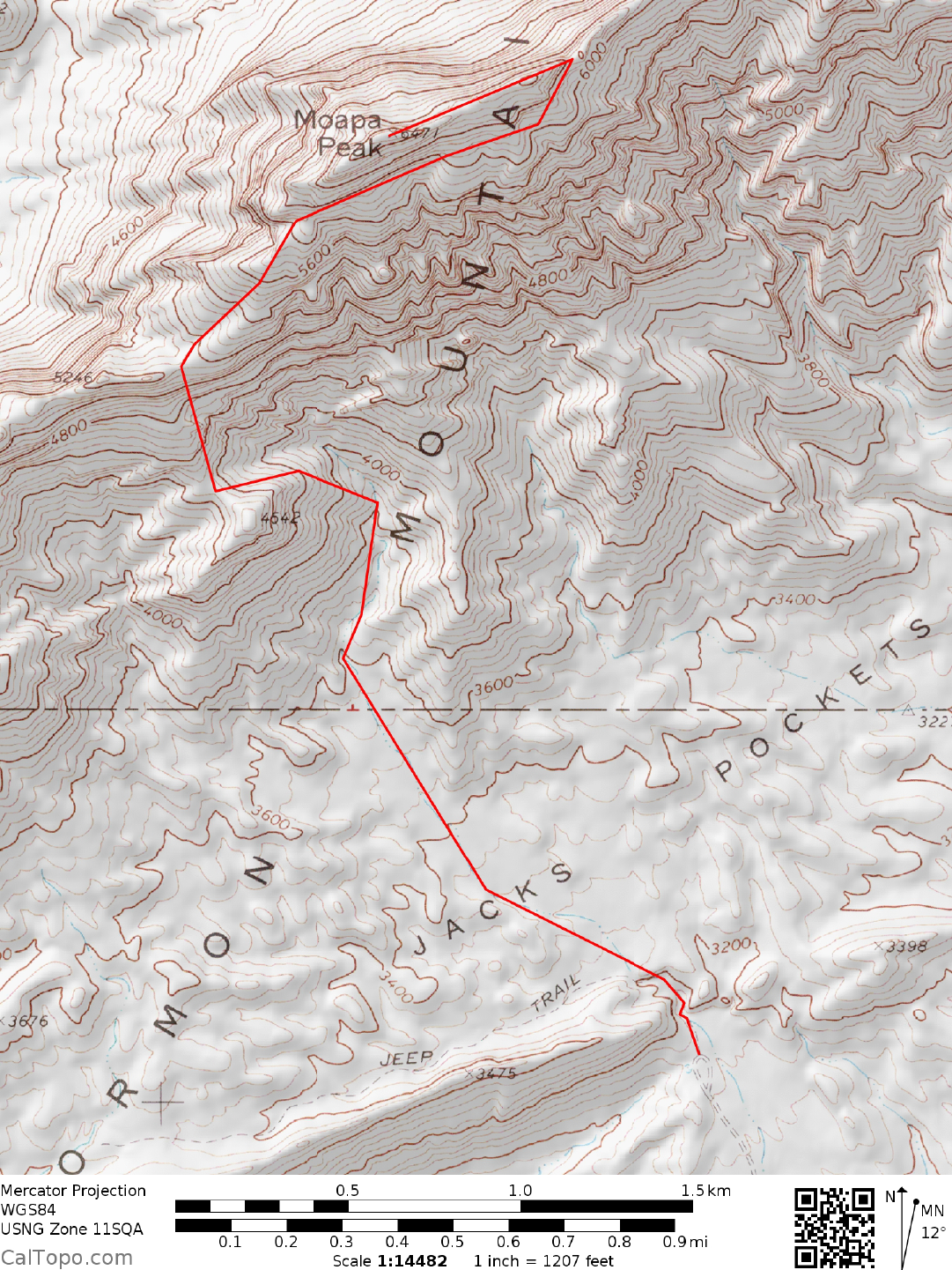
6 NEVADA RANGES GUIDE NO. 6.12
MOAPA PEAK 6471 FEET CLASS 3
MILEAGE: 352 miles of paved road, 8.7 miles of fair to good dirt road.
DRIVE: From Las Vegas, NV. drive approximately 60 miles N on Interstate 15, leaving the highway at
signed Exit 100 for Carp/Elgin. This exit is 7 miles beyond or E of the turn-off for Glendale, NV. Turning
left (N), follow the road under the freeway and then right on a paved frontage road for about 100 yards to a
good dirt road junction. Turn left (N) here, following the road as it passes a corral on the left and under a set
of power lines, eventually bearing NE to its end 8.7 miles from the frontage road pavement. Park.
CLIMB: From the vehicles, follow a jeep trail NW for 0.25 miles into an area known as Jacks Pockets, then
cross-country NW toward point 4542. This will lead to a large wash which is followed N around the E side
of point 4542 to the 3900 foot level. Leaving the wash here, head left (W) up a slope to the saddle located 0.1
miles NW of point 4542. Head NW from here up the ridge to a headwall at about 4800 feet elevation. Work
your way up ducked 3rd class cracks and ledges for 100 feet to easier ground. Turning right (NE), follow a
short ramp to easy slopes that lead up to the base of cliffs high on Moapa's SW face. Contour NE along the
base of these cliffs about 0.5 miles, then turn left (NW), ascending to the summit ridge midway between
Moapa and point 6091. Follow the summit ridge SW to where it becomes a knife-edge. The route from here
is obvious, following the airy crest for about 200 yards to the top.
NOTE: The final approach to Moapa is along a knife-edged ridge with exposure.
Some climbers may have difficulties here, requiring a reassuring word or a rope
belay.
ROUND TRIP STATS: 3400 feet of elevation gain, 6 miles, 6 hours
SIDELINES
1. Moapa Peak was named for a local tribe of Southern Paiute Indians. The name Moapa is derived from
Moapariats, which translates into "Mosquito Creek People".
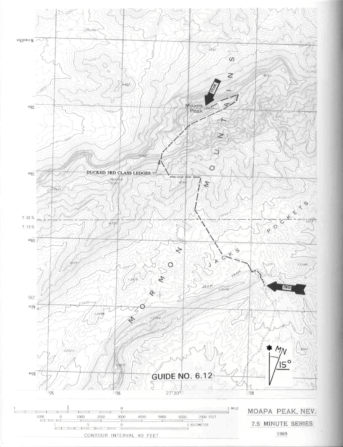
Ducked 3rd Class ledges