6 NEVADA RANGES GUIDE NO. 6.10
McCULLOUGH MOUNTAIN 7026 FEET CLASS 1
MILEAGE: 258 miles of paved road, 4.9 miles of good dirt, 3.7 miles of fair to poor dirt road
DRIVE/ROUTE A: Leave California Interstate 1-15 at the Nipton Road exit (40 miles N of Baker, CA or 10
miles S of Stateline, NV). Drive approximately 10 miles E on Nipton Road to the railroad crossing at the
small town of Nipton, CA. Continue 8.1 miles E on the Nipton Road to a good dirt road turnoff 0.5 miles E of
highway milepost marker 5, en route crossing the state line into Nevada (Driving from US 95, this dirt road
turnoff is 12.8 miles W of Searchlight, NV or 0.5 miles W of highway milepost marker 6). Turn left (N) here,
coming to a fork just after crossing over a cattle guard in 0.4 miles. Bear right (N), driving 0.6 miles to a
power line road. Bear right (NE) on the power line road and drive 3.9 miles to a junction, turning left (W) on
a fair dirt road and driving 1.5 miles to a fork. Bear right here and drive 2.2 miles to the parking spot for
Route A. As a check on your location, an old corral can be found 0.4 miles further up the road on your right.
For those interested in spending the night, there are some good camping spots alongside the road in this area.
NOTE: Sandy spots that have trapped conventional 2WD vehicles have been reported in the last 5 miles of
this drive. This trip should probably be done with a 4WD vehicle.
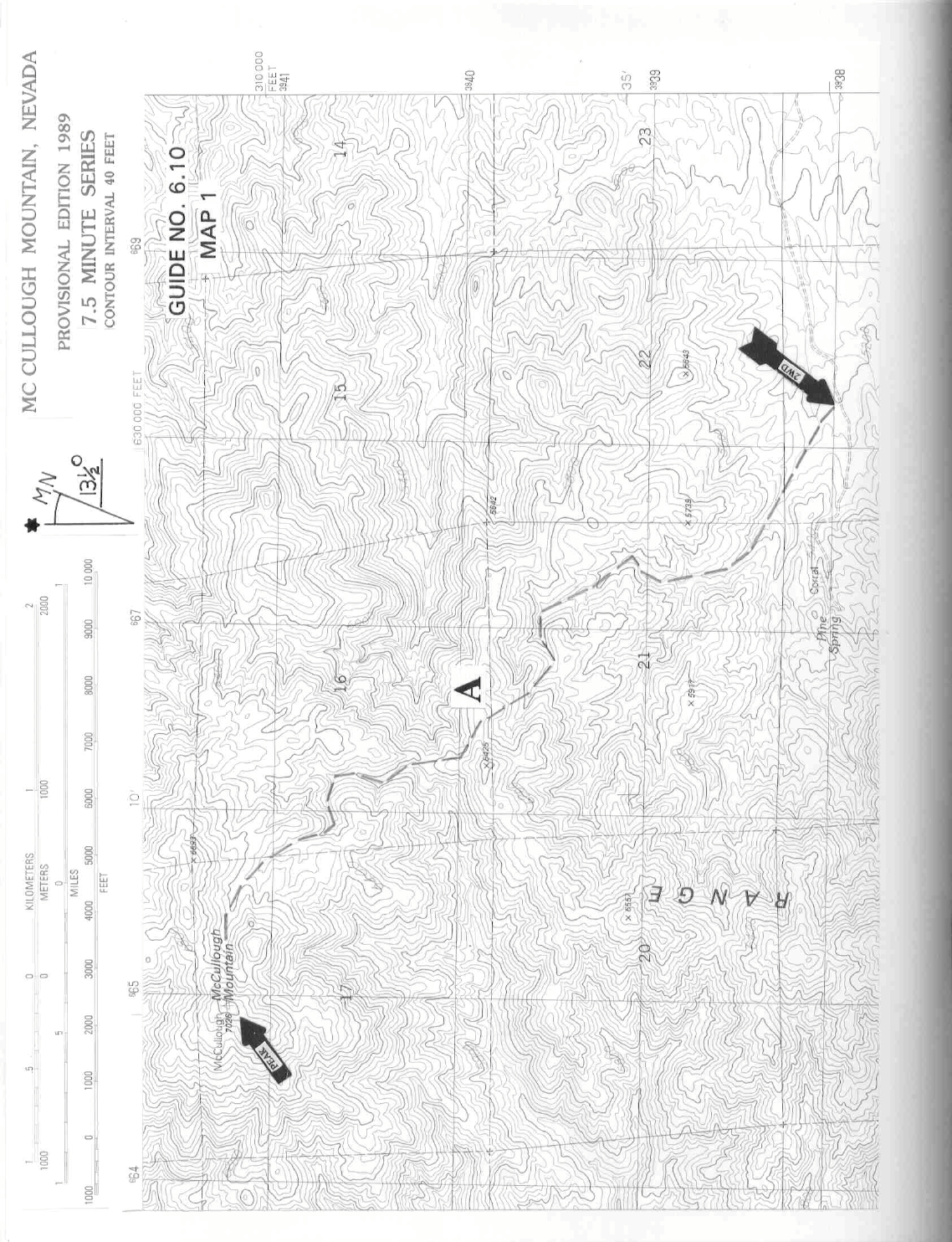
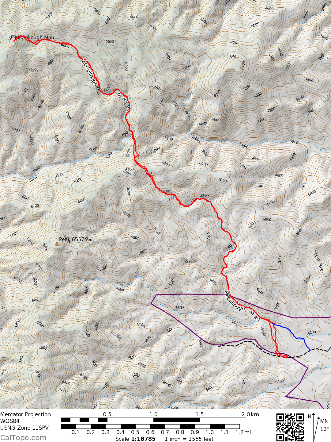
CLIMB/ROUTE A: See Map 1. Before you begin this hike, orient yourself by locating point 6425 at a
bearing of 315° and a distance of 1.7 air miles from the parking spot. This point is a critical landmark for
proper navigation on the mountain. From the parking spot hike NW over a small hill, dropping into a wash on
the other side. Hike 2 miles up the wash, bearing right at all major forks, until you arrive at a saddle (UTM
664398) just E of point 6425. Contour through the trees along the NE side of point 6425 to an obvious saddle
0.2 miles to the N. Orient yourself again by locating the summit of McCullough at a bearing of 310° and
distance of 1.1 air miles. From here, descend 100 feet N into a wash, following it generally NW for 1.0 mile
to a point 0.25 miles E of the summit. Continue W up easy slopes to the top.
ROUND TRIP STATS/ROUTE A: 2000 feet elevation gain, 7 miles, 5 hours
DRIVE/ROUTE B: Exit Interstate 15 at State Line, NV (aka Primm, NV) and drive 0.3 miles E, turning left
behind Buffalo Bills Casino. Continue 0.2 miles to a parking lot and, driving through this lot, pick up a dirt
road that is taken 0.6 miles E to where it merges with another road. Bear right and drive 0.9 miles to railroad
tracks. Crossing the tracks, continue straight 1.0 mile to a fork and bear right (The left fork can be taken when
the Beer Bottle Pass road is washed out, but it adds another 2.1 miles to the drive). Drive 5.4 miles to a
Microwave Relay Station road, where you'll turn right (S) and go 2.2 miles to a fair dirt road at some corrals
and a water tank. Turn left here, following the road NE for 0.25 miles, then right (S) for 5.15 miles to a
grouping of corrals on the left side of the road. About 100 yards before the corrals look for a faint road
heading NE up a wash. Turning here, follow the sandy road for 3.6 miles, bearing left at all apparent forks
(4WD recommended in the wash because of loose sand) to a cabin on the right, above the wash. This cabin is
about 400 feet W of Railroad Spring. Park.
McCULLOUGH MOUNTAIN (CONTINUED)
6 NEVADA RANGES GUIDE NO. 6.10
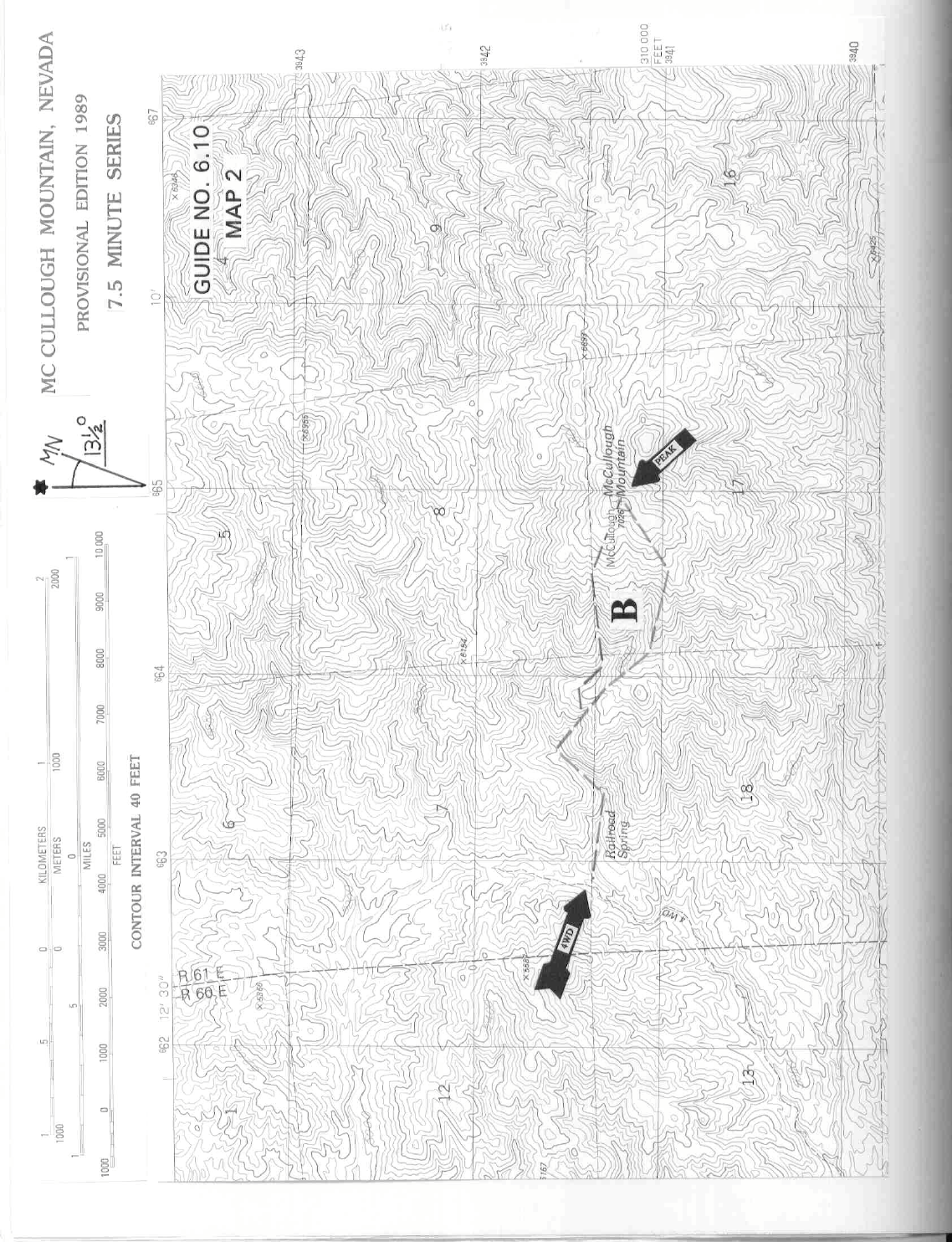
CLIMB/ROUTE B: See Map 2. From this parking spot most any combination of canyons and ridges heading
E will take you to the summit. One proven route from the vehicles is to hike E then NE up the main canyon
for about 1.0 mile and then turn right (SE) up a ridge to the top.
ROUND TRIP STATS/ROUTE B: 1800 feet elevation gain, 3 miles, 3 hours
SIDELINES
1. Getting to the summit of McCullough via ROUTE A can be a navigational problem. Hiking mostly along
the bottom of forested washes with few clear views of any significant landmarks is bad enough, but when
coupled with a complex wash and ridge system, you have the recipe for disorientation. As if that weren't bad
enough, throw in some generously "ducked" routes leading off to nowhere from the main ascent route!
Needless to say, plan on knowing how to use a map and compass before starting out on Route A in search of
the elusive McCullough.
2. If reading about ROUTE A in SIDELINES 1 discourages you from trying it, then consider the shorter
ROUTE B to the top, but only with a 4WD vehicle. Although the drive for ROUTE B is longer, the
navigational problems likely to be encountered on this route should be minimal compared with ROUTE A.