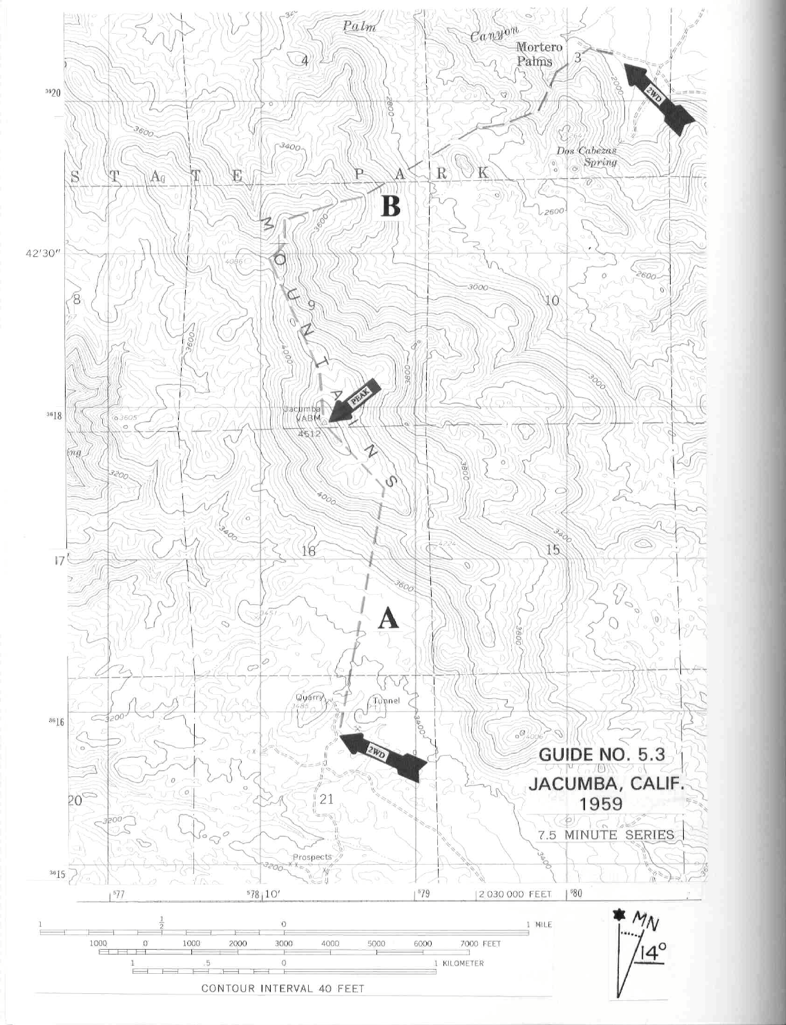
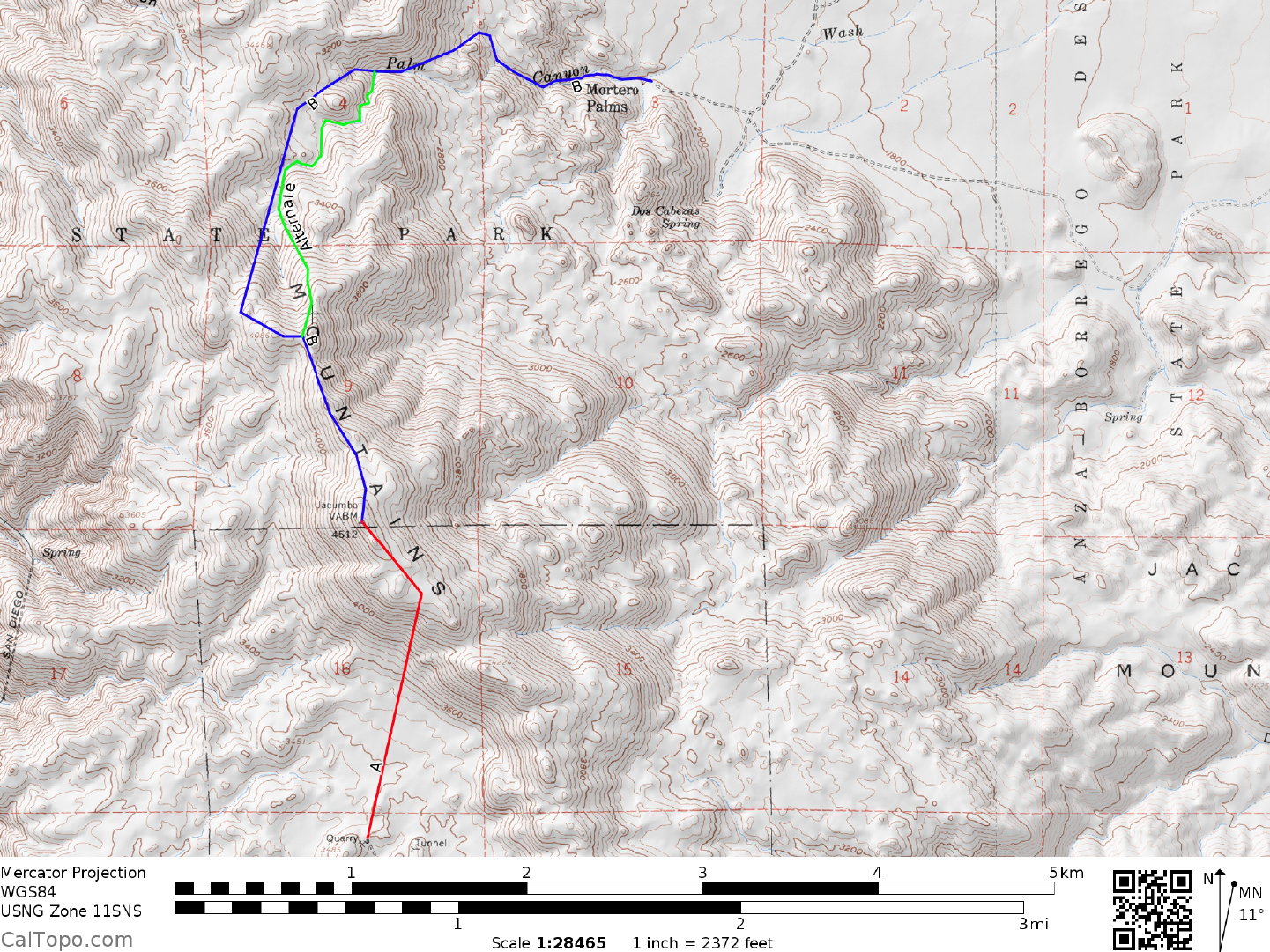
5 SAN DIEGO & IMPERIAL COUNTY RANGES GUIDE NO. 5.3
JACUMBA MOUNTAIN 4512 FEET CLASS 1
MILEAGE: 205 miles of paved road, 5.7 miles of poor to 4WD dirt road
DRIVE/ROUTE A: This route requires high clearance vehicles. 4WD is not necessary, but would make the
drive much easier. About 51 miles E of El Cajon, CA (38 miles W of El Centro, CA) leave Interstate 8 at the
Jacumba exit. Turn right (S) at the off ramp stop sign and continue on the signed Carrizo Gorge Road S for
1.1 miles to its end at the junction with Old Highway 80. Turn left (E) and drive 1.75 miles to a dirt road
heading N toward Interstate 8. Turn left (N) here, passing under power lines in 0.15 miles and continuing
another 0.35 miles to a junction. Stay on main road, which passes under Interstate 8 in 0.1 miles. 0.3 miles
beyond the underpass bear right at a fork. In 0.2 miles you'll pass the ruins of the Mica Gem Mine. Follow
the main road generally N from here 1.9 miles over a saddle at 3600 feet elevation (paralleling power lines for
part of the way) to the first of two radio repeater stations located just off the road on nearby hills. Beyond this
first repeater continue along the right (E) side of a hill (second repeater located here) to a road tee. Bear left
(SW) at this tee, following the main road 1.6 miles W then NW to a fork. En route to this fork a number of
side roads will be encountered. Be sure to avoid them by staying on the "main" road. Bear right at a fork and
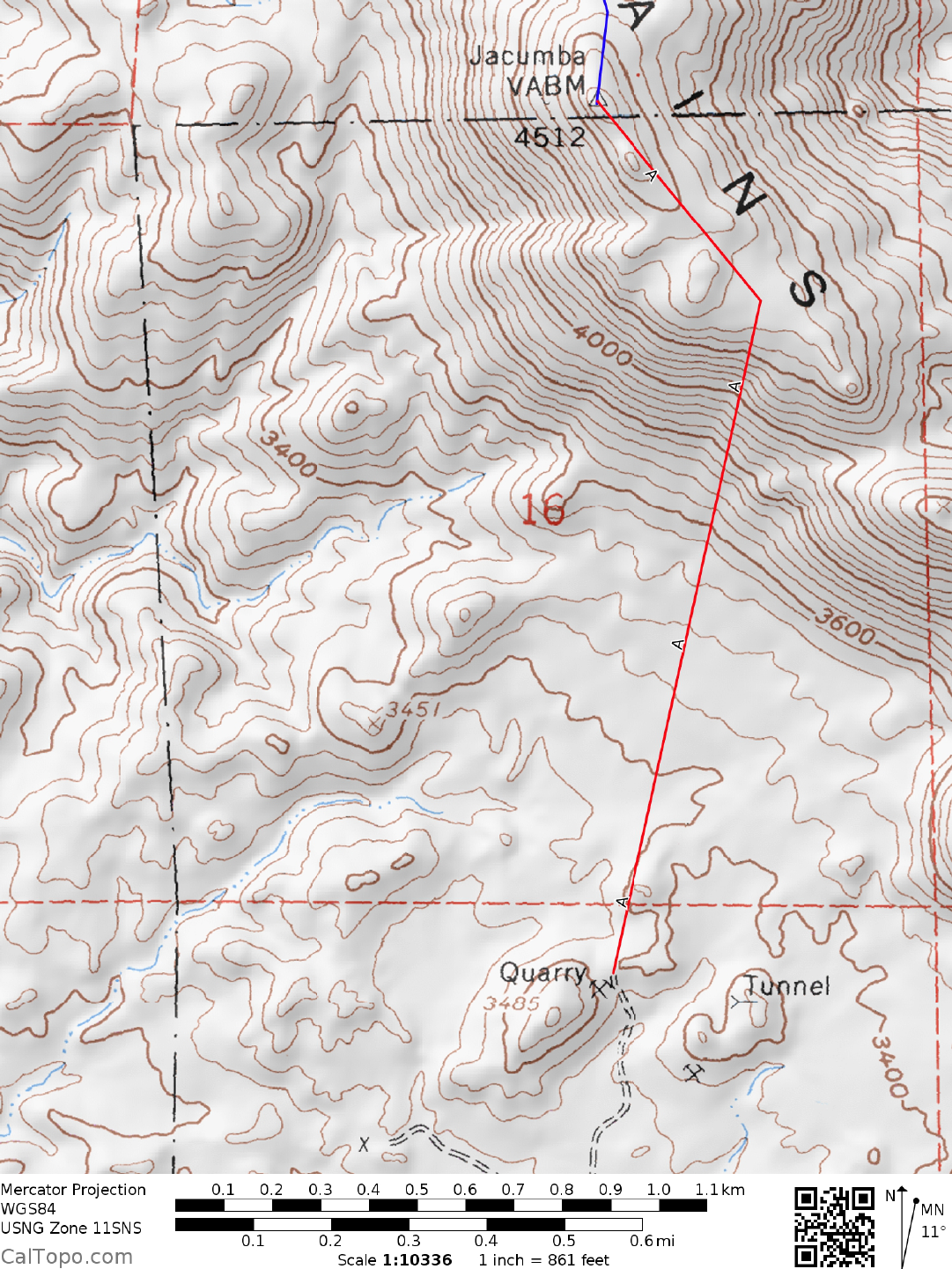
drive about 0.1 mile, parking near hill 3485.
CLIMB/ROUTE A: Jacumba Mountain is visible about 1.0 mile N of the parking spot. Hiking directly to the
base of the peak across a brushy area cut by numerous washes, ascend sandy slopes to the summit ridge about
0.3 miles SE of the peak. Follow the summit ridge NW, skirting a few false summits to the highpoint. As is
usually the case, the summit is the last bump on the ridge.
ROUND TRIP STATS/ROUTE A: 1300 feet elevation gain, 2.5 miles, 2-2.5 hours
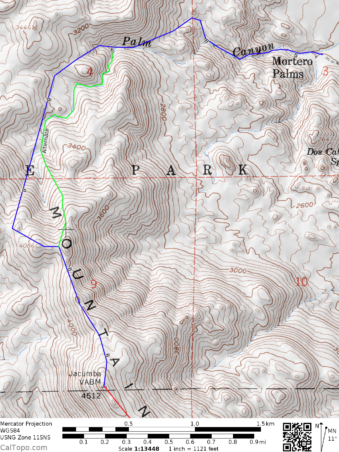
DRIVE/ROUTE B: From Ocotillo, CA drive 8.6 miles N on County Highway S2 to the boundary of Anza-
Borrego Desert State Park. 0.4 miles beyond the boundary turn left (SW) on a good dirt road and drive 4.0
miles to RR tracks at Dos Cabezas. Turning left at the RR tracks, drive 1.5 miles to where you'll cross over
them. Follow the road (bearing left at forks) 1.7 miles from here to a fork, bearing right and driving 0.4 miles
to Mortero Palms. Park.
CLIMB/ROUTE B: Ascend the canyon to the SW for 0.75 miles to the flattish ground at 2600 feet elevation,
then SW across the flats to the base of the mountain. Climb slopes to the summit ridge about 0.75 miles
NNW of the peak. Turn left (SSE), following the ridge past a number of false summits on your way to the
top.
ROUND TRIP STATS/ROUTE B: 2600 feet elevation gain, 5 miles, 6 hours