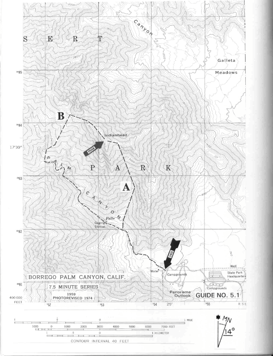
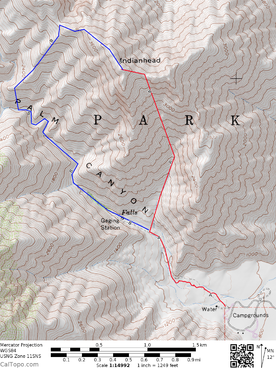
5 SAN DIEGO & IMPERIAL COUNTY RANGES GUIDE NO. 5.1
INDIANHEAD 3960+ FEET CLASS 2
MILEAGE: 198 miles of paved road.
DRIVE: From the traffic circle in the center of Borrego Springs, CA. drive W on Palm Cany
on Road for 2
miles, make a right and head N to the Borrego Palm Canyon Campground. Follow the road for just over 1.5
miles through the campground to the day-use parking lot located at the NW corner of the grounds.
CLIMB/ROUTE A: Follow the nature trail starting at the day
-
use parking lot, hiking NW into Borrego Palm
Canyon for approximately 0.75 miles to the mouth of a prominent wash at UTM 535820 on the SE side of
Indianhead. Ascend this wash to the 3650+ foot elevation saddle just E of the summit. Head left (W) from
here up to the top.
NOTE: This is the most direct route up Indianhead from the Borrego Palm Canyon
Cam
pground. It is a steeper clim
b than Route B and has more needle-tipped agave
per square foot than most any other peak described in this guide.
ROUND TRIP STATS/ROUTE A: 3200 feet elevation gain, 4 miles, 5 hours
CLIMB/ROUTE B: Follow the nature trail starting at the day
-
use parking lot, hiking NW into Borrego Palm
Canyon for 1.5 miles to a large palm oasis. Continue up the canyon another mile on a fair trail to about the
1800 foot level at UTM 520833. Turn right (N), picking your way up to a ridge which is followed to the
3200+ foot elevation saddle on the NW ridge of Indianhead. Turn right (SE), following the ridge 0.5 miles to
the summit.
ROUND TRIP STATS/ROUTE B: 3200 feet elevation gain, 8 miles, 7 hours
SIDELINES
1. The peak can also be climbed from Borrego Palm Cany
on via the prom
inent S ridge which is rated Class 3
to 4. SW face routes from Borrego Palm Canyon are also possible and vary anywhere from Class 3 up to
Class 5, but entail considerable bushwhacking in spots.
2. A day-use fee is collected at the entrance station of the Borrego Palm
Cany
on Campground. Coin operated
hot showers and flush toilets are available at the campground.
Reservations may be made for the campground
in advance. The higher the site number, the closer it is to the trail head.
Revised 12/3/17