4 RIVERSIDE COUNTY RANGES GUIDE NO. 4.9
SPECTRE POINT 4400+ FEET CLASS 2
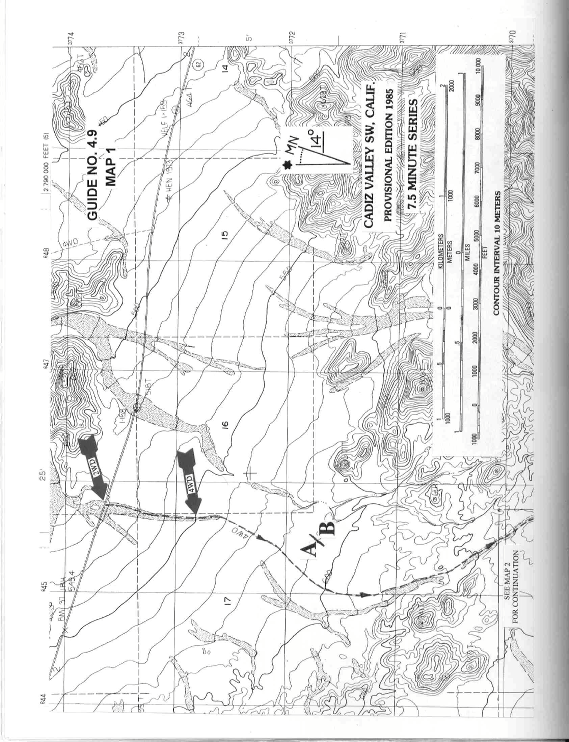
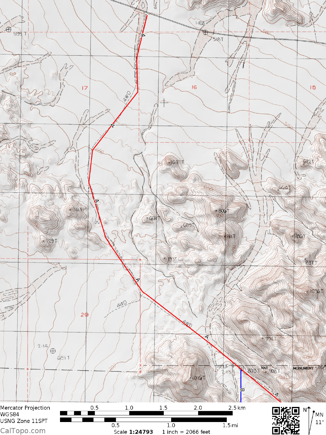
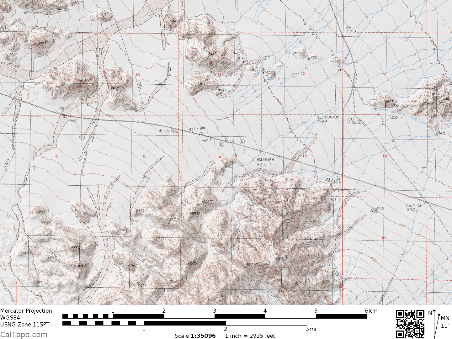
MILEAGE: 187 of paved road.
DRIVE/ROUTES A & B: From Twentynine Palms, CA. drive 40 miles E on State Route 62 to highway
milepost 72. Continue another 0.8 miles E on SR 62 to a road heading SSE towards the Coxcomb Mountains.
All
vehicles park alongside the highway
. The 4WD section previously described has been closed. It is possible
to drive approximately 50 yards off the highway to the fence posts. The road is quite sandy, but may give
enough room to camp at the trailhead for a small party.
CLIMB/ROUTE A: From the highway hike south west across the desert until you intersect the former 4WD road.
Continue on the road for approximately 4 miles, taking the left fork towards the canyon mouth. Follow the road as
it drops down into
a sand wash, continuing to where the canyon necks down and boulders appear at 4.5 miles. Continue
through the canyon for approximately a mile, reaching a saddle at 860 meters (2820 feet) elevation. Drop down from
this saddle, continuing SE in the canyon for approximately half a mile to its intersection with another canyon joining
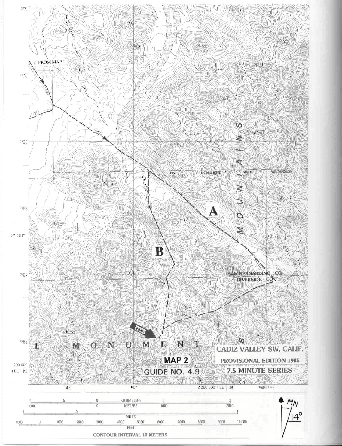
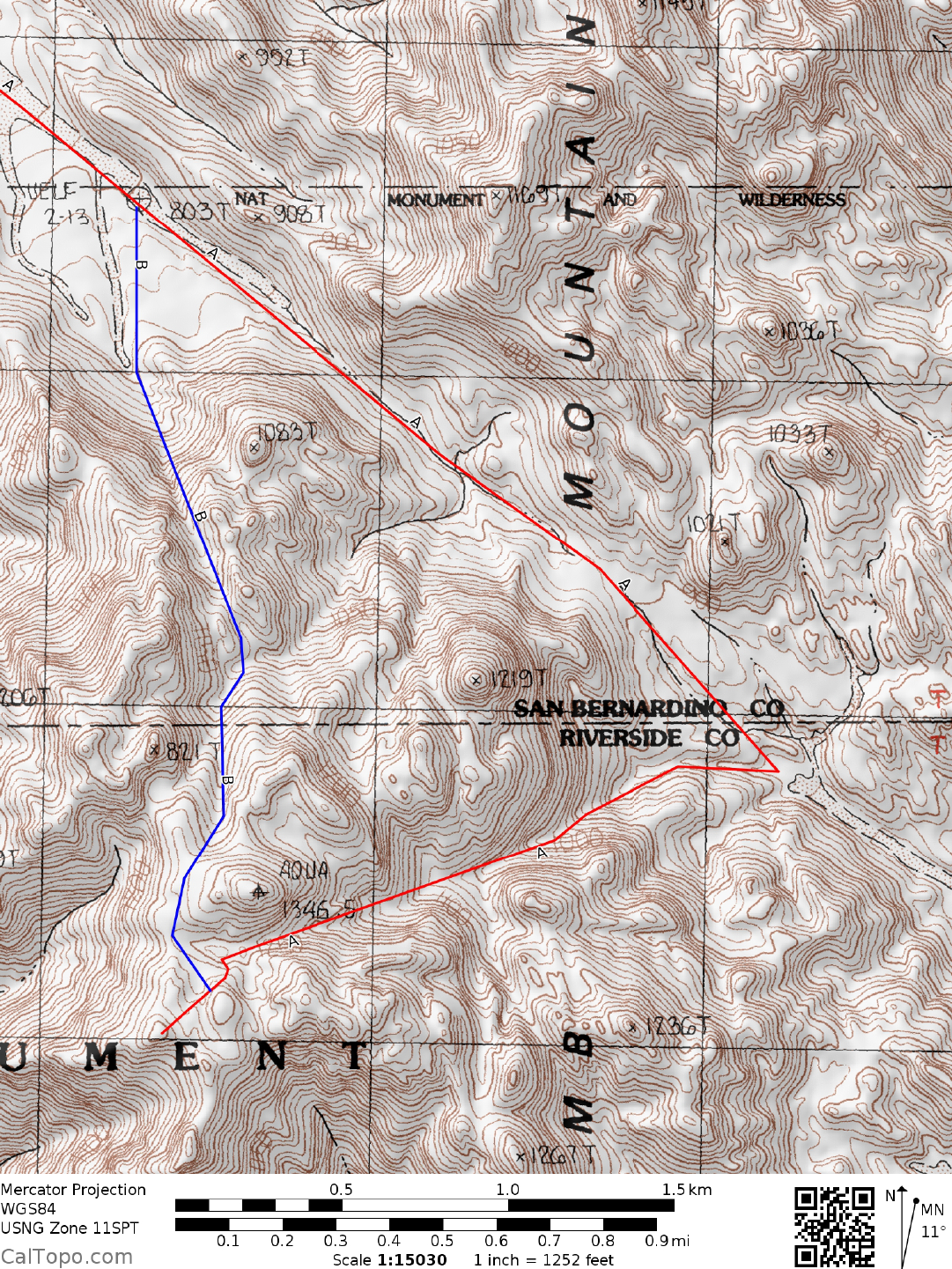
from the SW. Turning right, follow the SW canyon for 1 mile through two rocky "steps" to a saddle (UTM 476663) at
1240 meters (4070 feet) elevation (some class 3 terrain may be encountered). At this point you'll be just S of benchmark
"Aqua", aka Tensor Peak. Continue SW across rocky terrain to the NE ridge of Spectre which is followed to the top.
As an alternate, climb the N face of the mountain to the summit.
CLIMB/ROUTE B: Hike south west until you intersect the 4WD road. Follow the sandy road 0.2 miles S to a fork.
Bear right and hike
3.3 miles SE, leaving it and heading S across easy terrain to the mouth of the prominent, steep
wash at UTM 473680. Ascend the wash SSE to a saddle (UTM 475673) at 1120 meters (3675 feet) elevation.
Continuing SSE, hike 0.1 miles to an E-W wash approximately 100 feet lower than the saddle. Bear right and follow
the wash to a saddle just W of benchmark "Aqua", keeping left at all forks along the way. From this saddle Spectre can
be seen at a bearing of 200°. Hike SSW to the base of the peak and then up the N face or NE ridge to the top.
ROUND TRIP STATS/ROUTES A & B/2WD: 2650 feet elevation gain, 14 miles, 10 hours
SIDELINES
1. Spectre Point, located 0.3 miles SW of benchmark Aqua at UTM 474660 is the highpoint of the Coxcom
b
Mountains. Careful study of the Cadiz Valley
SW 7.5 minute topo would not lead you to believe this
however. The ma
p shows benchmark Aqua as the highpoint at 1346.5 meters elevation, placing Spectre Point
(unnamed on map) at 1300+ meters elevation. In actuality, the Cadiz Valley SW 7.5 minute topo is incorrect,
having accidently omitted a number of contour lines from the top portion of Spectre Point, which is estimated
to be about 70 feet higher than benchmark Aqua.
SPECTRE POINT (CONTINUED)
4 RIVERSIDE COUNTY RANGES GUIDE NO. 4.9
2. Benchmark Aqua is known to DPSer's as Tensor Point. It can be climbed easily via class 2 slopes. Dyadic
is the DPS name for the point 0.3 miles ENE of Spectre Point at UTM 478661. It is a harder climb than either
Tensor or Spectre Points, being high 3rd class by its easiest route.
3. Between 1942 and 1944, more than one million American soldiers were trained in the deserts of California
and Arizona to ready
them for combat against German Field Marshall Rommel'
s Afrika Korps. Major General
George S. Patton, Jr. was designated to establish and command the effort at this Desert Training Center. He
was only at the center for four months before being assigned to commence the North African campaign, code
name Operation Torch. Today, there are still reminders of the Army's presence in the desert, one area being
near the Coxcomb Mountains at Camp Iron Mountain. The remains of the camp chapel, rock-lined streets and
what used to be a large topographic map of the entire Desert Training Center are still to be found. To get there
drive about 1.1 miles E of the State Highway 62/177 junction on State Highway 62. Turn left (NE) on a dirt
power line road and drive 2.5 miles to a fenced off area with a sign indicating the former camp. For more
information, consider a visit to the General Patton Memorial Museum at Chiriaco Summit on Interstate 10
about 25 miles E of Indio, CA.
4. Spectre Point is located within the boundaries of a wilderness area of the newly
created Joshua Tree
National Park. This new wilderness area was created as part of the California Desert Protection Act of 1994,
Public Law 103-433, Section 402/601(a)(2). The Act re
designated Joshua Tree as a national park and added
an additional 234,000 acres for preservation.
5. Primitive camping may also be found along a sandy road approximately four miles east of the trail head. One
mile in there is a loop pullout with a fire ring near a rocky hill. Other places may be found along side the road itself.
See the additional map at the end of this section.
Revised 5/1/18
Trail Head
Road in
to
camping
Camping