4 RIVERSIDE COUNTY RANGES GUIDE NO. 4.4
PINTO MOUNTAIN 3983 FEET CLASS 1
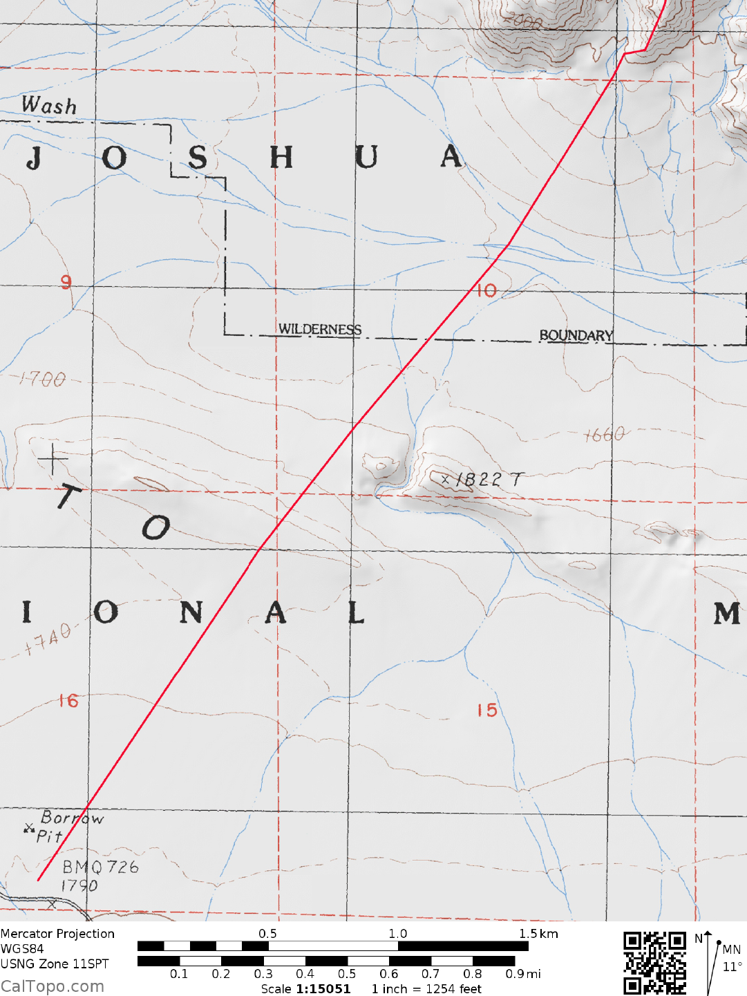
MILEAGE: 172 miles of paved road
DRIVE/NORTHERN APPROACH: From the main stop light intersection of State Highway 62 and Adobe
Road in Twenty
nine Palms, CA drive E 1.0 mile on State Highway 62 to the signed Utah Trail and turnoff for
the Joshua Tree National Park Visitors Center. Turn right (S) here and drive 8.8 miles to a fork. Keeping
straight here (right will take you back out of the Park to the town of Joshua Tree, CA) on the Pinto Basin
Road, drive about 16.5 miles to a parking area 0.1 miles past (S) Park highway milepost 16. Park.
DRIVE/SOUTHERN APPROACH: From Indio, CA drive
E
approximately 23 miles on Interstate 10 to the
signed Mecca-Twentynine Palms exit. At the offramp stop sign, turn left (N) on the signed Cottonwood
Springs Road, reaching the Joshua Tree National Park entrance station at Cottonwood Springs in 7.0 miles. A
park entrance fee must be paid here before continuing further into the Park (See SIDELINES below).
Continue N from the entrance station on the Pinto Basin road for 14 miles to a large parking area on the right
side of the road. This parking area is 0.1 miles S of Park highway milepost 16. The parking area is large
enough to accommodate well over 20 vehicles.
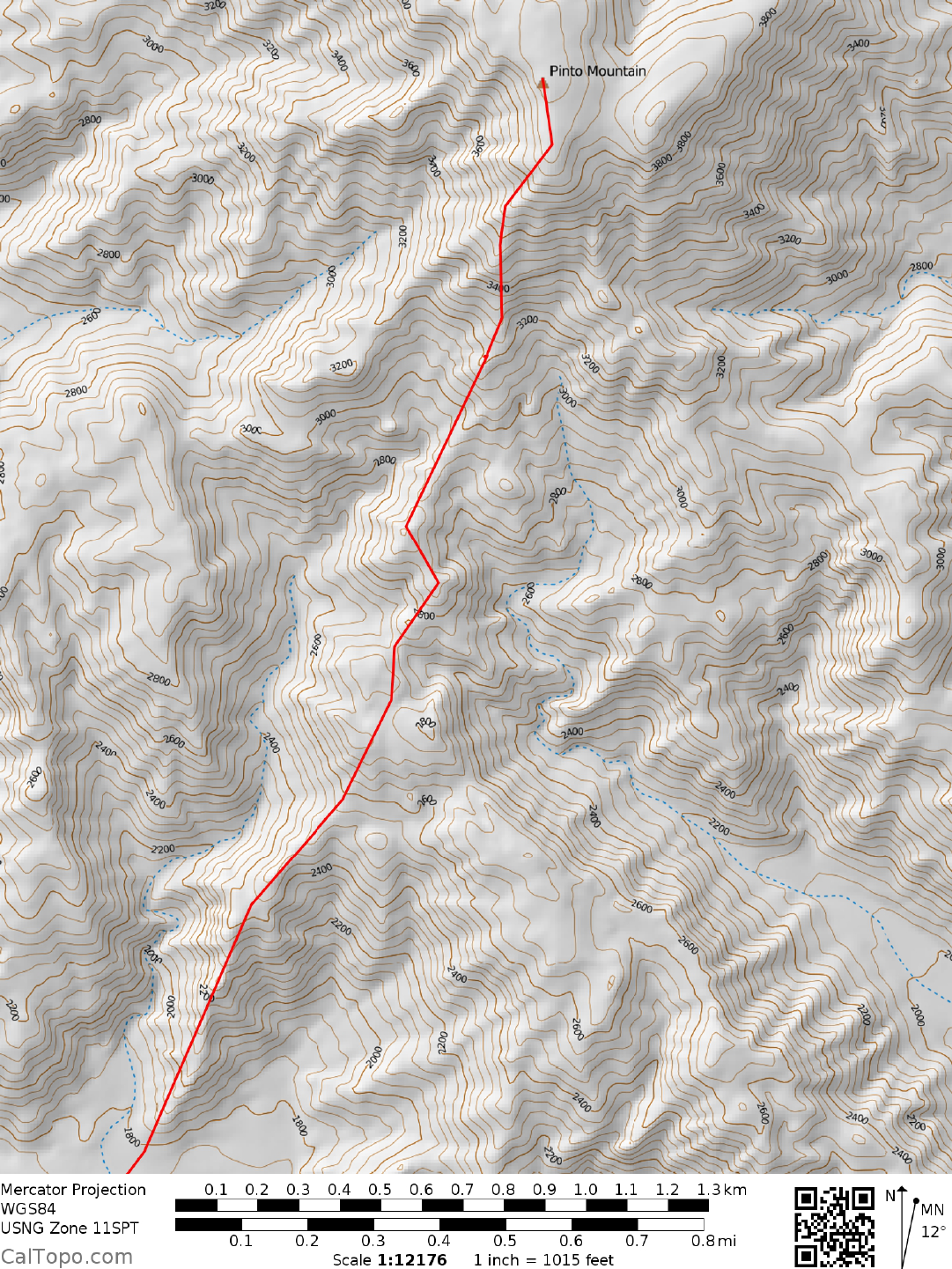
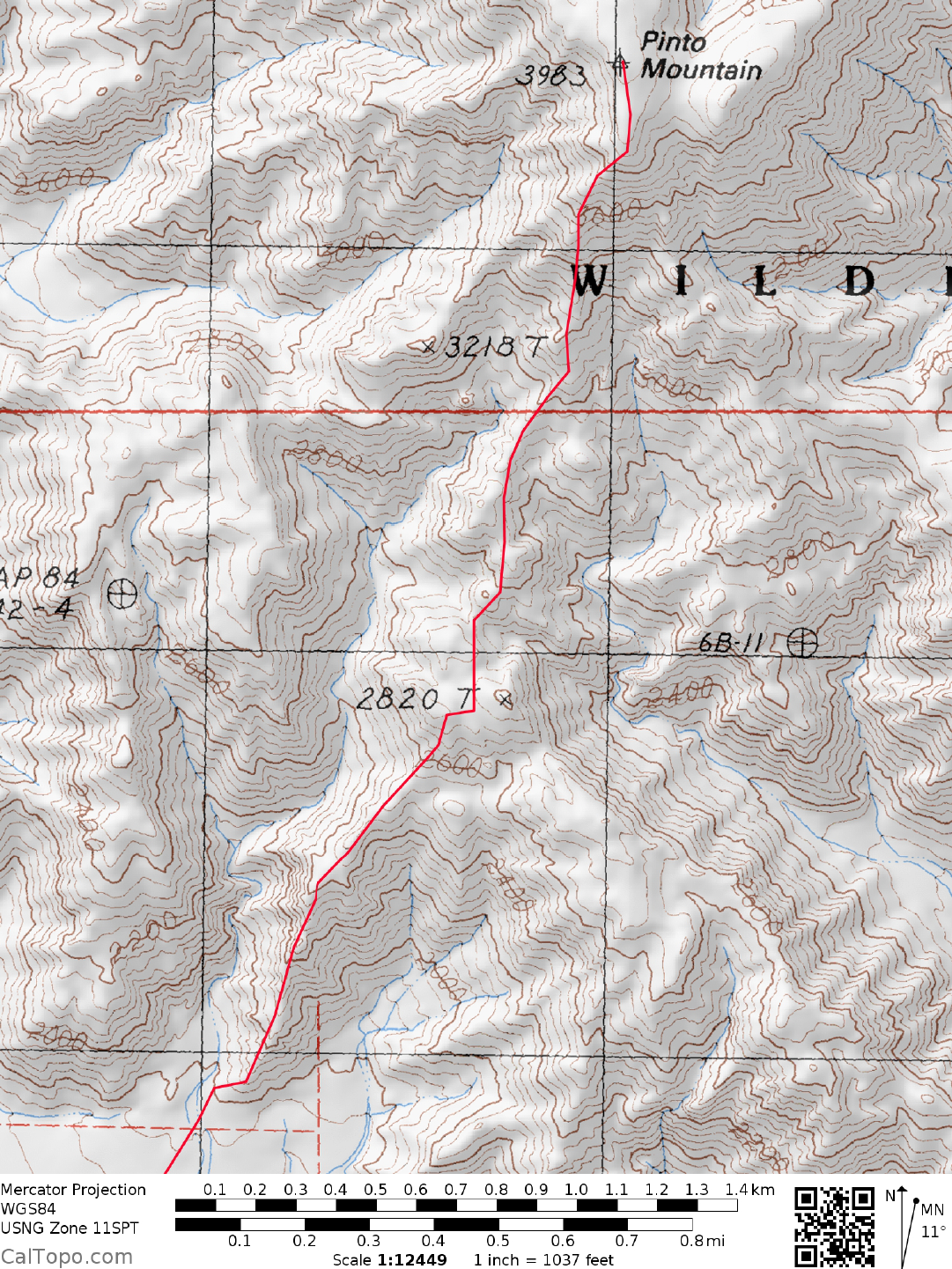
HIKE: Before starting the hike, be sure to sign in at the Backcountry
Registration Box located at the far end
of the parking lot. From
the parking area, the cone shaped summit of Pinto can be seen at a bearing of 32°.
Having identified it, next locate the ridge at a bearing of 36° lying between two major washes at the base of
the mountain. Walk across the desert flats for about 2.5 miles to the start of this ridge at the foot of the
mountain, en route passing over a low sand dune across your path. Ascend the ridge, following it and a
sometimes faint game trail for about 2.0 miles to the top, which is marked with a large stone cairn. As an
alternate, you can also hike up the major wash to the left (W) of the ridge for about 0.75 miles and then bear
right up a steep, rocky slope to gain the above mentioned ridge.
ROUND TRIP STATS: 2400 foot elevation gain, 9 miles, 5-6 hours
SIDELINES
1. See Eagle Mountain #1 SIDELINES for pertinent inform
ation on cam
ping and/or hiking in Joshua Tree
National Park.
2. From the summit of Pinto you'll be able to see these landmarks at the following bearings: Sheephole
Mountain at 14°, Spectre Peak at 74°, Granite Mountain #2 at 86°, Palen Mountain at 100°,
Black
Butte at
138°, Eagle Mountain #1 at 169°, Rabbit Peak at 214°, Mount San Jacinto at 254°, Mount San Gorgonio at
274° and the 29 Palms USMC Base at 322°.
Revised 2/6/18