3 SAN BERNARDINO COUNTY RANGES GUIDE NO. 3.15
MOPAH POINT 3530 FEET CLASS 3
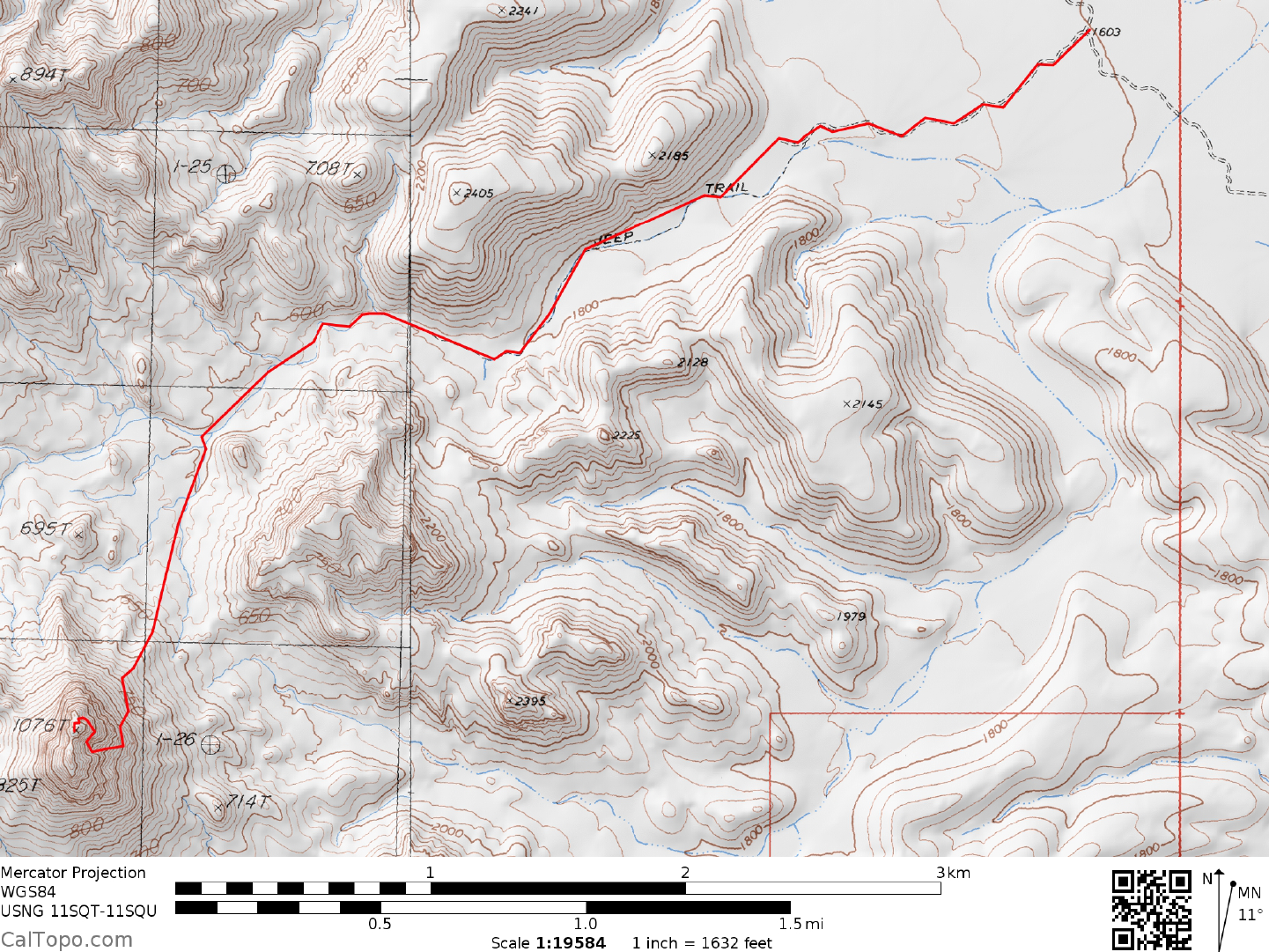
MILEAGE: 251 miles of paved road, 4.4 miles of good to fair dirt
DRIVE: From Vidal Junction, CA. drive 12.3 miles N on US 95 (0.1 miles S of highway
milepost 22.0) to a
faint dirt road turnoff heading left (W) toward the Mopah Range. Turning left here, follow a generally good
dirt road 4.4 miles to the Turtle Mountains Wilderness boundary. Park.
CLIMB: Hike the dirt road 0.75 miles WSW to its end at the m
outh of a wash near
the ruins of a stone cabin.
Hike SW up the wash approximately 1.8 miles to a point (UTM 062998) just NW of hill 660+. Here, at a
bearing of 194°, you'll see an obvious notch at the base of the cliffs on Mopah's E face. Head toward this
notch by turning left (SSW), leaving the main wash and hiking up a smaller wash for about 0.3 miles.
Leaving the smaller wash here, continue cross-country to the obvious notch mentioned above, climbing
through it and following along the base of cliffs S to a second notch. Climb through this second notch and
enter a large chute which is ascended by staying near its left side until cliffs bar further progress. At this point
bear right towards an overhanging cliff with a shallow cavity (cave) beneath it. Ascend to the cavity, and
from its far right side climb about 12 foot of 3rd class rock to an easy slope above. Follow this easy slope for
150 feet to a narrow, steep chute about 50 feet long with a notch at its upper end. Climb the chute to the notch
and drop 10 feet down the back side to a small platform at the base of a cliff (Alternately, climb about half
way up the chute and exit right on a ducked ledge which leads around to the back side of the notch.). From
here climb the crux move on this route, an 8 foot section of near vertical, awkwardly sloping 3rd class rock by
diagonally up and right to a ledge which is followed for 30 feet to easy ground. A rope belay will probably be
wanted by most climbers, particularly on the descent. From here proceed uphill and W to the summit of
Mopah. Descend the same way, as any other route would require higher class climbing and/or rappelling.
ROUND TRIP STATS: 2000 feet of elevation gain, 8 miles, 6 hours
SIDELINES
1. Mopah's southern neighbor Umpah, is the high point of the Mopah Range at 3553 feet elevation; 23 feet
higher than Mopah. It can be scaled by
the following
route: Climb the prominent gully on the N side of the
peak to its headwall, which is overcome along its right margin. Continue up easy slopes, keeping Umpah's
cliffs on your right, eventually reaching the eastern skyline ridge. Either climb this ridge (class 3+) or cross
over it, dropping down its S side to easy terrain which is followed up to the summit area. The final rocks can
be climbed via a class 2+ chimney on the SSE side or a bit harder class 3 wall on the S side. Round trip stats
for both peaks in one day are 3800 feet of elevation gain, 9 miles, 8 hours.
2. The Mopah Range is located within the boundaries of the Turtle Mountains Wilderness Area. This new
wilderness area was created as part of the California Desert Protection Act
of
1994, Public Law 103-433,
Section 102 (68). The Turtle Mountains Wilderness Area encompasses approximately 144,500 acres of land
and is managed by the Bureau of Land Management (BLM).
Revised 2/27/18