3 SAN BERNARDINO COUNTY RANGES GUIDE NO. 3.13
CHEMEHUEVI PEAK 3694 FEET CLASS 2
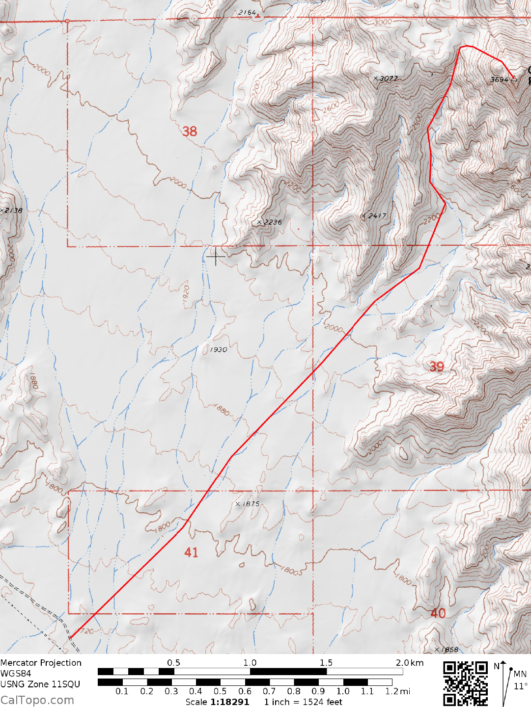
MILEAGE: 267 miles of paved road, 4.2 miles of good dirt road
DRIVE: From Vidal Junction, CA. drive 27.8 miles N on
US Highway 95 to the signed, paved Havasu Lake
Road, which is located 0.3 miles N of highway milepost marker 37 (If approaching from Interstate 40, drive
21 miles S of Needles, CA). The sign at this intersection reads “Chemehuevi Valley, Lake Havasu 17 miles”.
About 100 yards N of the Havasu Lake Road, turn off US 95 onto a good dirt road heading SE and
paralleling power lines. Drive 4.2 miles to where the road passes under the power lines for the second time.
Park.
CLIMB: Hike NE for 2.5 miles at a 35° bearing across the desert flats to the m
outh of a cany
on at about the
2,200 foot elevation level. Follow this canyon NW then N for just under a mile to a saddle located 0.25 miles
NW of the peak at 3,120+ feet elevation. From here, turn right (SE) and climb just under 600 feet to the
summit.
ROUND TRIP STATS: 2000 feet elevation gain, 7.5 miles, 4-5 hours
SIDELINES
1. The Chemehuevi are native Indians of the Eastern Mojave region. They
were traditionally
nomadic
hunter-gatherers who subsisted on deer, bighorn sheep, snakes, birds, rodents, lizards and a variety of desert
plants including mesquite, agave and various cactus species.
2. Views from the summit of Chemehuevi include Lake Havasu to the east, Whipple Mountain to the
southeast, Turtle and Mopah Peaks to the southwest and Stepladder Mountain to the west
across
the
Chemehuevi Valley.
3. Chemehuevi Peak is located within the boundaries of the Chemehuevi Mountains Wilderness Area. This
new wilderness area was created as part of the California Desert Protection Act of 1994, Public Law 103-433,
Section 102 (10). The Chemehuevi Mountains Wilderness Area encompasses approximately 64,320 acres of
land and is managed by the Bureau of Land Management (BLM).
Revised 2/27/18