3 SAN BERNARDINO COUNTY RANGES GUIDE NO. 3.8
GRANITE MOUNTAIN #1 6762 FEET CLASS 2
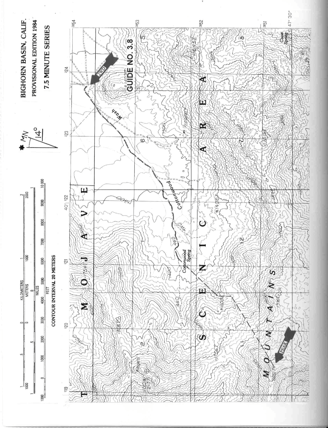
MILEAGE: 282 miles of paved road, 1.95 miles of good dirt.
DRIVE: From Barstow, CA. drive 78 miles E on Interstate 40
to the Kelbaker Road exit. Turn left (N) on
paved road, driving about 8 miles to Granite Pass, which has a microwave relay station on the E side of the
road. Continuing over the pass, you'll cross a cattle guard in 0.3 miles. Drive 1.5 miles past the cattle guard
and turn left (SW) onto a good dirt road (Another dirt road 0.25 miles S of this turnoff can also be taken. It
joins with the other road in 1.7 miles, but is of poorer quality). Follow it for 1.7 miles to a junction of three
roads near a picnic table. Park. The Mojave Wilderness begins just W of this parking spot.
CLIMB: Heading downhill here, hiking 0.25 miles SW on the
continuation
of the road to a fork just past a
fence. Take the right fork and walk 0.2 miles to a corral and water tank on the left. Continue 1.3 miles SW on
the progressively deteriorating road, bearing right at all forks, to a huge boulder off the right side of the road.
Head out on a 224° bearing, following a large gully all the way to the summit ridge just S of the top. Turn
right and walk to the high point.
ROUND TRIP STATS: 2900 feet elevation gain, 6.5 miles, 5 hours
SIDELINES
1. Kelso Depot, located 14 miles N of Granite Pass on the Kelbaker Road, m
a
kes for an interesting stop. The
Spanish-style railway station was constructed by Union Pacific in 1924 to provide accommodations for
railroad employees and serve as a waiting room for passengers. The site of Kelso was chosen because of the
availability of dependable water which was required by the steam locomotives of the day. The depot was
closed in 1985.
2. The Kelso Dunes are located about 8 miles N of the Granite Mountains. They
have the distinction
of being
among the highest in the United States, with the largest having a maximum height of 600-800 feet from base
to summit. The building blocks of these dunes is sand blown from the Mojave River Sink near Afton Canyon,
some 30 miles to the west. These dunes are known for the low-pitched sound they produce when the top layer
of sand breaks away and slides down over the adjacent underlying layer. The signed turnoff to the dunes can
be found 8.0 miles S of Kelso on the Kelbaker Road. Turn W here on an excellent dirt road and drive 2.9
miles to a signed parking area. The dunes are a 0.25 mile walk N from here.
3. Granite Mountain #1 is located within the Mojave Wilderness of the Mojave National Preserve, form
erly
the East Mohave National Scenic Area. This wilderness area was created as part of
the California Desert
Protection Act of 1994, Public Law 103-433, Section 106 (a)(3). The Mojave National Preserve encompasses
approximately 1.4 million acres of land and is managed by the National Park Service (NPS).
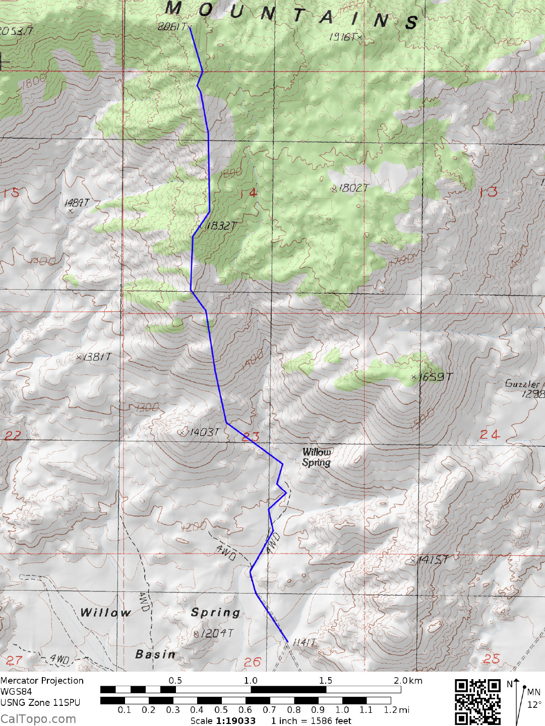
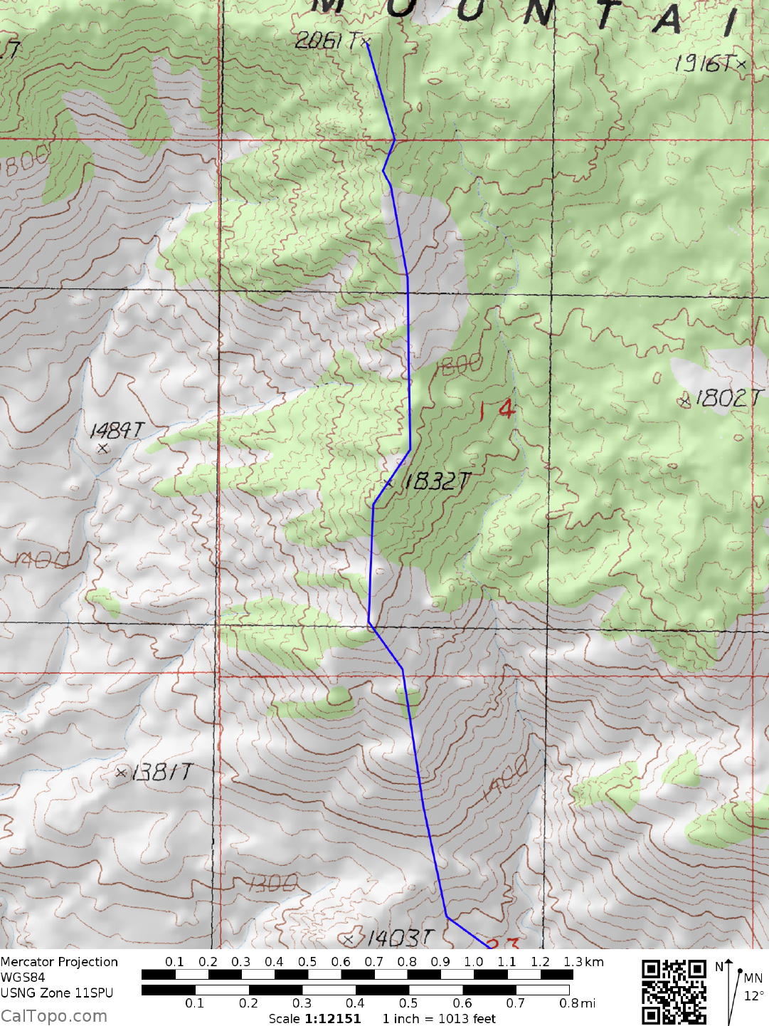
Revision in progress. Correct maps added for south ridge route. Description of south ridge route to follow. 1/31/18