3 SAN BERNARDINO COUNTY RANGES GUIDE NO. 3.2
KINGSTON PEAK 7336 FEET CLASS 2
MILEAGE: 254 miles of paved road
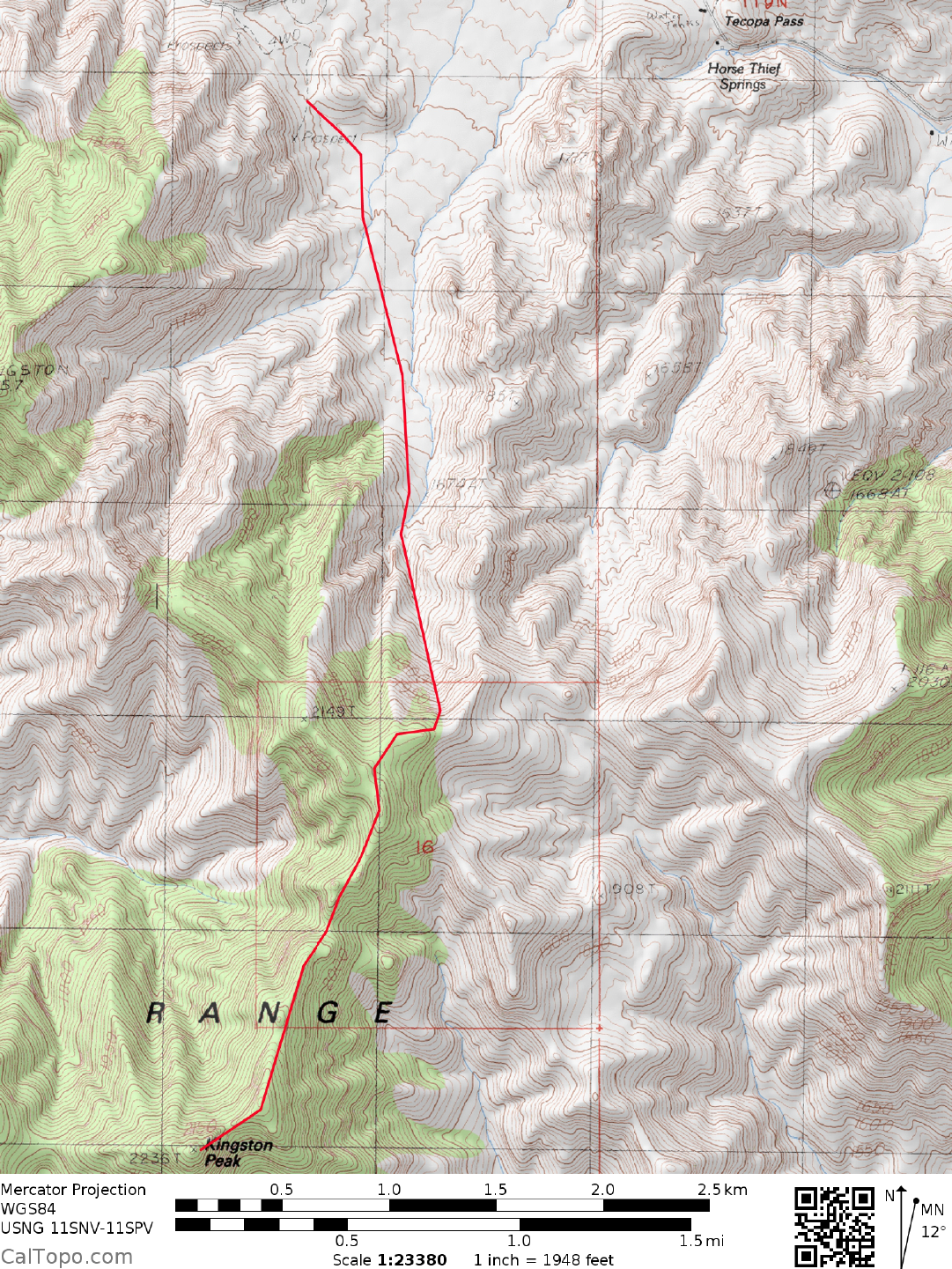
DRIVE/EASTERN APPROACH: From Baker, CA drive 26.2 m
iles N on Interstate 15 (toward Las Vegas)
to the Cima Road exit. Leaving the Interstate here, turn left (N) and drive about 30 miles on the signed, paved
Excelsior Mine road to the turnoff for a large parking area just off the right (N) side of the road (about 1.5
miles W of Horsethief Springs). This parking area is located where the road reaches its highpoint at a saddle
at 1550 meters (5085 feet) elevation. Park. 4WD's can get about 0.7 miles closer to Kingston by following a
dirt road SE from the parking area turnoff (this road is shown as a 4WD road on the 1984 Horsethief Springs,
CA 7.5 minute topo). Bearing left at a fork about 50 yards in from the Excelsior Mine Road, drive 0.4 miles
to a saddle just W of hill 1580+ meters. At the fork here bear left (downhill) and follow the road SE for
another 0.3 miles to near the W margin of a wash. Park. The road starts bearing right and up a subsidiary
canyon beyond this point, taking you further away from a convenient starting point for this hike.
DRIVE/WESTERN APPROACH: From the intersection of the Tecopa Hot Springs Road and the Old
Spanish
Trail
Highway in Tecopa, CA., drive E on the Old Spanish Trail Highway for 1.5 miles to the signed
Furnace Creek Road. Turn right (E) and drive about 19.0 miles on this narrow, paved road to its highpoint at
a saddle at 1550 meters (5085 feet) elevation. Bear left here into a large parking area. See EASTERN
APPROACH directions above for 4WD road from here.
CLIMB/2WD: From the large parking area just N of the Excelsior Mine Road the peak is hidden
from
view,
however the saddle you'll hike to a 2030 meters (6660 feet) elevation is clearly seen at a 165° bearing. Hike
0.7 miles SE, following the 4WD road described in the above DRIVE/EASTERN APPROACH directions.
Leaving the road here, bear left into a wash which is followed S for about 2.0 miles (rather brushy in spots) to
the 2030 meter (6660 feet) saddle at UTM 993559. At this saddle turn right (W) up the ridge for 0.25 miles to
a second saddle at 2110 meters (6920 feet). Heading SW from here, follow the ridge line all the way to a
notch just NE of the summit, generally keeping to the left (E) of the crest when difficulties arise. From the
notch follow a faint trail up along the SE side of the summit mass to the top.
ROUND TRIP STATS/2WD: 3800 feet elevation gain, 9 miles, 8 hours
ROUND TRIP STATS/4WD: 3600 feet elevation gain, 7.5 miles, 7 hours
SIDELINES
1. Kingston Peak is located within the boundaries of the Kingston Range Wilderness Area. This new
wilderness area was created as part of the California Desert Protection Act
of
1994, Public Law 103-433,
Section 102 (32). The Kingston Range Wilderness Area encompasses approximately 209,608 acres of land
and is managed by the Bureau of Land Management (BLM).
Revised 7/28/17