3 SAN BERNARDINO COUNTY RANGES GUIDE NO. 3.1
AVAWATZ MOUNTAIN 6154 FEET CLASS 1
MILEAGE: 219 miles of paved road, 7.2 miles of poor dirt road, 0.4 miles of 4WD road
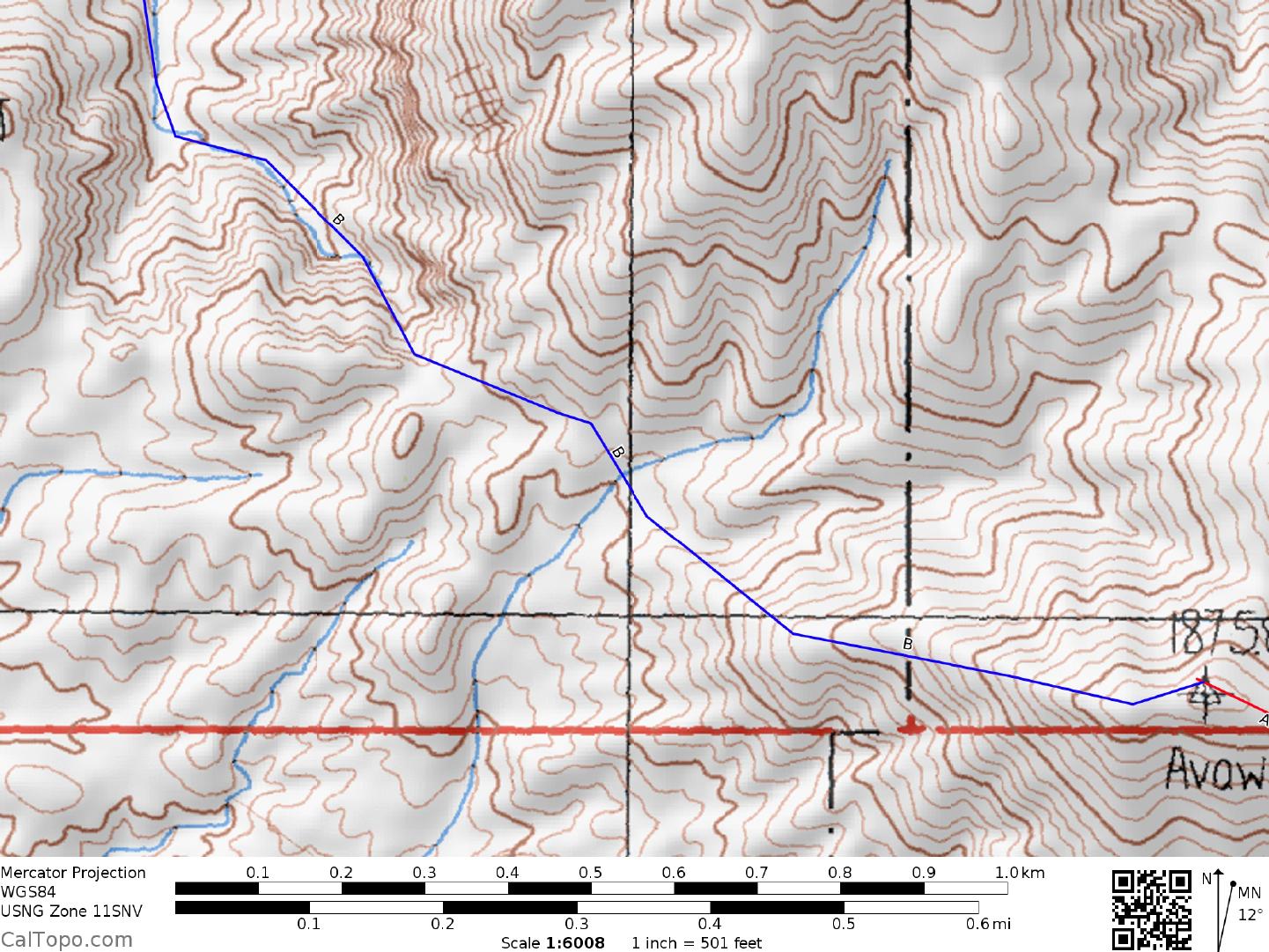
DRIVE/ROUTE A: From Baker, CA. drive 19.1 miles N on State Highway 127 (0.1 miles N of highway
milepost 19.0) to a faint dirt road turnoff on the left (W). Because of a deep drainage trough between the
highway and the road heading toward Avawatz, low clearance vehicles are advised to park off the E side of
the highway. High clearance vehicle can continue across the drainage trough, driving 4.5 miles W on poor
dirt to the Old Mormon Springs road fork. All high clearance vehicles should park here.
The road in the canyon
is now impassable.
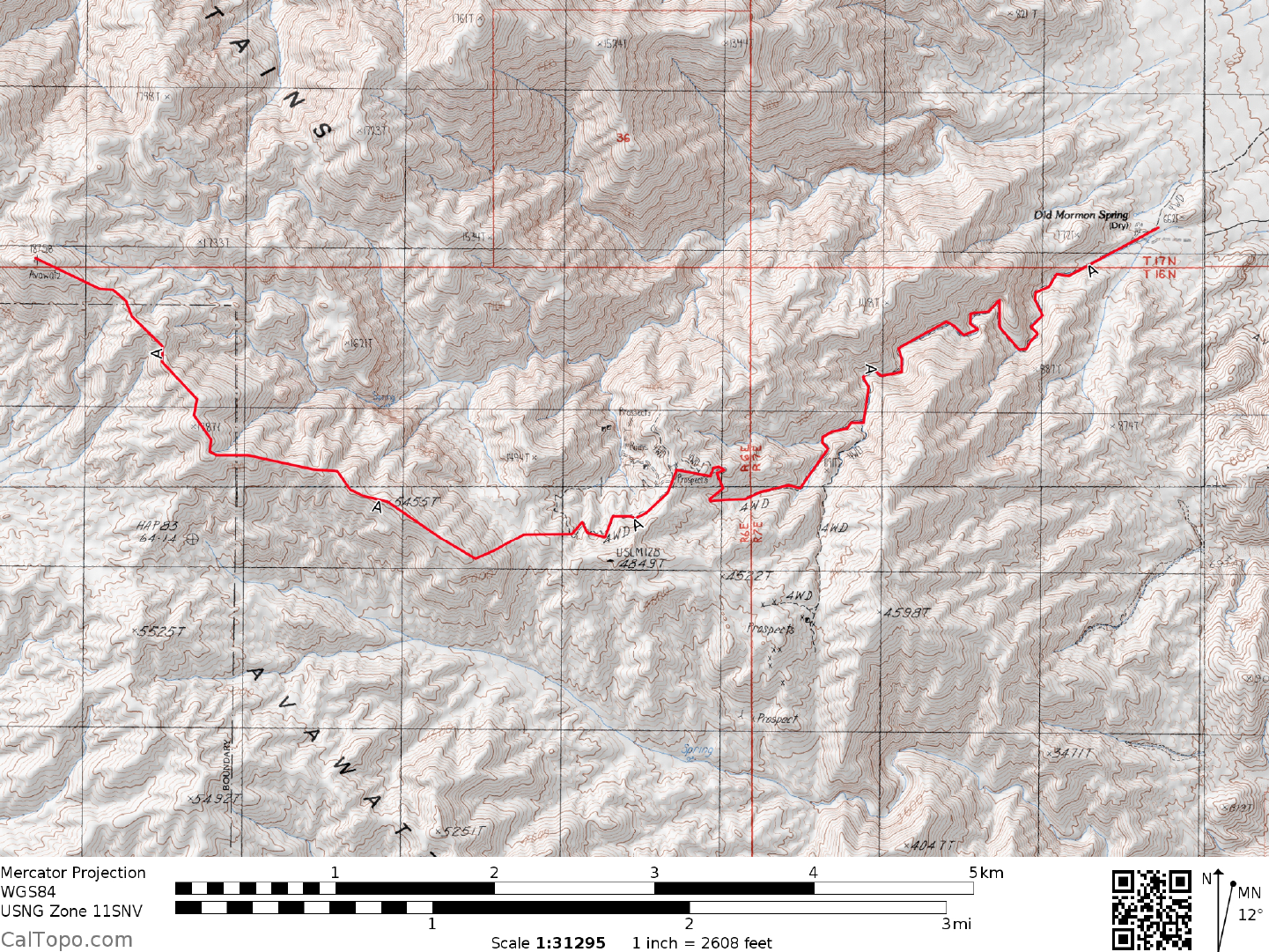
CLIMB/ROUTE A: See Map 1. Hike the
up the canyon and turn left, climbing the hill
above the road for 200 feet to the ridge. Drop down the back side to a saddle at 4700 feet elevation at UTM
637282. From
here ascend loose slopes to the W, gaining the ridge and following it over point 5455,
eventually picking up a faint use trail. Follow this trail generally NW along the ridge nearly all the way to the
top.
ROUND TRIP STATS/2WD/ROUTE A: 2700 feet elevation gain,
13+ miles, 10 hours
DRIVE/ROUTE B: Drive 29.7 miles N of Baker, CA. on State Highway 127 (0.2 miles N of highway
milepost 29.5). Turn left (W) on the excellent, signed "Harry Wade Exit Route" dirt road and drive 1.8 miles
to a junction. Turn left (S) here on a fair dirt road, driving 3.7 m
iles to a fork. Bearing left, drive
approximately 0.7 miles to a fork a few yards from what onece was a cabin and sign "California Desert Studies
Consortium".
Bear left, parking standard 2WD vehicles at the cabin. 2WD high clearance and 4WD vehicles may
be able tocontinue another 0.7 miles up the left fork road.
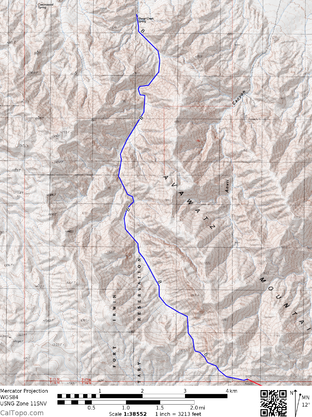
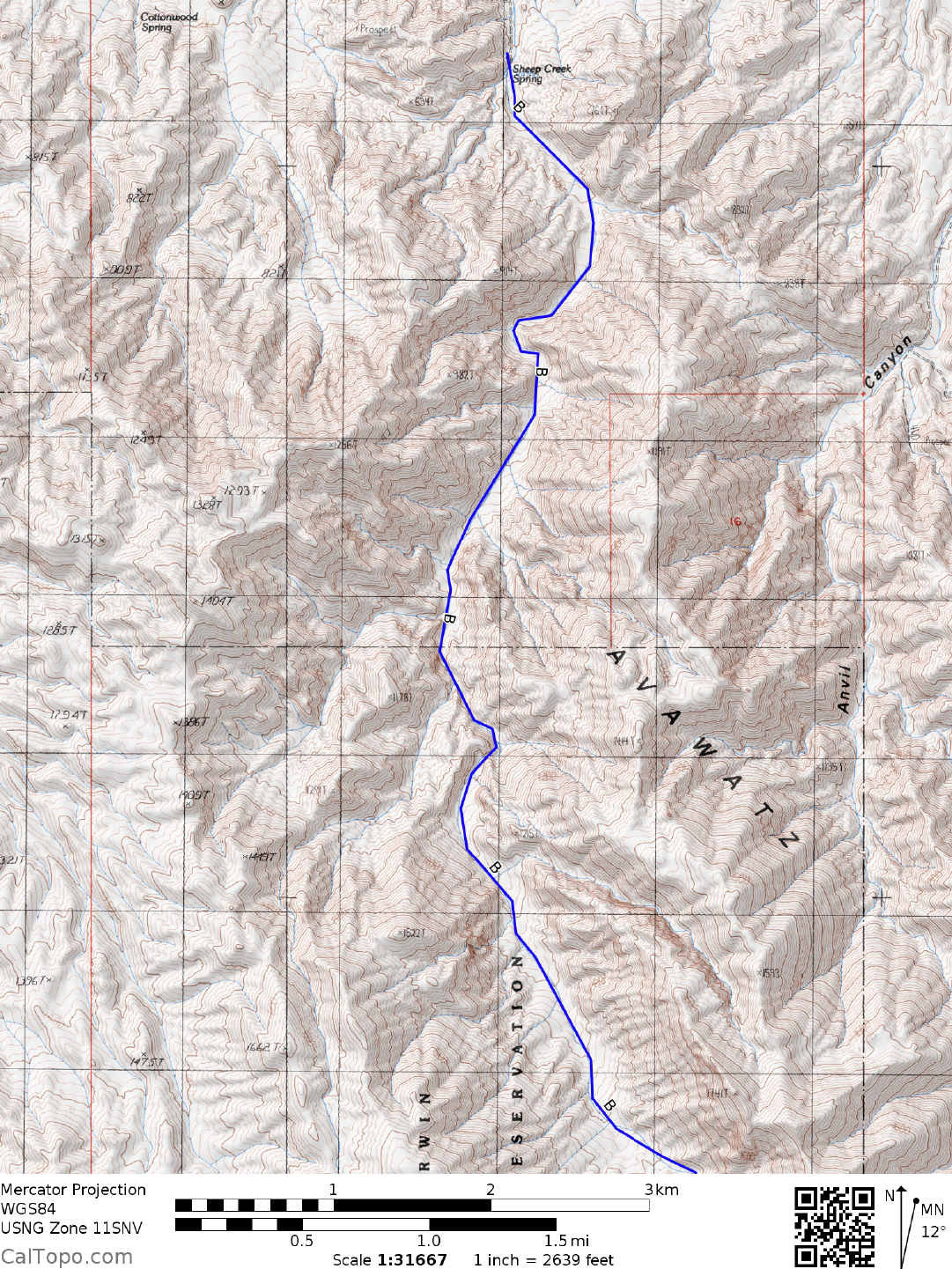
CLIMB/ROUTE B: See Map 2. Hike S up the broad wash, passing an abandoned m
ine site and following
the remnants of a mile-long pipeline past a spring (year
round water) with a sheep guzzler. A couple of class 2
moves will be encountered in the narrows of this canyon. At the head of the canyon, follow a ducked route
with one short class 3 move, topping out on the E-W ridge just E of point 1650+ at UTM 597303. Contour E
on a bearing of 95° toward the saddle just N of the peak. Go SE up any ridge to the top. NOTE: There is a
pole on top of the false peak to the north.
AVAWATZ MOUNTAIN (CONTINUED)

3 SAN BERNARDINO COUNTY RANGES GUIDE NO. 3.1
ROUND TRIP STATS/ROUTE B/2WD: 4600 feet elevation gain, 18 miles, 10 hours
ROUND TRIP STATS/ROUTE B/4WD: 4500 feet elevation gain, 15.5 miles, 9 hours
SIDELINES
1. Both of the routes described for this peak require the clim
ber to pass through a portion of the Fort Irwin
Military Reservation en route to the summit. No signs are posted along these routes to identify the boundary
of Fort Irwin.
2. The Avawatz Mountains got there nam
e when two m
iners, Johnny Moss and Sam Strong discovered
copper and silver bearing ores there in the early 1870'
s. They organized what was then called the Ava Watts
Mining District to develop their claims. Although the promise of riches didn't hold, the name of the mining
district did, eventually going through a series of name modifications until the present day Avawatz was settled
on. The lady, Ava Watts, remains a mystery lost to the ages.
3. The cabin near road's end in Sheep Creek Canyon is the property
of the State of California, Desert Studies
Consortium. It is open to the public and provides a nice shelter in bad weather. The spring behind the cabin
flows year-round and offers cool relief after a long day of hiking. However, spring flow is inconsistent, so
bring plenty of water of your own.
4. Take tim
e for a side trip to Saratoga Spring and its three large ponds; a rare oasis in an otherwise arid
desert. Just drive the Harry
Wade Exit Route dirt road 4 miles W of the Sheep Creek fork and follow signs to
the spring. The AAA Death Valley
map shows the route.
5.
Avawatz Mountain is located within the boundaries of the Avawatz Mountains Wilderness Study Area
(WSA). This new wilderness study area (not wilderness area) was created as part of the California Desert
Protection Act of 1994, Public Law 103-433, Section 104 (b)(1). The Avawatz Mountains Wilderness Study
Area encompasses approximately 61,320 acres of land and is managed by the Bureau of Land Management
(BLM). The majority of land through which the Drive/Route A road passes is now BLM administered WSA.
Although the road will remain open to vehicular traffic, it most probably will not be allowed to be maintained
in the future. The Drive/Route B road appears unaffected by the newly-created WSA.
Revised 7/28/17