2 DEATH VALLEY RANGES GUIDE NO. 2.20
PAHRUMP POINT 5740 FEET CLASS 2
MILEAGE: 269 miles of paved road
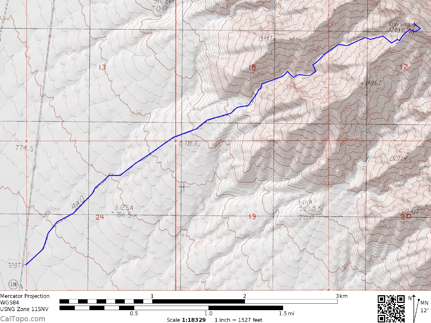
DRIVE: From Shoshone, CA. drive 10.5 miles N on State Route 178 (Charles Brown Highway) to a faint dirt
road heading NE across Chicago Valley towards the Nopah Range. This faint dirt road is about 75 yards N of
highway milepost 53.50. Park along the shoulder of the highway. The Nopah Mountains Wilderness
Boundary is located just E of the highway.
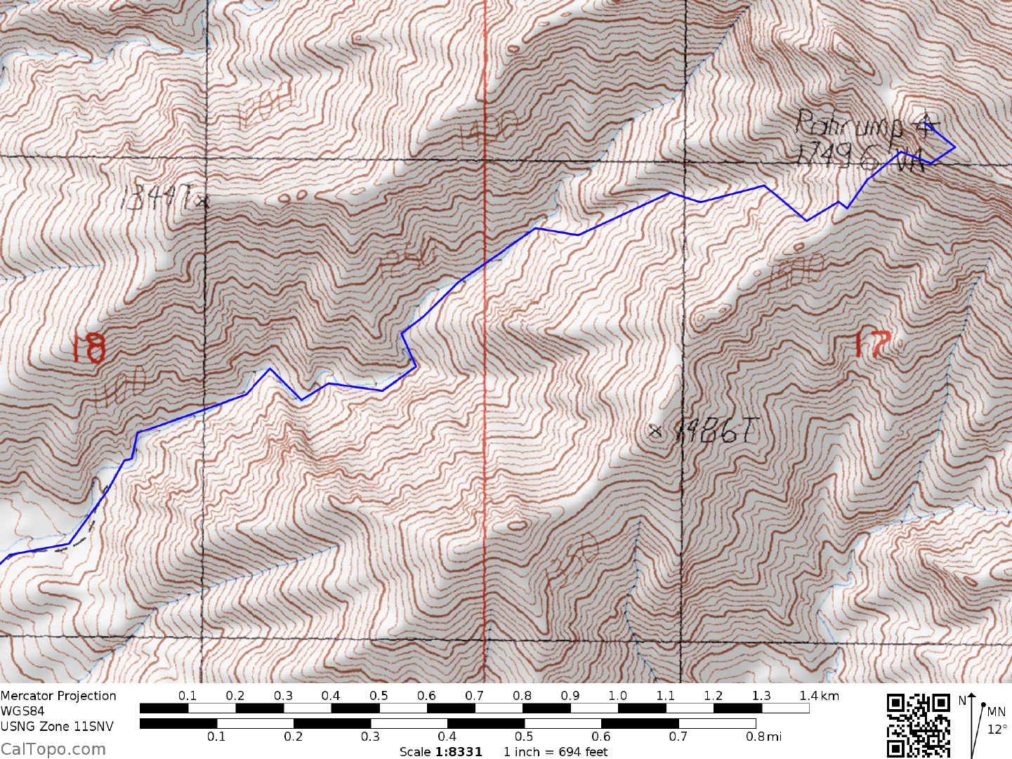
CLIMB: Hike 2.0 miles NE up the faint dirt road to its abrupt end at the mouth of a canyon near the base of
the mountain. Continue NE up the canyon, following it through a series of 90° bends to a fork at 1150 meters
(3770 feet) elevation. Bear left and continue up the canyon to another fork at 1255 meters (4120 feet)
elevation. Bear right here, staying in the canyon until you reach within about 100 feet of a 10-15 foot dry
waterfall near 1465 meters (4800 feet) elevation. Bear right here and climb up a steep, loose slope to the ridge
above. You'll top out on this ridge at a saddle at about 1555 meters (5100 feet) elevation. Head up the ridge
for about 50 yards, then left through a ducked notch, traversing up and left through a second notch with a
"window rock" on its left side. Follow the obvious chute up and right from here to the ridgeline above, where
you'll continue hiking NE until you reach the summit ridge. Turn left (NW), following the narrow, rocky
summit ridge a short distance to the top.
ROUND TRIP STATS: 3400 feet elevation gain, 8 miles, 7 hours
SIDELINES
1. When Captain George M. Wheeler (Wheeler Peak in Nevada is named after him) of the United States
Army Engineers visited the Pahrump Valley in 1872, he noted that it contained several oases. The most
predominant oasis was Pah-rimp Springs, where a number of Paiute Indian families were living, growing corn
and melons. The name Pah-rimp (now Pahrump) may have come from the Southern Paiute words pa for
water and timpi for stone (later modified to rimpi), thus Pah-rimpi or "water-stone". Other Southern Paiute
tradition suggests the meanings "great spring" or "cave from which water flows".
2. See Sidelines 1, Stewart Point (Guide No. 2.19) for details about the nearby Tecopa Hot Springs.
3. Pahrump Point is located within the boundaries of the Nopah Range Wilderness Area. This new
wilderness area was created as part of the California Desert Protection Act of 1994, Public Law 103-433,
Section 102 (40). The Nopah Range Wilderness Area encompasses approximately 110,860 acres of land and
is managed by the Bureau of Land Management (BLM).