2 DEATH VALLEY RANGES GUIDE NO. 2.19
STEWART POINT 5265 FEET CLASS 2
MILEAGE: 274 miles of paved road.
DRIVE: From Shoshone, CA. drive 15.5 miles N on State Route 178, the signed "Charles Brown Highway",
to a turnout about 1 mile past the high point of the road adjacent to highway milepost 58.50. Park.
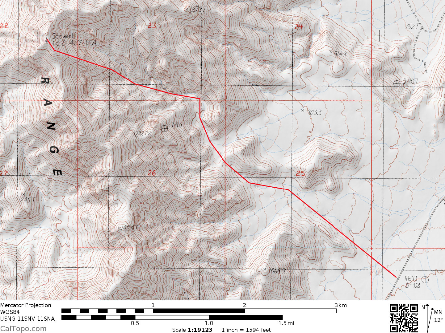
CLIMB: Head W across easy terrain at a bearing of 300° to a saddle at 980 meters (3215 feet) elevation
(UTM 733012). Drop down from this saddle in a NW direction into the main wash and follow it NNW,
taking a right fork just after encountering a black rock dike. Further up climb a 10 foot dry waterfall (easy
Class 3) and then pass around and partially under a 12 foot high rock. Scramble out of the canyon to your left
here and parallel it to a saddle, dropping back into the canyon about 200 yards upstream. This maneuver
bypasses some rather difficult dry waterfalls in the canyon. Continue up the canyon another 200 yards to a
major fork at 1155 meters (3790 feet) elevation (UTM 722021). Climb directly up the ridge that separates
these two forks, following it NW to the summit.
ROUND TRIP STATS: 2600 feet of elevation gain, 6.5 miles, 5 hours
SIDELINES
1. The Tecopa Hot Springs, located a few miles S of Shoshone, CA are certainly worth a visit if you're in the
area. They are free public baths maintained by Inyo County and are open 24 hours a day, except Monday-
Friday 7AM-12NOON when they are closed for cleaning. The baths are separate for men and women with no
mixed bathing allowed. Nude bathing only; no clothes allowed in the pools. There are two pools in both the
mens and womens bathhouses; a hot pool (108°F) and a cool pool (100°F). Children under 16 must be
accompanied by an adult. There are also private hot baths just N of the public baths that charge an entry fee.
2. Stewart Point is located within the boundaries of the Resting Spring Range Wilderness Area. This new
wilderness area was created as part of the California Desert Protection Act of 1994, Public Law 103-433,
Section 102 (52). The Resting Spring Range Wilderness Area encompasses approximately 78,868 acres of
land and is managed by the Bureau of Land Management (BLM).