2 DEATH VALLEY RANGES GUIDE NO. 2.17
EAGLE MOUNTAIN #2 3806 FEET CLASS 3
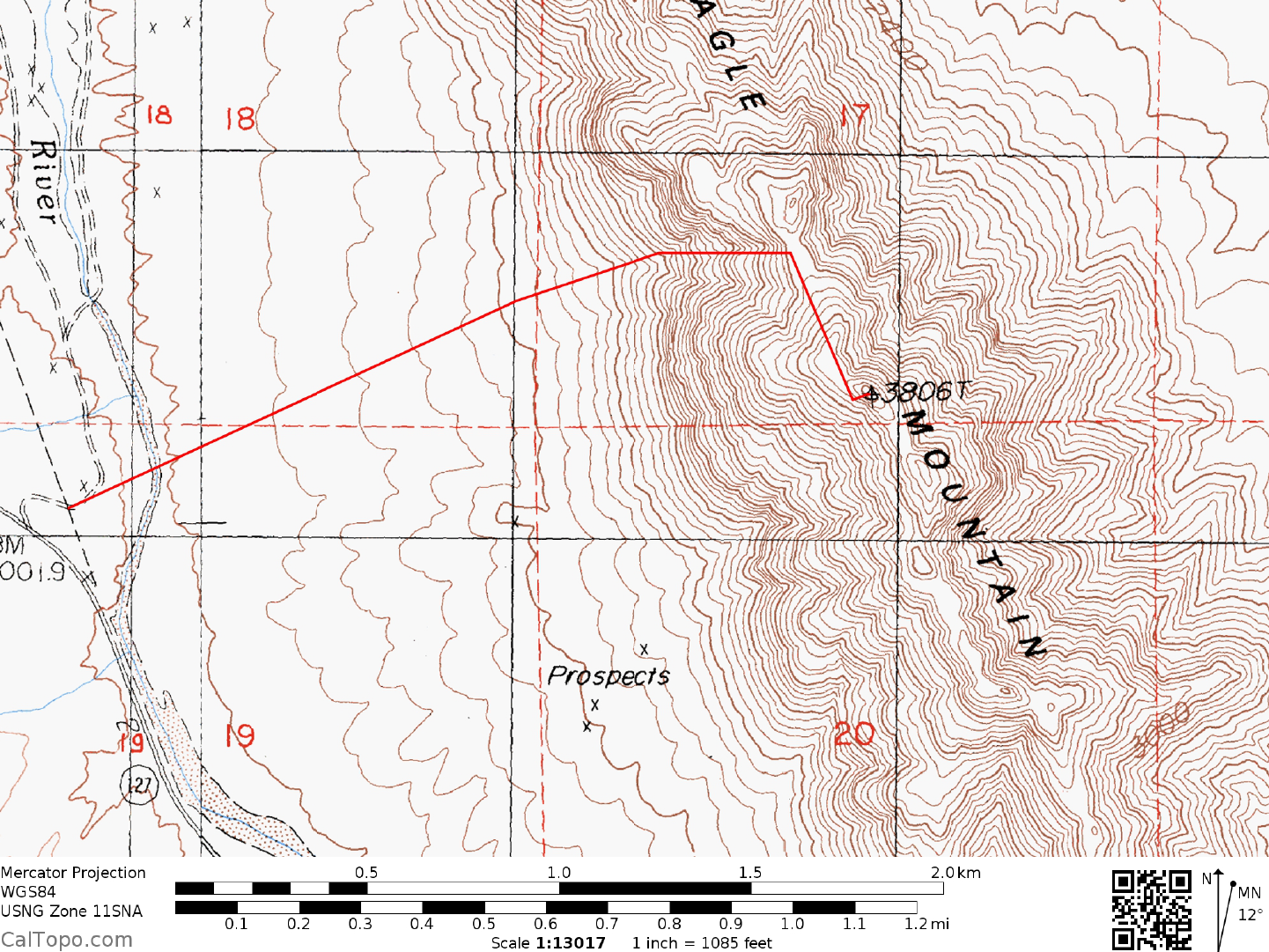
MILEAGE: 275 miles of paved road
DRIVE: From Shoshone, CA. drive N about 17 miles on
State Route 127 to where the highway begins a
sweeping turn to the left. At 0.25 miles N of highway milepost 33.50 turn right on a good dirt road and drive
0.1 miles to a fork where the road passes under power lines. Bear left here to a second fork in 50 yards, where
you'll bear right and drive 0.1 miles (under a second set of power lines) to a parking spot along the W bank of
the Amargosa River. Park.
1RWHWKHURDGPD\EHFORVHGDWWKHKLJKZD\VRWKHVKRUWGLVWDQFHGHVFULEHGPD\
KDYHWREHKLNHG
CLIMB: Looking E from the parking area at a 73° bearing, three chutes can be seen emanating upward from
the base of the mountain. The furthest left (N) of the three is the one you'll climb on this route. Hike across
the river and desert flats to this chute and climb the rocks on the left side of the chute to avoid a dry waterfall
at the start. Entering the chute above the dry waterfall, climb it to its top and then angle up and right over a
rock rib to the middle of the three chutes (A white rock band on this rib will help you to located this crossover
point on your descent). Climb the middle chute, which eventually broadens into a rocky slope further up, all
the way to the base of a wall directly above you. Now angle right to gentle slopes, traversing under an
obvious headwall toward the notch to the south. Just before reaching this notch, climb up over rock slabs and
angle right to a small notch just below the summit mass. From this notch, hike S along the base of cliffs to the
summit block, climbing the N ridge to the top. The start of the summit ridge is Class 3 with good handholds;
acrophobic beginners might want the reassurance of a rope here.
ROUND TRIP STATS: 1800 feet elevation gain, 3 miles, 3 hours
SIDELINES
1. The Amargosa River may be flowing aboveground when y
ou choose to climb Eagle. During the wetter
months of winter it can be hard to cross and stay dry at the same time. Although it's not deep, it can be too
wide to jump and its banks can be quite muddy. During the dry summer months the river flows underground
with hardly a trace of its presence.
2. See Sidelines 1, Stewart Point (Guide No. 2.19) for details about the nearby Tecopa Hot Springs.
3. Eagle Mountain #2 is located within the boundaries of
the Resting Spring Range Wilderness Area. This
new wilderness area was created as part of the California Desert Protection Act of 1994, Public Law 103-433,
Section 102 (52). The Resting Spring Range Wilderness Area encompasses approximately 78,868 acres of
land and is managed by the Bureau of Land Management (BLM).