2 DEATH VALLEY RANGES GUIDE NO. 2.15
PYRAMID PEAK 6703 FEET CLASS 2
MILEAGE: 296 miles of paved road
DRIVE/ROUTES A & B: From the intersection of State Highways 190 and 127 at Death Valley Junction,
CA drive 11.5 miles W on Highway 190 to an extremely faint dirt track heading right (N) toward Pyramid
Mountain (This dirt track is 0.2 miles E of highway milepost 129.00). If you're approaching from the
intersection of State Highway 190 and the Badwater Road near Furnace Creek, CA in Death Valley, drive
17.5 miles E on Highway 190 to this spot. Park alongside the shoulder of the highway.
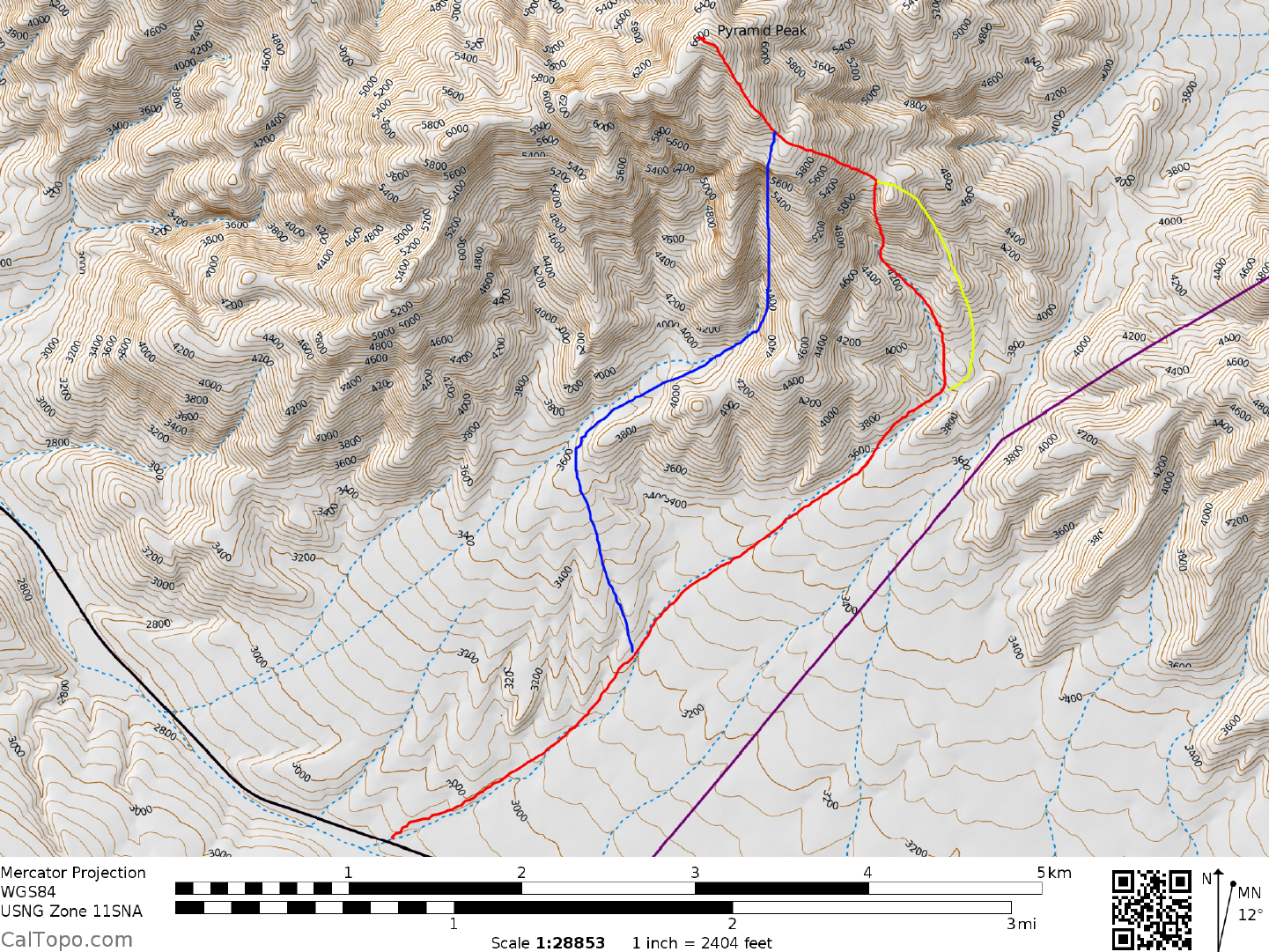
CLIMB/ROUTE A: Hike NNE up the faint track toward the low spot in the distant hills by following a
combination of tire tracks and large ducks for about 2.5 miles to a location (UTM 366252) just E of point
3900. Continue NE up the wash from here and in about 0.4 miles exit left (NW), climbing the ridge to point
4600+ at UTM 366263. Follow the ridge generally W to the 6000 foot elevation level about 0.5 miles SE of
the peak. It's here that you'll encounter a black, jagged ridge that runs NW toward the summit. Follow a game
trail along the base of cliffs on the left (W) side of this ridge to the summit area, where easy slopes lead to the
top.
CLIMB/ROUTE B: As in Route A, head NNE up the faint track toward the low spot in the distant hills.
Instead of hiking to the right (E) of point 3900 however, contour around its left (W) side to a large gully. Hike
this gully N for about 0.5 miles to where the angle steepens appreciably. Bear right (NE) here, gain the
ridgeline and follow it NW for 0.5 miles to the 5100 foot level near UTM 359265. Hike generally W from
here to a black, jagged ridge at the 6000 foot elevation level, about 0.5 miles SE of the peak. Follow a game
trail along the base of cliffs on the left (W) side of this ridge to the summit area, where easy slopes lead to the
top.
ROUND TRIP STATS/ROUTES A & B : 3500 feet elevation gain, 10.5 miles, 8 hours
SIDELINES
1. This peak is located within the boundary of Death Valley National Park.
2. DPS peaks visible from the summit of Pyramid can be found at the following bearings; 95° Mummy Mtn,
100° Charleston Mtn, 115° Potosi Mtn, 128° Pahrump Peak, 131° Eagle #2 and Nopah, 135° Clark Mtn, 148°
Brown Peak, 167° Avawatz Mtn, 206° Needle Peak, 213° Manly Peak, 224° Porter Peak, 231° Sentinel Peak,
240° Telescope Peak, 283° Tucki Mtn, 307° Tin Mtn, 320° Palmer Mtn and 324° Grapevine and Corkscrew
Peaks.
A
B