2 DEATH VALLEY RANGES GUIDE NO. 2.10
MANLY PEAK 7196 FEET CLASS 1
MILEAGE: 193 miles of paved road, 18.6 miles of excellent dirt, 10.6 miles of poor to 4WD dirt road.
DRIVE/ROUTE A/WESTERN APPROACH: From Trona, CA., drive N 23 miles on the paved Trona-
Wildrose Road to the signed Ballarat Road. Turn
right (E) on this excellent dirt road and follow it 3.6 miles to
the town of Ballarat. As you drive through Ballarat, you'll approach a white mileage sign at the junction of the
Ballarat and Wingate roads (This sign points out directions and mileages to various points of interest in the
area. "Goler Wash 15.3 miles" with an arrow pointing right is the direction you'll be travelling to get to Manly
Peak). Turn right (S) here on the excellent dirt Wingate Road and drive 15 miles to a fair dirt road heading
left (E) toward the mouth of Goler Wash. Following this road 1.4 miles will bring you to the narrow mouth of
the wash. Continuing E up the wash, in 2.8 miles you'll pass the Keystone Mine on your right (active mine;
keep a lookout for large ore trucks on the road between here and Ballarat) and in 2.0 more miles reach a fork
at the base of a short, steep hill. Take the left fork to bypass this hill and drive 2.6 miles to Mengel Pass at the
signed boundary of Death Valley National Park. As you near the pass and continue over it into Butte Valley,
the road gets bad in spots; high clearance and possibly 4WD is necessary to negotiate some of the worst of
these areas. Over Mengel Pass the road drops into Butte Valley and in 1.3 miles intersects a dirt road on the
left. Turn left here and drive a very short distance to where you can turn left again, following this road about
0.5 miles to its end at Russell Camp, a very nicely preserved cabin available on a first come-first serve basis.
Park just outside the gate.
Note: recent trip reports indicate that this road may be impassible to all but the burliest
4WD vehicles. Drive at your own risk.
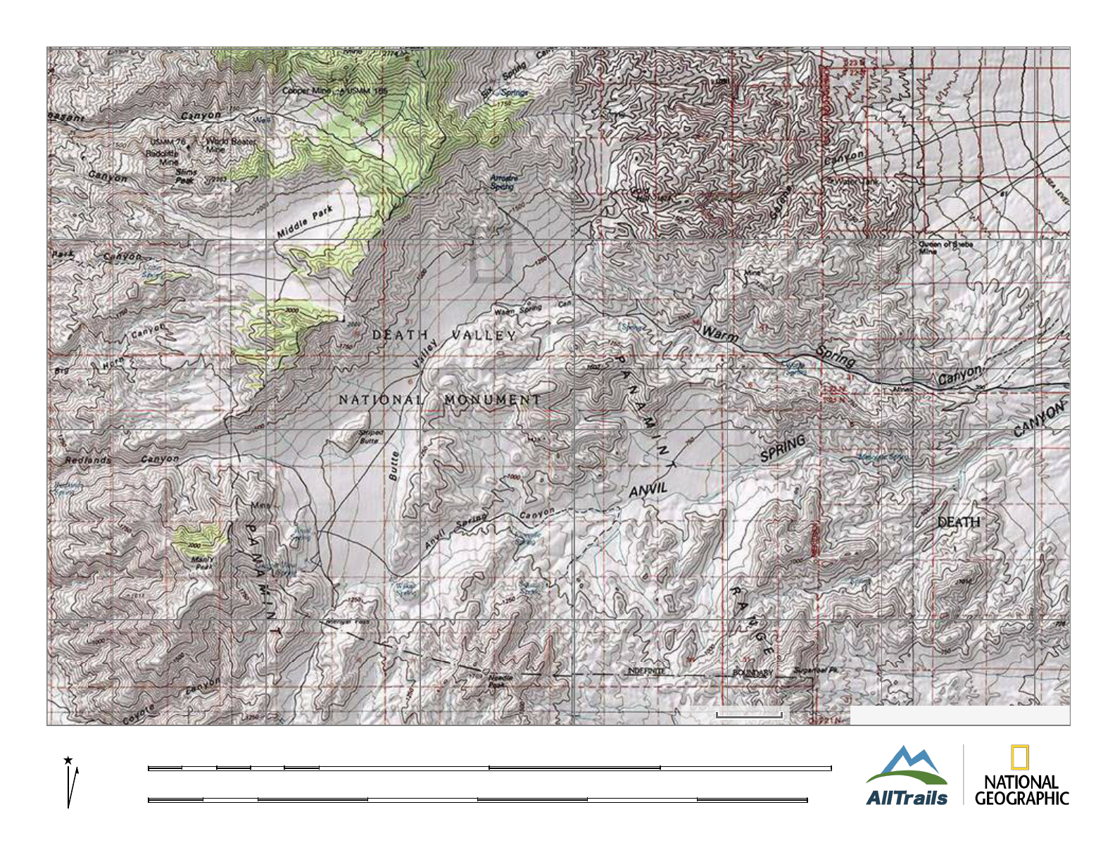
DRIVE/ROUTE
A/EASTERN APPROACH: From Shoshone, CA., drive 1.5 miles N on State Highway 127
to State Highway 178. Turn left on State Highway 178 and drive 29.1 miles to the signed West Side Road, en
route entering Death Valley National Park. Turn left onto the excellent dirt West Side Road and follow it 2.8
miles to a signed fork "Butte Valley 20 miles, Furnace Creek 41 miles". Bear left here, driving 7.1 miles on
good dirt to a fork where you'll bear right, dropping into a wash. In 3.7 miles you'll come to the Warm
Springs Mining Camp and perhaps the crux portion of the road, a narrow, rocky uphill pitch with lots of sharp
rocks that could easily puncture a tire (You will need high clearance and 4WD here and in spots for the next
several miles through the canyon narrows. Once you enter the lower end of Butte Valley, the condition of the
road improves). From this crux move, follow the road another 11.1 miles to upper Butte Valley and a dirt
road intersection. Continue straight 0.2 miles (right will take you to the stone Geologist Cabin and left to
Willow Spring) to a junction and bear left (S), driving 0.4 miles to a fork. Turn right here and follow the road
0.5 miles to its end at Russell Camp. Park just outside the gate.
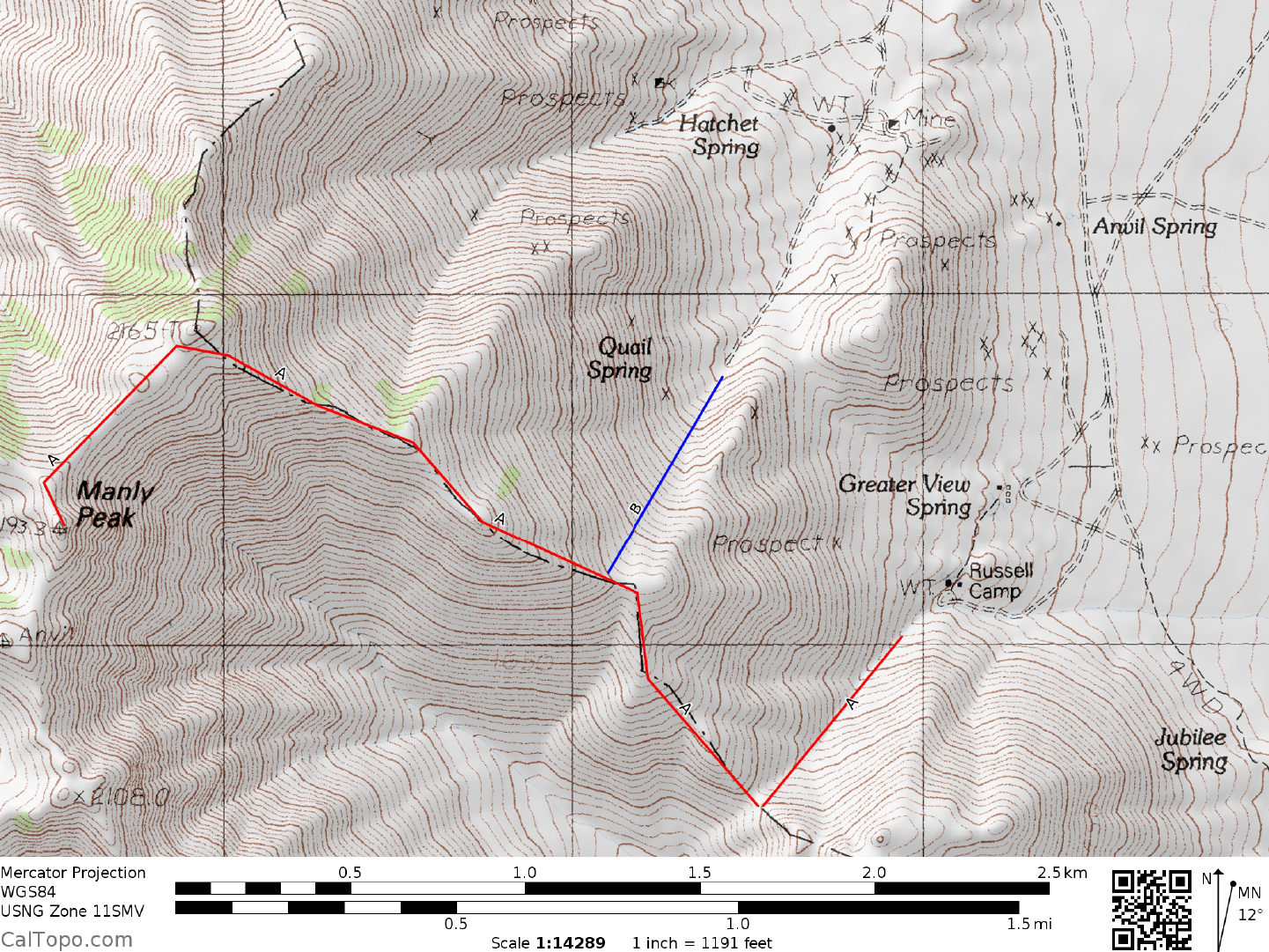
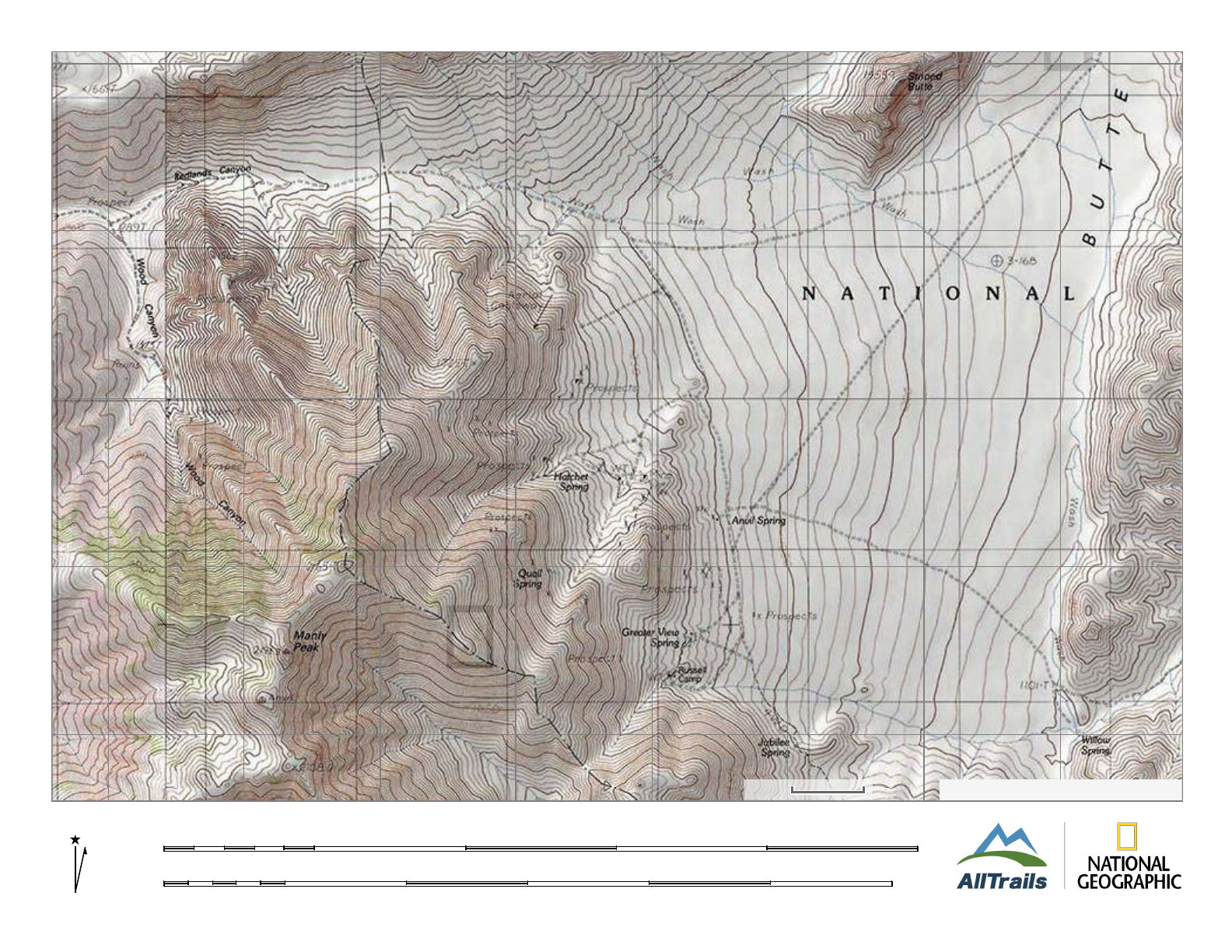
CLIMB/ROUTE A: From Russell Camp, hike SW up the canyon to a saddle at 1550 meters elevation (UTM
915736). At the saddle turn right and hike NW, following the ridge for 2 miles to near point 2165. Either hike
over this point or sidehill below it on its S side, following the ridge SW for 0.5 miles to the summit block of
Manly. NOTE: The register is usually found in a metal container nailed to a post at the base of Manly's
summit block. The climbing to this point is only Class 1. If you climb to the actual highpoint of Manly Peak,
you'll have to do the awkward Class 3 block. A crack on the W side of the
2 DEATH VALLEY RANGES GUIDE NO. 2.10
MANLY PEAK (CONTINUED)
block or the friction slab next to it offers a way to the top. For those unsteady at rock climbing, a short rope or
sling (35 feet) can be anchored to a boulder at the top of the summit block crack to offer some protection.
ROUND TRIP STATS: 2800 feet elevation gain, 6 miles, 5 hours
DRIVE/ROUTE B: From Mengel Pass drive N into Upper Butte Valley
1.3 miles to the turnoff for Russell
Camp. Instead of turning left here, continue straight (N) 0.5 miles to a fork. Bear left (right goes down Butte
Valley to Warm Springs Canyon), driving N 0.7 miles to a dirt road heading left (W). Turning left here, drive
0.4 miles to a fork. Bear left and go 0.7 miles to the end of the road near Quail Spring. See Manly Peak, CA
7.5 minute topo for details of roads in this area.
CLIMB/ROUTE B: Head SW up dirt slopes to the ridge at 1750 m
eters (5740 feet) elevation to join Route A,
which is followed to the summit.
ROUND TRIP STATS/ROUTE B: 2300 feet elevation gain, 5 miles, 4 hours
SIDELINES
1. This peak is located within the boundary of Death Valley National Park.
2. Manly Peak was named in honor of William Lewis Manly
, a scout from the Bennett/Arcane group of
pioneers who crossed Death Valley in 1849. He and his companion, John Rogers were successful in finding a
route out of Death Valley over the Panamint Range.
3. If you come over Mengel Pass on your way to climb Manly
, be sure to stop there and visit the grave of
Carl "Peg Leg" Mengel, marked by a large cairn with a headstone at its base. The headstone simply states the
years he lived, 1868-1944; the ground beneath the cairn contains his remains. His nickname "Peg Leg" came
after a mining accident in Nevada when he was severely injured and lost a leg to amputation, having a wooden
one fashioned to serve as a prosthesis. Mengel, a degreed mining engineer from San Bernardino, had a
working gold mine and stamp mill in upper Butte Valley in the 1890's, the remains of which can be visited in
a short trip from Russell Camp. Mengel resided in the cabin located adjacent to Greater View Spring. This
cabin was built long before his time, in 1869, by Mormons who mined in the area. Like many other old
cabins in the desert, this one is "maintained" by people who want to preserve it for its historic value. You'll
find some basic supplies and emergency provisions available inside. Please keep it in the same order you
found it and perhaps donate an item or two to the supply stock already there.
4. Butte Valley is a great place for cabin exploring. If y
ou're lucky enough to find the Russell Camp cabin
vacant, be sure to spend a night there. The multi-roomed structure is located very close to a spring and has
piped water for kitchen use and an indoor shower. An irrigation system maintains some thriving
MANLY PEAK (CONTINUED)
2 DEATH VALLEY RANGES GUIDE NO. 2.10
cottonwood trees around the cabin as well as a small flower garden. A fire ring and picnic table is available
just outside the front door. The Geologist's cabin, just down the road from Russell Camp is also worth a visit.
This cabin, located just above Anvil Spring offers great views of Striped Butte, especially around sunset.
5. The Goler Wash area has many points of interest, one of the eeriest being the Barker Ranch and environs.
The ranch received nationwide notoriety
in the late 1960's as the desert headquarters of the infamous Manson
Family. It was here that Charles Manson "flew" his magic bus, loaded with disciples up to the ranch in 1969.
As was later discovered, he didn't bring it up Goler Wash from Panamint Valley, but instead drove it over the
Warm Springs Road and down over Mengel Pass. Still quite a feat considering the fact that it was a full sized
school bus! Later that year, in October, the Inyo County Sheriff's Department conducted a raid of the ranch
during which they netted Manson and many of his followers. Brought to jail in Independence, CA. on grand
theft auto charges, they were within weeks linked to the Tate-LaBianca murders in Los Angeles. Subsequent
trial testimony revealed the alleged existence of between one and three graves in the immediate vicinity of the
Barker Ranch, the occupants of those graves being unfortunate victims of the Family. Although no bodies
were ever found, there is a strong suspicion that they may be buried somewhere near the ranch. The ranch,
shown on the 1950 Manly Peak 15 minute topo, is the cabin site N of the road between Sourdough Spring and
Myers Ranch. It consists of a fenced grounds enclosing a main cabin with some smaller shacks adjacent to it,
a concrete "swimming pool" behind the main cabin, a few miscellaneous animal pens and a drip irrigation
system maintaining a few nice trees around the grounds. As you drive up, scan the hills on both side of the
road for evidence of the "bunkers" used by the Family as they kept watch over the approach to the ranch.
Because of its claim to fame, the Barker Ranch is visited by a fair number of people each year. Don't be
surprised if you're not alone while touring here. NOTE: The Myers Ranch, located 0.5 miles beyond the
Barker Ranch is posted as private property. Respect the privacy of the people living there and don't trespass.
MN
12.4°E
2/12/15
KM5 0 5 10 15
MILES2 0 2 4 6 8 10
−117.15 −117.10 −117.05 −117.00 −116.95 −116.90 −116.85
−117.15 −117.10 −117.05 −117.00 −116.95 −116.90 −116.85
35.90 35.95 36.00 36.05
35.9035.9536.0036.05
TOPO!®©2013NationalGeographic
2km
MN
12.4°E
2/12/15
KM1 0 1 2 3 4
MILES0.5 0 0.5 1 1.5 2 2.5
−117.13 −117.12 −117.11 −117.10 −117.09 −117.08 −117.07 −117.06
−117.13 −117.12 −117.11 −117.10 −117.09 −117.08 −117.07 −117.06
35.91 35.92 35.93 35.94 35.95
35.9135.9235.9335.9435.95
TOPO!®©2013NationalGeographic
500m