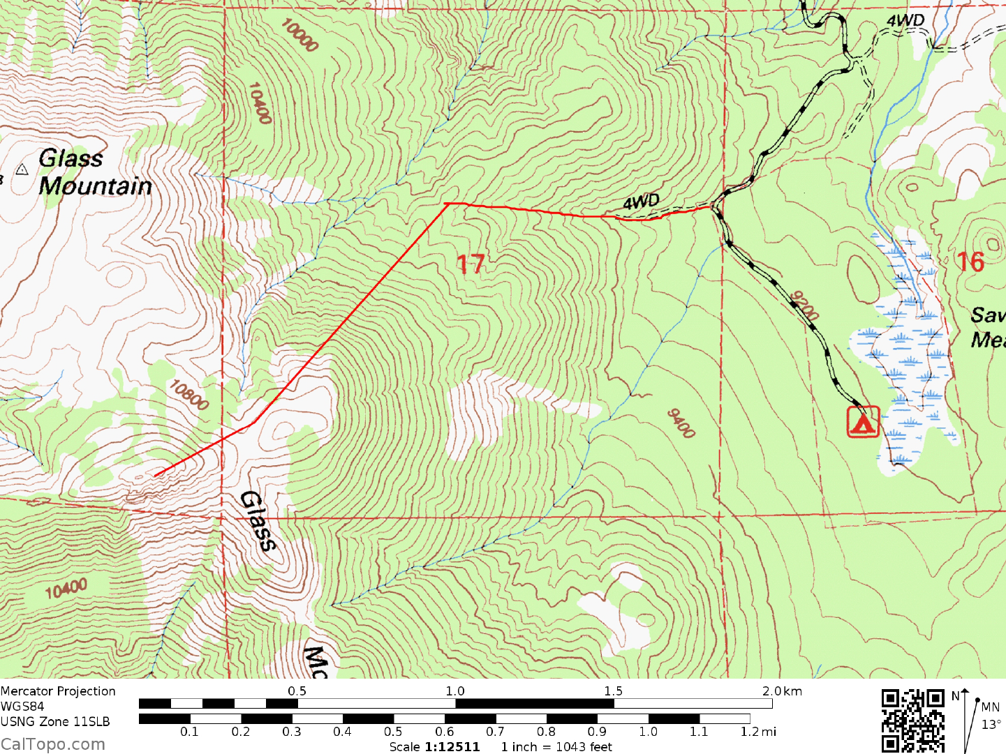
Guide
DRIVE/EASTERN APPROACH: From Benton, NV. drive 13.3 miles W on State Route 120 to the signed Forest Service road 1S01. Turn left (SW) on this excellent dirt road and drive 0.7 miles to where you'll make a right turn and go 6.6 miles to an intersection. Turn left here and drive 3.1 miles to a junction, turning right and driving 0.5 miles to an intersection. The previous TH was located 0.2 miles up what is now a closed road. There is room now for one or two vehicles. If camping there, continue 0.6 miles to the Sawmill Meadows Campground and start from there.
DRIVE/WESTERN APPROACH: From US Highway 395 about 5 miles S of Lee Vining, CA. turn right (E) on State Route 120. Drive about 32 miles to the signed Sawmill Road (Forest Service Road 1S01), turning right (SW) here on excellent dirt. Follow DRIVE/EASTERN APPROACH directions from this point to the trailhead.
CLIMB: Walk W about 0.5 miles at a 285° bearing up the canyon to a small saddle at 9880 feet elevation (UTM 509819). Climb SW up the forested ridge and slopes, passing just to the N of point 10937 and dropping slightly to a broad saddle. Hike 0.2 miles WSW from this saddle to the peak. ROUND TRIP STATS: 1900 feet elevation gain, 3 miles, 3 hours, 4.2 miles from the campground.
SIDELINES
- Don't be confused about the true highpoint of Glass Mountain. There is a peak with a radio repeater station on its top about 0.75 miles NW of the summit. This peak is called Glass Mountain on the 1986 Provisional Edition 7.5 minute series topo but is shown to be 17 feet lower than the true summit.
- Glass Mountain got its name for the vast obsidian (volcanic glass) deposits found on its slopes. Large specimens of both brown and black obsidian can be found on the slopes just to the S of the climbing route at about the 9600 foot elevation level.
- The Sawmill Meadow Campground mentioned in the DRIVE/EASTERN APPROACH directions abovehas a few campsites with picnic tables, making it a convenient place to camp when doing Glass Mountain.